|
 |
 |
 |
 |
|
|
|
|
|
|
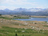
Monday, August 7 - 12 miles to spring nine miles north of South Pass
We enjoyed our day off in Lander. Its a small enough town its easy to walk around, with good restaurants, two good groceries, book stores, an outdoor store, etc. Some shops were closed on Sunday, but we were able to get internet access ($10/hour) at the bookstore, and the outdoor store was open.
We left town late after visits to the library and post office, plus we just werent in a hurry. It worked out. We got a ride in about half an hour from a woman with two small kids on their way to meet her husband to go camping. She dropped us off about five miles from South Pass. We walked up the highway 2 ½ - 3 miles, then got a ride up the dirt road with a couple from Minnesota. We had a long chat with them at South Pass. We drank a final soda at the store, chatting with the clerk who is in local law enforcement but dreams of joining the FBI.

We finally got on the trail around 3:00. We knew there were several creeks and springs ahead, so we werent concerned about the late start as there were lots of options. As it turned out, it wasnt quite that easy. Pine Creek was full of beaver ponds and cows so the water was not really drinkable. Gold Creek was also dammed and had a resident cow herd, plus we saw the beaver swimming across the pond, so we kept going. The next spring at Burnt Meadow was not developed at all; it was just some wet spots in the meadow, with no pools deep enough to dip water. The next spring had a wide pool about two inches deep and full of algae, but it was useable. We got out my cup and dipped out a couple of quarts, then moved on a bit to set up camp in the trees, just before dark.
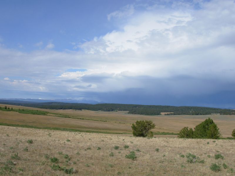
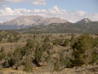
It was a really nice hike this afternoon. We followed jeep roads with no traffic and very little elevation change easy walking. Already we are in the foothills of the Winds, with rolling hills, trees, water and interesting rock formations. It rained briefly a couple of times and stayed cloudy all afternoon so the temperature was nice and cool. Since Lander was 92° when we left, it was a nice change to be hiking in the high 70s instead. Mark Flagler wrote in the South Pass trail register that it was 115° when they went through the desert last week.
We met our first southbound thruhiker, Pi, today. He was in a hurry to get to Lander, but was nice enough to talk with us for a long while. I was hoping wed meet him. A few hikers are three to six days behind him, he thinks, so we may run into a few this week. I hope so.
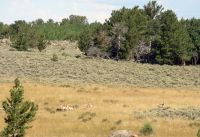
Wildlife count was 49 antelope, a dozen grouse and the beaver. All in all, it was a very good day.
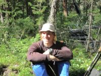
Jim: It was nice to finally meet a southbound thruhiker. We thought we might meet one or two in the desert south of here, but it didn't happen that way. As usual, I think we tried to give Pi more information than he was ready for. Maybe some of it will stick. But at least we tried. And he had some good information about the hikers and the trail in return.
We got a little tangled up at Pine Creek. We got into the beaver mess the first time we tried to cross. We did the same thing in '99. But this time we backed out and went south another hundred yards or so and it was an easy crossing. Didn't even get our feet wet.
There are water sources here - just not necessarily good ones. But they'd be usable if one were desperate.
Tuesday, August 8 20 miles
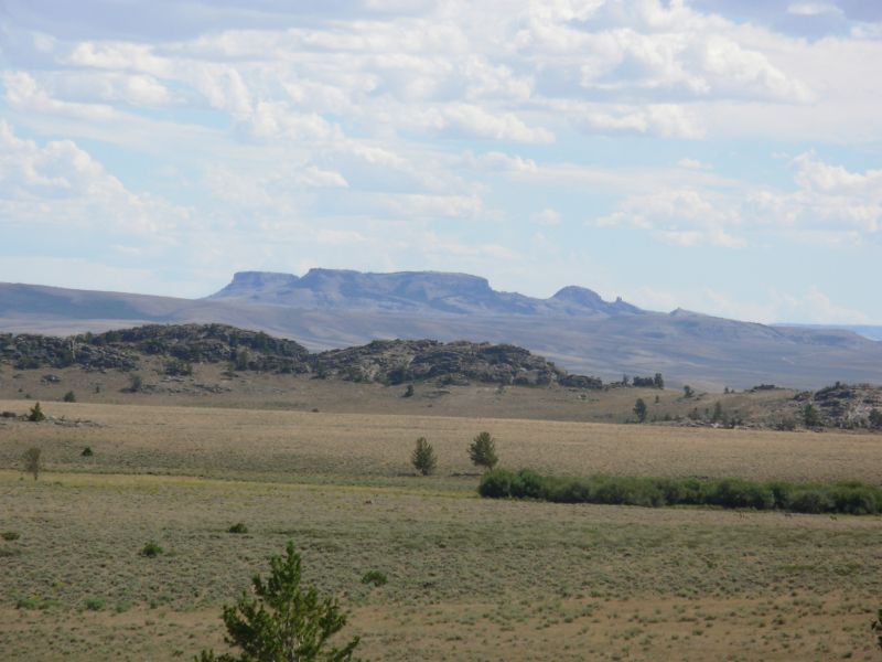
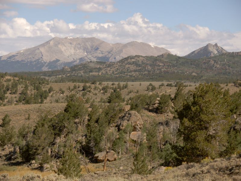
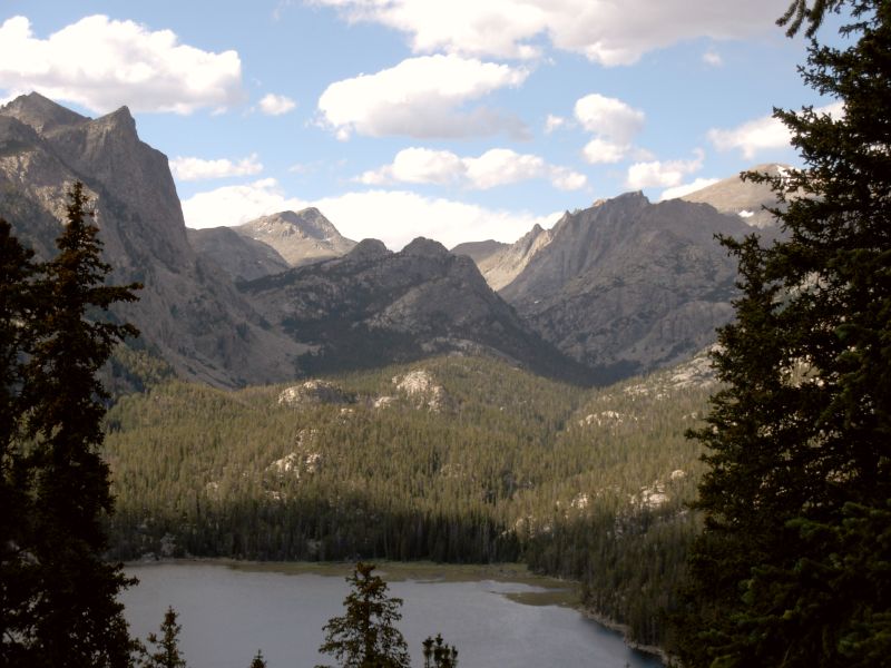
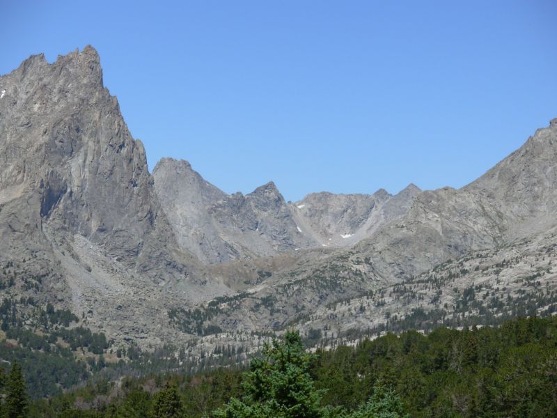
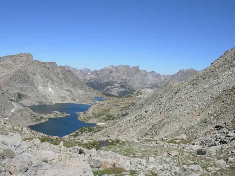
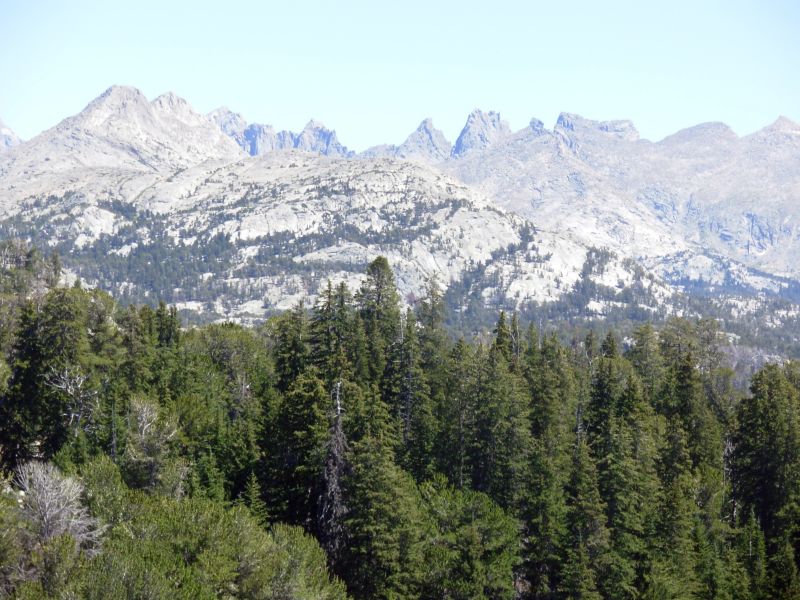
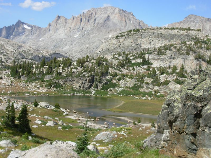
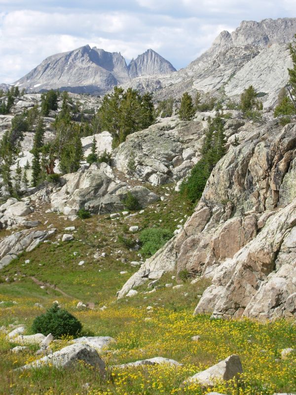
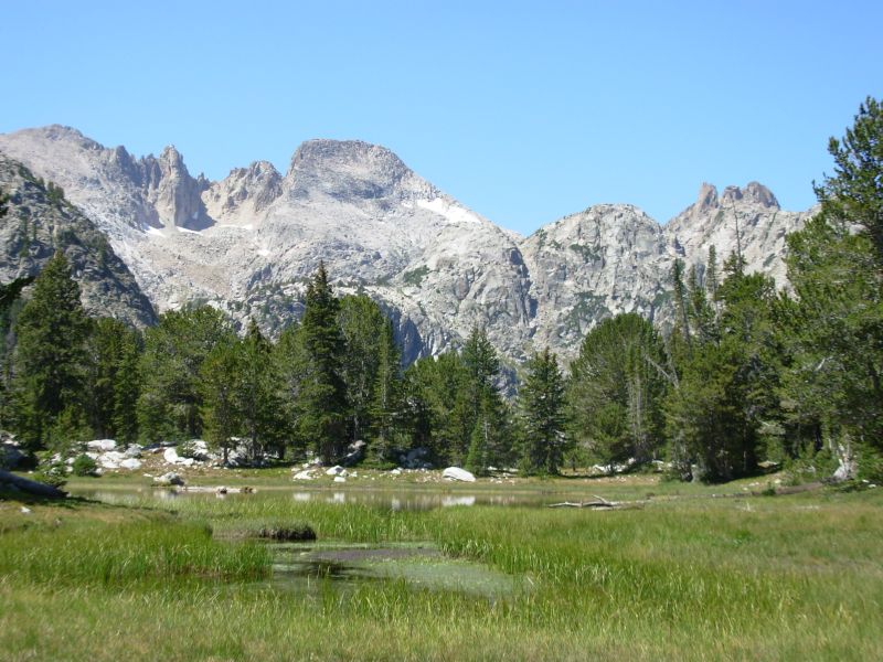
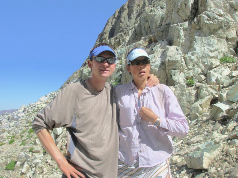
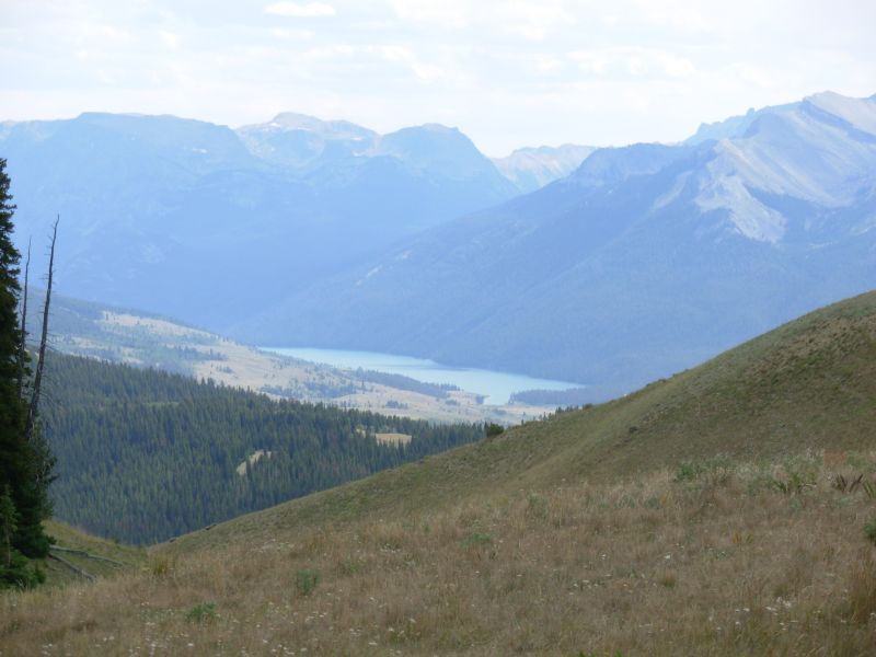
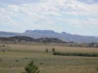
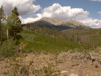
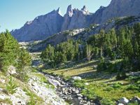
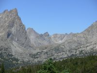
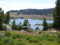
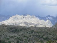
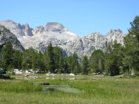
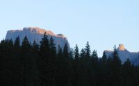
We had a very pleasant morning hiking along the edge of the Bridger Wilderness. In a few miles well cross into the forest where well be hiking for the next nine days. Im excited to be getting back into the mountains again, especially here in the Winds. Weve been following jeep roads up and down through the hills. We actually saw a few cars a rare occurrence on these roads. There were a couple of government vehicles and a couple parked at a tiny campground on the Sweetwater River. We saw 32 antelope and some grouse this morning. Im a bit worried about the next 25 miles, which features obscure trail over a high pass. It is supposed to be scenic, but also has talus and scree. They stopped maintaining the trail over Temple Pass years ago. We took a different route last time, past the Cirque of the Towers. It was a really nice one, but we wanted to try something different, just to see what Temple Pass is like. It will be odd hiking above 10,000 again after 10 days at 7000. The Wind River Range is very scenic, but also very strenuous.

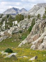
We left our jeep road at the Sweetwater Gap trailhead and picked up decent trail through burnt forest. Only the first two miles were burned, and that was several years ago since the saplings were 4-8 high. We climbed to a ridge and after that were in dense forest for the rest of the day. The trail was in much better shape than I expected. So far, navigation has been easy. The trail is rough eroded with some steep ups and downs--but it is easy to follow. The trail passes through narrow rocky canyons with lots of big granite boulders very different. We worried about finding a campsite but we lucked out and found a decent spot well off the trail. There is no sunlight, because of the steep canyon walls, but its flat and relatively smooth. We got water from the outlet to a nearby meadow and I even washed up a little. One of the stream crossings took care of my feet and lower legs. We encountered four elk three that we saw and another that we only heard as it crashed through the trees. We saw its tracks on the trail, so were fairly sure it was another elk.
Jim: Finding tonight's campsite was tricky - we followed an obscure side trail that led nowhere - not even to a campsite. But we wandered around a little and found a flat spot off the shoulder of the ridge we were on. Later we found that someone had camped right beside the trail just a few yards beyond where the side trail took off.
Wednesday, August 9 18 miles to Big Sandy Lodge
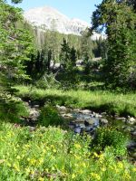
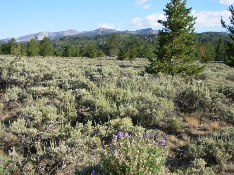
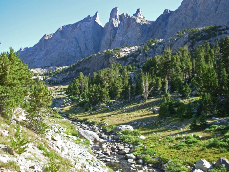
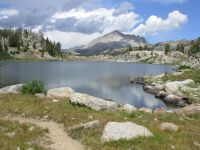
It was a beautiful day, clear and cool. The sky was a rich deep blue, contrasting with the white granite and green pines. I enjoyed the morning walk up the valley of Little Temple Creek with its steep white walls on both sides. There were flower-filled meadows: purple daisies, yellow flowers, blue gentians, orange paintbrush, etc. At the upper elevations we saw sky pilot again. That blue flower only grows above treeline. I love being back in the mountains.
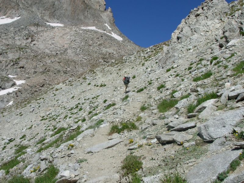
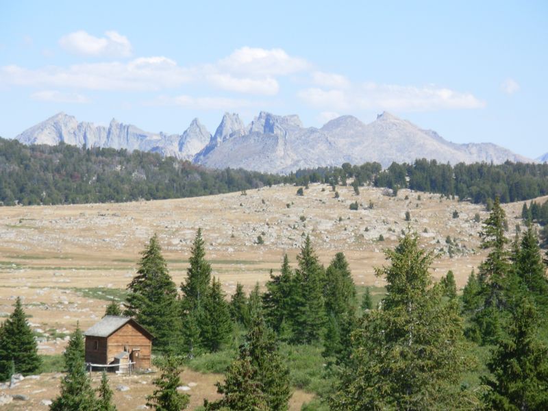
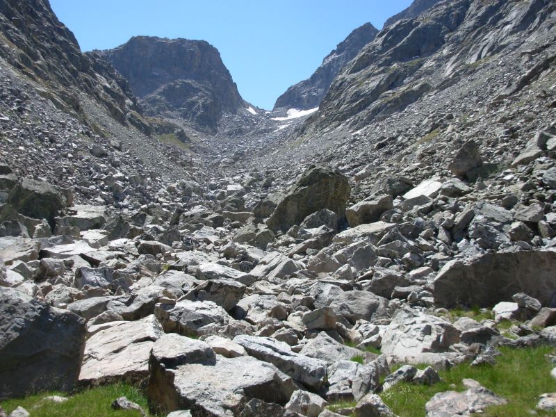
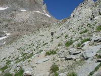
The hike over Temple Pass turned out to be much easier than I expected. We were able to stay on trail most of the way. We lost it for a little while in the upper meadow just below the pass, but after climbing a bit, we spotted switchbacks heading up. There was one brief spot where the trail was washed out and had narrow paths across, but the rest of the climb wasnt bad at all. The views were stupendous. At the top we had a little bit of talus and then a steep steep trail descended to Temple Lake (850 in 0.8 mile). The trail around the lake was a bit obscure at times, but eventually we found good tread heading west. It wasnt the trail we intended to take, but it was a good shortcut that went past a couple of lakes to Big Sandy Lake.
We had been alone since meeting Pi, but around Big Sandy Lake we saw lots of people hiking, rock-climbing, camping and fishing. Then we had the trail to ourselves again past Diamond, V and Meeks Lakes. The peaks and sparkling lakes were gorgeous. We even had a view into the Cirque of the Towers.
We rushed a bit to get to Big Sandy Lodge. We had mailed a resupply box there and hoped to get dinner as well. We arrived at 4:30 to find the place almost empty except for one lone cook preparing dinner. That soon changed as some fishermen returned and three families arrived to begin their vacation. We emptied our box, left a few things for the hiker box and stayed for supper: chicken, rice, salad, corn and cornbread. It was a better dinner than I had planned, so worth the price, despite the burnt cookies. Then we picked up our very heavy packs and moved on a mile or so back up the trail to find a campsite in the trees.
Jim: For years, Temple Pass has been billed as an extremely difficult route, but we didn't find it to be that way at all. The toughest part was the descent on the north side of the pass - because it's so steep. The Forest Service apparently doesn't want to route the trail that way, but there's no good reason that I can see to not do so. Much of the trail is already in place and just needs some maintenance work. The trail over Temple Pass needs some work and new trail would need to be built on the north side, but that would presumably be cheaper building the 30 miles of trail that they're proposing. It would also be a better and more scenic trail. And finally, it would be a trail that would be used. The trail that's being proposed would be used by horse packers - and by those few (hopefully VERY few) CDT hikers who insist on being "pure" and following only the "official" trail. Yeah - there really are some of those poor souls out there in fantasyland.

So far the Winds are living up to my memories - raw, rugged and beautiful. Gotta love it.
We've also seen lots of people - though not nearly as many as we saw in 1999. One group looked like a corporate team-building activity. We passed them like a shot. Getting stuck behind them would have slowed us down considerably. There were a number of others who were fishing or out for a short time or had gone up to Jackass Pass for the view of the Cirque. All this activity, of course, is due to the proximity of the Big Sandy trailhead.
Speaking of Big Sandy - things have changed there, too. It's a little less friendly now than it was 7 years ago. Some of that is due to the nature of their business - horse packing is a tough business - so is running a lodge. But some of it is also due to the crappy attitude of some of the thruhikers. When a thruhiker comes through and complains about the service, the prices, etc then it makes all thruhikers look like rude, ungrateful a******s. Rumor has it that this year a couple came through and wanted to be treated as "special" - meaning cut rates on their services. I believe they got some of what they wanted - but they screwed up the attitude at Big Sandy for the rest of us. My attitude is that the Big Sandy services and prices are no secret - if you don't know what they are (i.e. - if you're surprised) it's your fault for not doing your homework - don't blame them. Their website specifies what their services and prices are. And if you can't afford the prices - or just don't want to pay them, then don't go there. Again, don't blame them. They provide services that you're not obligated to take or use. So suck it up and hike.
For us, Big Sandy was just fine. The food was good and we got our maildrop. And then we moved on. That's all we needed.
Thursday, August 10 18 miles to Dream Lake Creek
Another beautiful day in paradise. I know how badly rain is needed here, but it is nice to have blue skies instead of gray. Of course, in the desert I was quite grateful for the cloudy days that kept us cool. Here at 9000 it is cool enough that I welcome the sunshine.
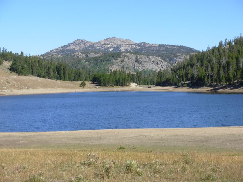
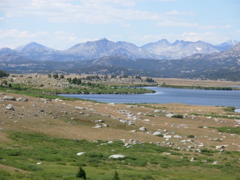
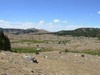
In the spirit of adventure and exploration, we are trying an alternate route again. It is rather an obvious one: Jim Wolfs recommended route is the Fremont Trail, which we followed last time. Paralleling it a mile or two away is the Highline Trail, which is actually the official route. It is a bit lower than the Fremont, despite the name. So far it has been a really nice hike. We passed a couple of lakes. One lake, Boulter, was so low it looked like a reservoir. Then we followed a river for a while, crossed several meadows that were too dry for flowers and passed some dramatic black and orange striped cliffs. We get glimpses of peaks near and far, including the Cirque. I think this route has more up and down and maybe more trees than the Fremont through here, but it is a nice walk.

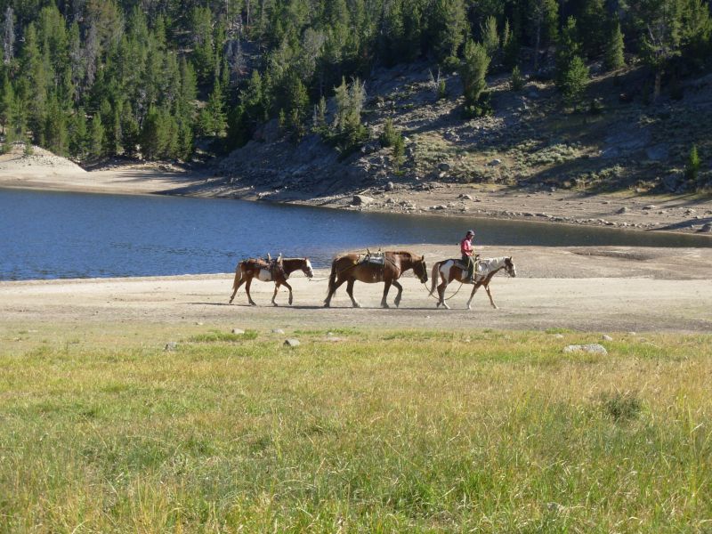
One reason I wanted to try this route is that I thought it would be less populated than the popular Fremont Trail. I remember how crowded Dads Lake was last time. I was sort of right. We havent seen any backpackers yet, just one man on horseback leading two horses and a shepherd with an enormous flock of sheep. There may have been more than one flock. The first group had three white sheep dogs one of which got very belligerent. The second group had little black and white dogs. One of the dogs was injured. Sheep are noisy creatures when theyre on the move: lots of baas and bleats and bells and barking dogs. We were very happy they were going the other direction, except when one group ran right toward us, driven from behind, and I thought we were going to be knocked down by a stampede. They swerved at the last minute. We saw another herd later, headed in the other direction, at Cross Lake. They were on the far side of the lake, so we could barely see them, but we could hear them across the water.
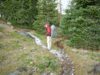
The afternoon was a good one. I like the Highline Trail. We got views of the peaks along the Divide and several lakes. It stays fairly high on a ridge, so you look out and down. The peaks were very dramatic. The lakes were beautiful with sapphire sparkling waters. The trail itself got a bit obscure at times. We lost it up on a plateau and in a meadow when the tread vanished, then took a wrong turn completely when we followed some clear tread and it turned out to be the Scab Lake Trail, not the Highline. It started to turn more and more westward instead of northwest, so we checked our maps and found a trail ahead that would get us back on track. That only added about 1½ miles. We stopped early because all the up and down had taken a toll on us. We had been following Dream Creek and stopped just short of the lake. We were able to wash up in the creek below the lake, a most welcome event. The horses pulverize the trail into a fine powder that goes right through our clothes, shoes and socks, especially my running shoes. My feet were black!
We had the trail to ourselves until after 5:00 when we ran into a group of guys heading the other way on the Dream Lake Trail. We spotted several people fishing, but saw no other hikers. Odd. Hiking alone through this country really feels good. Last time we saw so many people there was no sense of wilderness until the last day when we were past the Cirque. Today was different. It is all so very beautiful, but I enjoy it more when Im not distracted by horses and hordes of people.
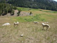
Jim: We were following a ridge when we saw a flock of sheep in the valley below. As we got closer, it looked like there were 2 or 3 mixed flocks down there. And then the sheep dogs got into the act - at first they tried to bunch the sheep. And when that didn't work all that well (there were a whole LOT of sheep), they came after us. I guess they figured if you can't protect from the threat, then eliminate the threat. Anyway, three of them came up the ridge after us. Two of them responded to my voice and went back down, but the third one wanted a piece of me, so we had to establish the pecking order. He got the idea and left - albeit reluctantly.
A little later, we were nearly run over by another flock that was headed in the other direction, but they veered off just a few yards in front of us. A little too close.
After that, the Highline Trail turned into a bushwhack across a ridge, with a few cairns along the way. Later on we missed a turn and had to do some creative navigation to get back where we wanted to be.
Friday, August 11 15 miles to Horseshoe Lake
Today was an unexpected day, in some ways. We woke around 5:00 to the sound of a thunderstorm right overhead. Soon it started to rain. We went back to sleep, woke at 7:00, and it was still raining. So we snuggled back into our bags until it stopped. We got a late start since we waited for the tent to drip dry a little. We knew we would spread it out at lunch, but less water means less weight, so it was worth a few minutes wait.
We started back up the Highline Trail, but the meadows near Dream Lake showed no tread. We searched for cairns and went about half a mile from cairn to cairn before meeting another trail heading north with good tread. Jim suggested we follow it to the Fremont Trail, which was only a short way north of us. So off we went, with a little bushwhacking, to Bobs Lake and the CDT.

Around 11:00 we spotted two guys spreading their tents to dry in a meadow. We said hello and discovered they were two southbound CDT hikers: Ahab and Rusted Root. We sat down and joined them for a very early lunch. It was good talking with them.
We continued north past more lakes. Around 1:00 another storm appeared, dumping a lot of hail. We waited it out in a grove of trees, then when the hail stopped we headed out again. The ground was white. A little while later, we had more hail, and again we waited in trees for the fury to subside. It was an incredible downpour for a few minutes. The third hailstorm hit in a place where there were no trees. They hurt! The Fremont Trail climbed at that point above treeline, so we decided to go back to the Highline Trail about ½ mile away. The Fremont is shorter by five miles in this section, but does a lot more climbing. You climb to 10,800 four times in nine miles. Given todays thunderstorms, that didnt seem like a good idea when there was a lower alternative route. The Highline Trail goes from lake to pond to lake, mostly in trees. Unfortunately, a lot of the forest was burned, at least the first five miles or so. We did see a beaver in one of the ponds.
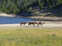
We had the trail to ourselves all afternoon until about 5:30 when we met a horse party. We saw another group on horseback around noon and some backpackers at 9:00 a.m., but it was mostly just us slipping and sliding on the trail. We got rained on a couple more times, but without all the sound and fury.
Jim: Meeting Ahab and Rusted Root was cool. Rusted Root is finishing a hike that he started last year. Ahab said he'd gotten started long distance hiking because of the Thruhiking Papers. I said thank you.
You'd think this was Colorado - the thunderstorms kept going on and on. And the hail was an interesting and unwelcome side effect. The temperature has probably dropped 20 degrees since yesterday.
Saturday, August 12 18 miles to Fremont Creek near Lower Jean Lake
We had a few sprinkles while cooking dinner, but, aside from an owl in a tree above us, and noisy neighbors across the lake, (I didnt appreciate the gunshots coming our way), we had a peaceful night.
The morning hike continued our ramble from lake to lake along the Highline Trail. There were several stream crossings, but nothing deep. The clouds are gathering for another exciting afternoon. This time we have to climb to 11,000, storm or not. Were climbing back to more dramatic country jagged peaks and vistas. I enjoyed the lakes, but I love the peaks too.
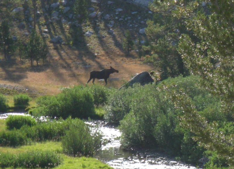
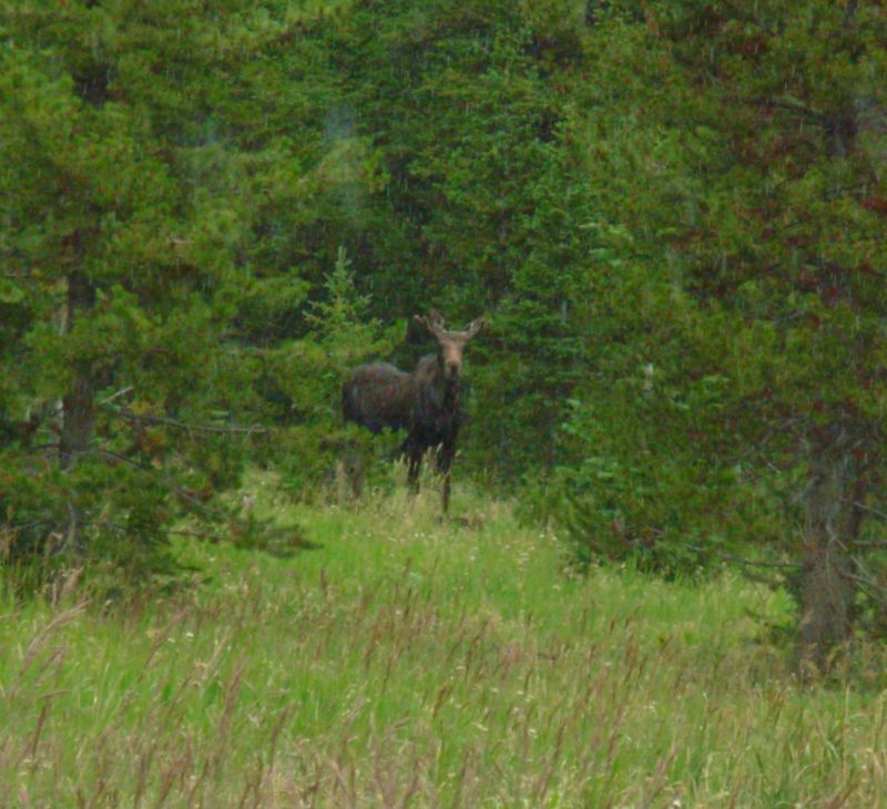
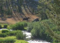
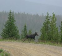
The trail was more crowded this morning: we saw ten backpackers and two fishermen whose dog was making it very difficult for them to catch anything as he chased after their line. We also saw two moose near Barnes Lake, our first on this trip. They were too far away for a good photo, and the bull ran off, but it was fun to see them.
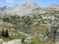
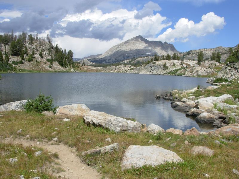
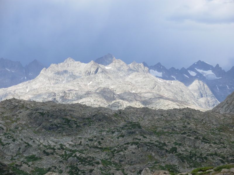
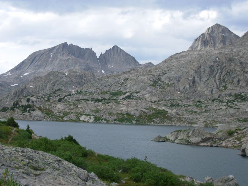
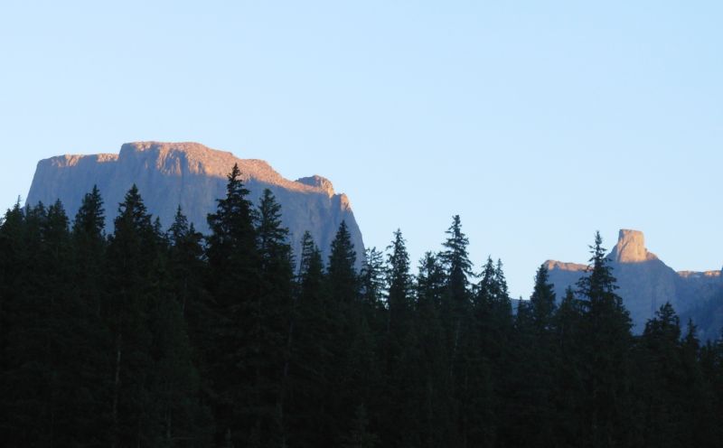
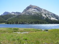
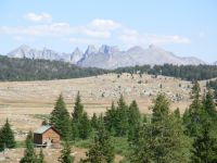
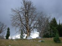
We had a small hailstorm around 1:30. Jim and I waited in the trees about 10 minutes, then it was over, nothing like yesterdays torrents. We were happy to wait since we were halfway up Lester Pass at the time. By the time we reached the top, the sun was shining. We chatted with a couple of backpackers there, then went on to admire the incredible view from the top. That climb was definitely worth the effort. There were jagged peaks and several unnamed lakes spread out below. We got views of those peaks for the rest of the afternoon as we wound our way northward. I dont remember much of this from last time and that surprises me. The land is rocky and broken with granite peaks and boulders. There are many ridges and hidden valleys, many with lakes and ponds. I remember long Lower Jean Lake, but the rest I had forgotten. We are camped at 10,800 near the creek with a view back toward the lake. It is cold, gray and windy, but very peaceful.

We only ran into three other people this afternoon: trail crew out on a dayhike. Theyve worked on about two miles of trail south of Lester Pass. It is much improved. Elsewhere the trail is rocky and eroded, which makes for slow walking, so their efforts were much appreciated. Someone left three good jackets on a rock, possibly the trail crew, though we spotted the jackets a couple of miles from where we saw the hikers. Yesterday we found a rusted ice axe on the trail. We have found a lot of bits and pieces from the horses too water bottles, tack, etc.
Jim: God must love rock - He made a lot of it. And a lot of it ended up in the Winds. The country is all raw gray rock, blue water and green vegetation. Beautiful.
We passed the camp where the trail crew is operating from early this afternoon, but we didn't realize that's what they were until later. There's been a lot of very recent trail work in this section so we should have figured it out sooner. Later on we met a couple of them - they were out hiking. It's always good karma to say "Thank you" to them.
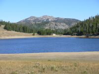
Sunday, August 13 16 miles to Green River Lake


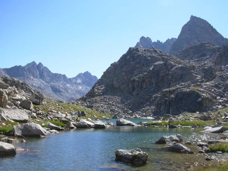
It was a beautiful day: blue skies and breezy. The mountains were spectacular. Peak Lake was a beautiful turquoise green. Dale Lake was as gorgeous as I remembered. They had done some trailwork on the trail below Cube Rock Pass--for a while it was beautiful sidehill--then they ran out of either time or money, so the last 200 yards were the boulder scramble I remembered, but without the snow chutes we had last time.
It was a slow morning because we kept running into people: first a climber who had come over Knapsack Col the day before (an off trail route, beautiful but very difficult), then we met Al Learned and his son. Al hiked the CDT last year and wanted to share the Winds with his son. Next Princess of Darkness (POD) and Disco, a couple of southbounders, appeared. They have an online journal. We talked to them for about an hour.
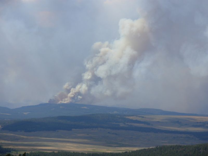
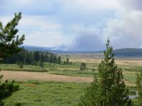
Lunch was in a meadow near beautiful Vista Pass. The next several miles should be fairly easy, if we dont run into any more thruhikers. Evidently we missed a few by doing our alternate route. POD warned us about a fire ahead in the Gros Ventre, quite near the trail. We can smell the smoke already.

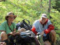
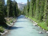
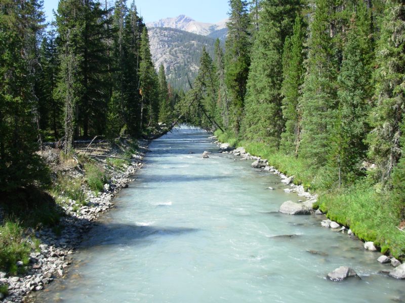
Later: we enjoyed our hike down the beautiful aquamarine Green River to Lower Green River Lake. The cliffs and peaks were very dramatic. Part was bands of orange that reminded me of Utah. It was easy walking, very enjoyable. Unfortunately we didnt get as far as we hoped because we spent another hour talking with three more southbound thruhikers: Matti/Speedo from Germany, Lisa/Love Barge and Skittles. Theyve been doing some interesting side jaunts: climbing in the Tetons, climbing Granite Peak in the Beartooths, and doing a side alternative route that enters the Winds over a glacier. They plan to do Knapsack Col and the Cirque, of course. Its good to see people enjoying their hikes and really exploring this incredible country, not just rushing to finish as quickly as possible.
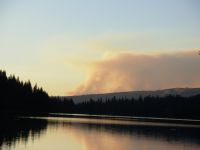
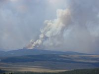
We camped above Green River Lake. When I went down to wash up, I could see a huge plume of smoke to the north not a good sign.
Jim:It was a good day - beautiful scenery, good weather, good trail - and a gaggle of southbound thruhikers. That always costs time - but for us it's always worth it. On the PCT we stopped to talk to a southbound section hiker and he was a little irritated (not with us). He said he'd passed a dozen or more thruhikers and we were the first who'd actually spoken more than three words to him. He considered that to be rude. I wouldn't disagree with him. If nothing else, the hikers going the other way often provide us with information about the trail ahead. It's not always as accurate as we'd like, but it's "information." Case in point is POD's warning about the fire in the Gros Ventre. Don't know how we'll deal with that but at least we're forewarned.
Somehow this section has been both longer and shorter than I expected. The hours (and the climbs) are loooong. And the days just seem to disappear. It's a peculiar kind of time compression that's happened on all our long hikes. There's an intensity to being out here that normally doesn't happen back in the "other world."
Monday, August 14 15 (?) miles Union Pass area
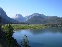
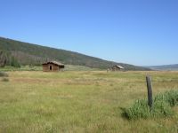
Jim and I didnt sleep much as we were too concerned about the next 50 miles, so we got an early start, for us, and enjoyed a solitary walk down Upper and Lower Green River Lakes. They really were green. We had beautiful views of Square Top, despite the smoky haze. All we saw were ducks on the water until we reached the trailhead. That was a bit confusing as there are a couple of trails but no signs, in either direction. Fortunately, we soon found trail heading past an old homestead and up into the hills. About two miles up the trail we ran into three more thruhikers: our old friend Mags hiking with Jess and Tradje. We sat for an hour and a half talking. Finally everyone started up again, but 15 minutes later we stopped at a viewpoint to eat lunch and enjoy the view. Even with the haze, there was a nice view down to the lake with the peaks behind.


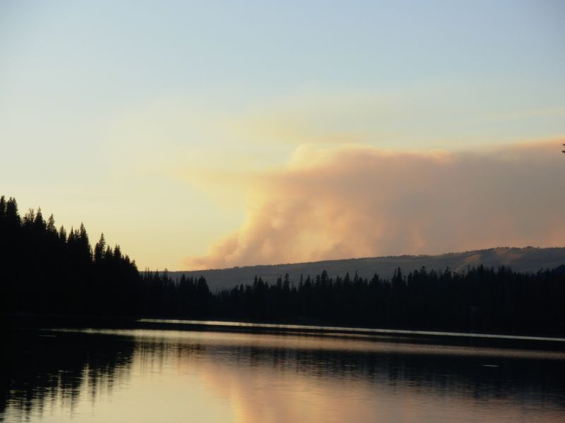
Mags told us the trail was closed when he left Dubois yesterday. The big plume of smoke we saw last night was gone in the morning, so we had some hope the fire was under control. When we reached Gunsight Pass we learned the truth: there were four huge towering plumes of smoke, 5-10 miles away. It was north and west of us, so we felt safe enough continuing to Union Pass where we could pick up a road that would take us out to the highway to Dubois. All the thruhikers we met the past two days had come that way. We learned that the fires were between Union Pass and Sheridan Pass along the CDT. Evidently, the fire was started about 11 days ago by lightning. The Forest Service decided to let it burn. Because there has been very little rain this month, the fire spread. A few days ago, it began growing rapidly and spread from one National Forest to another and now threatens homes in the Union Pass area, so they decided to fight it. At the moment it covers about 6000 acres.
We saw and heard three sandhill cranes today. The trail was faint across the grasslands. We couldnt be sure we werent following cow paths instead of the trail at times since almost all the carsonite posts that mark the route, erected in 1998, had fallen. We put some back up, but it was only a temporary fix since we needed a shovel to dig a hole for the posts.
It was very eerie hiking with those huge columns of smoke beyond the next ridge. We were south of the smoke until about 5:00, then we walked in heavy smoke. We couldnt see more than 100, our eyes watered and we started coughing. We planned to go over Union Pass and down the road as far as possible before dark. We didnt realize then that the road through Union Pass doesnt begin to descend for a couple of miles
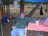
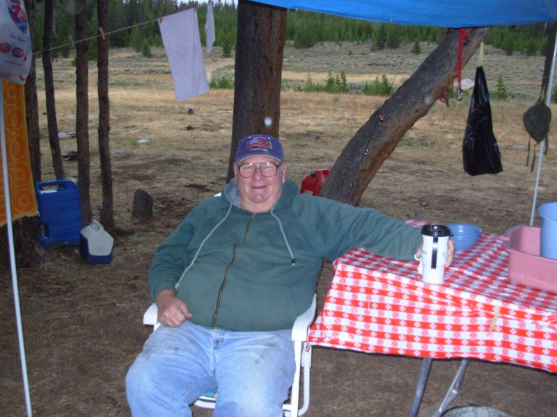
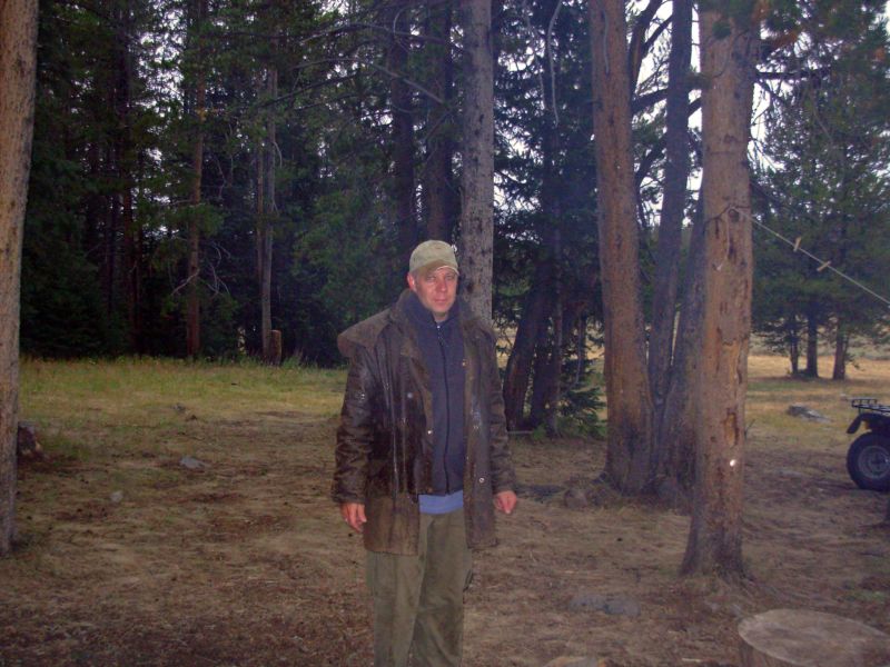
When we reached the road crossing, we decided to ask a couple of men camped there which direction was which, since there were two roads and no signs. They invited us to sit and visit, then offered us half their steaks which they were grilling over a fire when we arrived. Ron and Stewart were terrific trail angels. Ron is a retired teacher from Illinois, and Stew is his nephew from Knoxville. They come to Wyoming almost every year. They invited us to camp with them, gave us good water, dinner, coffee and donuts and good conversation around their fire. The wind shifted soon after we sat down, so the smoke from the forest fire cleared before we finished dinner. They said the previous night at Lake of the Winds the smoke was so bad they packed up their camp and went to town. We talked quite late, for us. We hadnt intended to stay, but when they said that if the Forest Service ordered an evacuation, they would drive us to town, we decided it would be a really good idea to stay with them. Besides, we enjoyed the conversation.
Jim:It was a good day until the end - and then it got better. We got the obligatory pictures of Squaretop and Green River Lake and then ran into Mags, Jess and Tradja. It's amazing that so many southbounders are this close together. Usually the pack is spread out more. Toward the end of the day, I got a little irritated because the smoke was really thick. Made it hard to breathe - and the pictures were - well, "interesting" is a good word. But certainly not clear. But then we ran into Ron and Stew - somehow a bit of Trail Magic always makes things a lot better.
Tuesday, August 15 15 miles to Dubois
We woke to the sound of rain on the tent, again. It sprinkled for about an hour, but not enough to get the ground wet. Ron offered me a cup of real coffee this morning, which I happily accepted. Last night he heated a bucket of water on the fire, which he offered to me to take a bath. That was wonderful! I was really filthy. Although I had intended to leave some for Jim, by the time I finished my bath, the water was so dirty I had to dump it. It wouldn't have done Jim the slightest bit of good. He said he didn't mind, since town was so close. He'd wait for a real bath. We headed down Union Pass Road around 7:45. It is pretty country: rolling grassy hills in the high country, then spruce forests and meadows below. The last few miles, outside the Shoshone National Forest, there are houses, mostly summer homes. We passed two restaurants, both closed today. It was a long walk.
The highlights were the wildlife sightings: two moose standing in the middle of the road, five elk, 3 hawks and a coyote. We also met two more Great Divide bike riders a few miles from the highway. It rained again for about half an hour. I hope it helps get the fire under control.
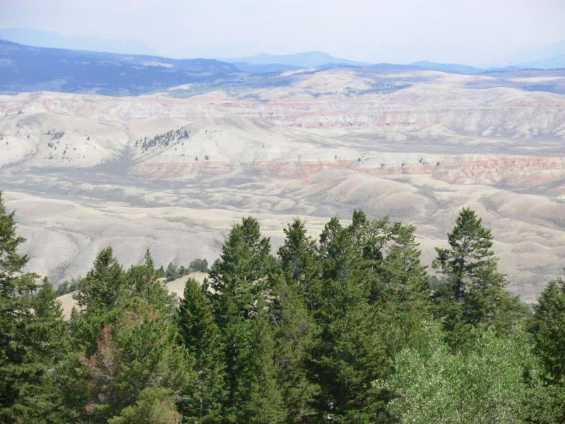
Yesterday had beautiful walking and some nice views. We even got a brief glimpse of the Tetons. Smoke haze obscured a lot today, except the red and white badlands on the other side of the highway. Those are beautiful. We followed the road down to the highway a few miles from town, drank a soda at the store there, then
hitched a ride into Dubois.
Jim: The day started off fairly clear - and got gradually more smoky -- but never as bad as it was yesterday afternoon. I actually managed to get the camera out in time to capture the moose. Usually either it's buried because of rain or I'm just a second or so too slow getting it out and all I get is the south end of the northbound moose/bear/whatever.
The big disappointment today was that with two restaurants on Union Pass road - both of them were closed on Tuesdays. We thought we might find lunch at one of them, but no such luck. Kinda like Worthington's bakery on the AT being closed one day a week - and that's obviously the day we got there. It was a long 15 miles to the highway - in part because we didn't know how long it would be when we started. And in part because it was all graded roadwalk.
We got a ride into Dubois with a couple from Colorado who have bought a house in Dubois and intend to retire here. They dropped us at the Black Bear motel and we got a room. Then we found out that the motel phone system is down. But they'll let us use the office phone. Shower, food, laundry - all good. And all within a short distance of the motel.
August 16-17 Rest days in Dubois

Jim: Dubois is another good trail town - except for the transportation problem. Getting into town - or back to the trail - is problematic becasue of the distance and local attitudes (hitching is illegal). And local law enforcement is usually not happy about hitchhikers. They have a problem with people who look like refugees from a homeless shelter. Not surprising. I'll refrain from pointing out how thruhikers look (and smell) after a week on the trail.
Home | Links| Trail Journals |
The Thruhiking Papers | Bun-bun
Created: Dec 2006
Revised: 30 Sept 2016Copyright © 2006-2017 Spirit Eagle