|
 |
 |
 |
 |
|
|
|
|
|
|
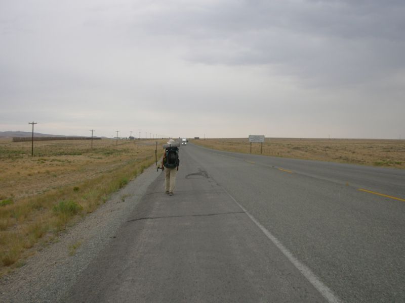
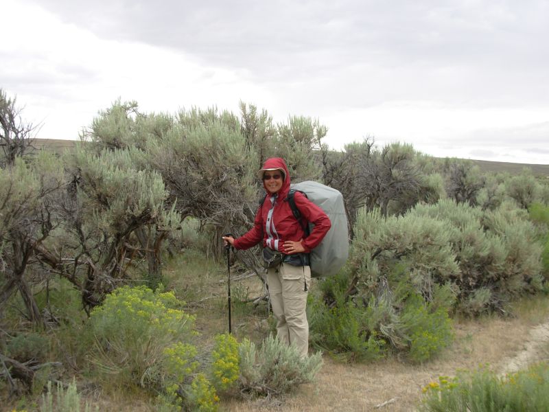
Monday, July 31 13 miles to Nine Mile Campsite
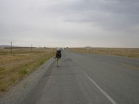
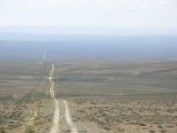
The plan was simple: spend the morning taking care of last minute errands and phone calls, leave around noon, go to Fish Pond Spring 11 miles out and enjoy a short easy day. The trail out of Rawlins follows a busy highway for 15 miles north and that would be a way of breaking up the roadwalk, especially since you continue on pavement for several miles after you leave the highway. The next water is 16-21 miles beyond, depending on which route you take, so we didnt intend to go much beyond Fish Pond.
We started out as planned, but decided to detour to the library first to see if anyone had answered my question, posted on CDT-L, about the status of Fish Pond Spring. On the way we ran into a couple of southbound Continental Divide bicyclists. Of course we had to talk. They told us that all the springs and streams were dry in the Basin aside from A&M Reservoir. Say what? Jim had talked to the BLM and they said there was plenty of water, they just didnt know the status of Fish Pond Spring. After a while we went on to the library where there was no response on the forum to my question from the hikers ahead of us. I didnt really expect one unless someone just happened to go to town at just the right moment, but it was worth trying. I had hoped that someone would post a general water status report, but no one bothered.

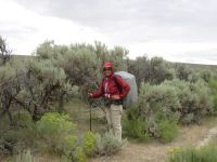
By the time we finished with the Internet, we were hungry, despite our late breakfast, so we got a final burger at Sanfords (but no beer, alas). We hit the road around 2:00. After a mile or so, we passed the BLM office and decided to stop in to see if Crystal, the Recreation Planner, had been able to get some information on the spring. She hadnt, but we had a very long and friendly chat with her and another BLM person. She suggested that we go to Nine Mile Campsite, which has trees, and try to get water out of one of the containers used to irrigate the trees planted there as a natural snow fence. We told her wed look at it as we passed. I wasnt crazy about the idea of the campsite, as it is right next to the highway, but the trees were a good selling point. One of the problems with long roadwalks through the desert is that there is no privacy--miles and miles of sage, but no bushes big enough to hide behind when necessary. The campsite, with its fringe of trees, at least gives an illusion of privacy.
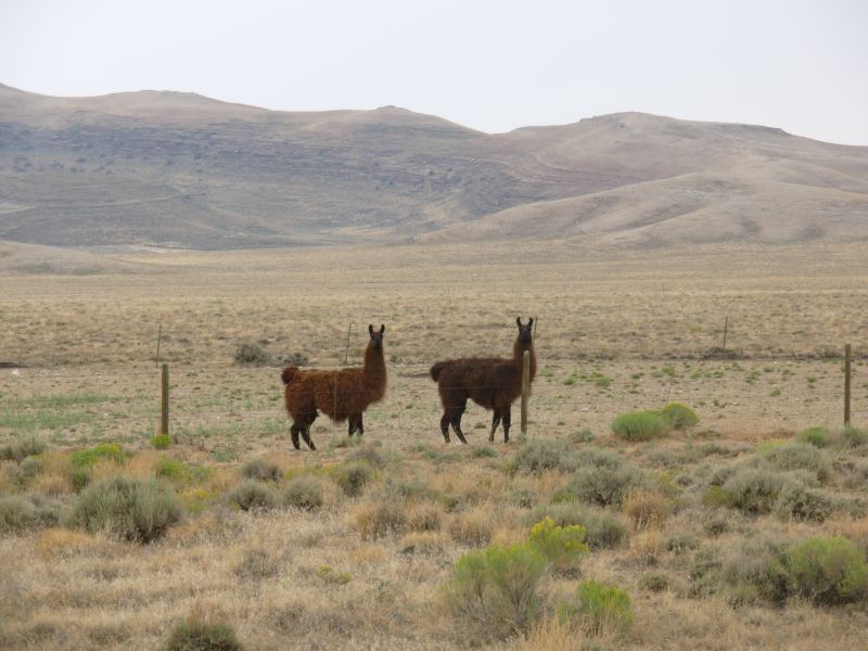
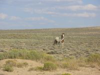
We left there around 3:00 and headed north again. I spotted a few antelope in the desert (six or so) and we passed a ranch with horses and llamas, but otherwise it is a lot of open, empty, sagebrush desert. After a little while, I saw a car turn around and come back toward us. It stopped and a couple got out asking, Are you hiking the CDT? It turned out they were Bruce and Paul Ward, heads of CDTA, on their way to a meeting with the Bridger-Teton Forest about the CDT route in the southern Wind River Range. There is a problem deciding on a route because the routes the hikers use (Temple Pass or Cirque of the Towers via Jackass Pass or Texas Pass) arent suitable for horses. The Forest officials want to build a new trail that would work for pack animals outside the Wilderness Areas. But hikers wouldnt use it. So they agreed to go look at the options. Our meeting was brief, but interesting. Id like to sit down with them sometime for a couple of hours and talk about the trail. We have had disagreements via email, but I think we could have an interesting discussion in person.
Soon after they took off it started to rain, lightly at first, then more and more heavily. We reached the campsite at 6:00 and went to check out the water containers. They were huge 1000 gallon plastic containers with very small (4) openings too small to put a pot in to dip water out and the water level was about two feet down. Getting water out wouldnt be easy. So we decided to continue two more miles to the Spring. It is on a side road, about 0.4 mile from the highway. A quarter mile in, the road was posted, No Trespassing. No exceptions. I will call the Sheriff if you step beyond this point. We looked around and saw that the spring was straight back and we could get there by heading cross-country without trespassing on the private land. If we hadnt been there before, we would have assumed that we had taken the wrong road, but I recognized the geography. We followed a cow path back to the spring, which is on BLM land. There were no cows a bad sign. The stock pond was dry. We climbed the style into the exclosure. The cistern lid was off, and it was empty. Last time we were there, the meadow around the cistern was wet and soggy it too was bone dry. Oh oh. We knew we didnt have enough water with us to continue 16 miles to Bull Spring. In town we had foreseen this contingency when we could get no information about the spring. Everyone kept telling us that this was an extremely hot and dry summer for Rawlins (though we didnt exactly experience drought in Colorado!) And while we had gotten to town okay, we noticed how low Little Sage Reservoir and the other ponds were. So Plan B was to hitch back to town for the night, get a ride or taxi back to the trail in the morning with enough water to get to the next water source. Good idea, but no one would stop. It was raining again and cold, so when I started shivering, after an hour or so, we decided to head back to Nine Mile campsite, stay the night there, and either figure out a way to get water or hitch to town in the morning. It wasnt dark yet, but dusk was not far off. Reluctantly we walked the two miles back to the sheltered camp next to the highway. I was close to hypothermia (hands too cold to work) and Jim was in a lot of pain all over, so bed seemed like the best bet. We ate a sandwich and lay down and were soon completely oblivious. I was really unhappy that no one would stop when we were so cold and wet. Jim said he felt feverish, aching from head to toe. We have no idea why. Despite the noise from the highway and the continual pitter-patter of rain on the tent, we slept very well.
Jim: Our great alternate plan if Fish Pond Spring was dry turned out to be not so great. We didn't want to start from town with water for 32 miles on top of six days of food if the spring was good - which is why we took the chance with the spring. But the spring was dry, dry, DRY. And then no one would pick up two hitchhikers standing out in the rain on that highway. We tried for about an hour, then walked back to Nine Mile Campsite (at the ten mile mark out of town, next to the highway) where we could shelter in some trees. Crystal at the BLM office had suggested trying to get water out of the big plastic tanks that they use to water the saplings that they planted there as a natural snow fence. We'll try that tomorrow. For tonight, I have a fever, joint and muscle pains and a headache. And Ginny is close to hypothermic. It's painkiller and crash time.
Tuesday, August 1 22 miles to Bull Rim
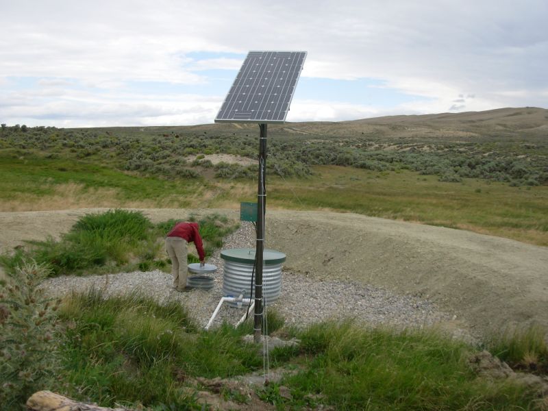
We woke to cloudy but dry skies. While I packed up, Jim took the water filter and bottles over to the irrigation tank and got water for us. It turned out the filters hose was just long enough to reach the water and small enough to fit in the opening. Hurray! We left a bit late, but happy. Jims fever seems to have passed.
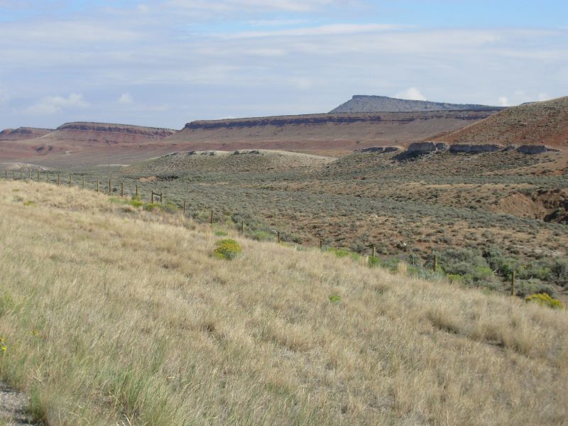
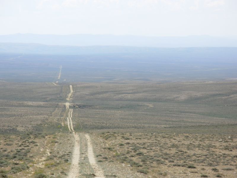
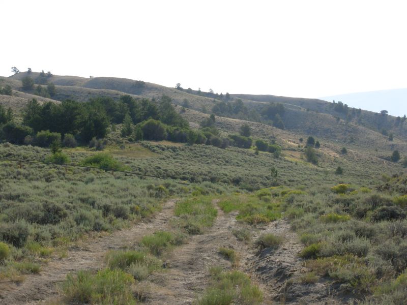
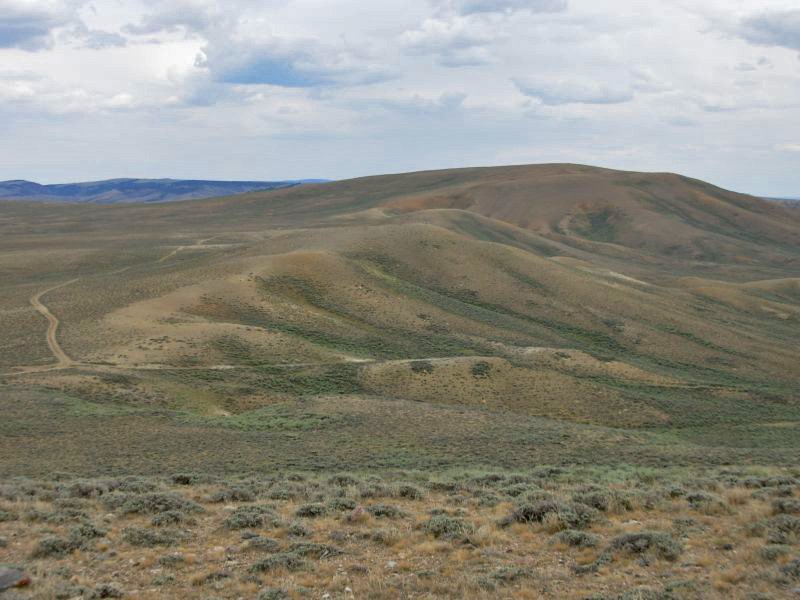
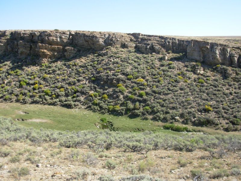
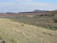
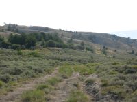
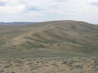
The land continued barren. There are some pretty red hills just at the junction with Mineral X Road, but most of the land was gray and brown. We decided to take a short cut we had done last time. In order to stay on public land, the CDT follows paved road past Bull Springs, then backtracks cross-country across the desert to the spring. There are jeep roads all over the place. One of them goes directly to the spring but crosses some private land. It is all open range, no fences, so the jeep track is an easy alternative. The short-cut saves five miles and about two hours of walking. We saw a few cows but no people in our trek across the desert. We reached Bull Spring around 3:30.
At noon, when we turned off the paved road, just as we were taking our first bite of lunch, it began to rain. We ate quickly and packed up as we were getting soaked. The rain turned into a thunderstorm with a couple of nearby flashes. With no trees nearby, we were the tallest things in that open desert. The rain continued, without lightning, for about three hours, off and on. When it stopped, the wind picked up, so we stayed cool all day. The biggest problem walking in the rain was that the road turned to muck which turned to clay. It stuck to our shoes and was really slippery. Where possible, we walked on grass, but I had some good slips and slides.
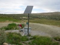
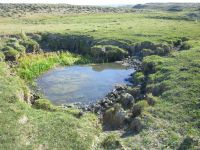
Bull Springs was an unexpected pleasure. It used to be one of the worst on the trail. We passed it up last time, it was so bad. The dead cows were definitely a deterrent, but the water itself was obviously badly fouled. They have recently fenced part of it and put in a solar well which produces lots of good water. That was a nice surprise.
About a mile past the spring, I spotted a hiker, resting near the trail. He was a section hiker from Arizona named Bill Webster. We talked for about an hour and he reassured us about the water situation ahead. It seems the creeks are dry but the springs are running. Whew.
Wildlife has been limited the past two days, partly because of the rain and partly because I wasnt watching as closely. We saw 21 antelope this morning and one coyote this evening, plus a horny toad. I saw a fox or small coyote last night too at Fish Pond Spring. We heard some coyotes as we were falling asleep last night. We were wakened in the night by a bellowing cow. I dont know what the problem was, but it went on for 15 minutes before the cow finally moved away.
We stopped early tonight so we could sit and enjoy the sunshine. We found a sandy spot by the road, a little protected from the wind. We watched the cows nearby and looked out over the desert. It was nice.
Jim: The opening in the water tank at Nine Mile Campsite is only about four or five inches in diameter, and the water was low. But I managed to get the water filter hose down to the water and pump out enough to get us to Bull Spring.
For most of the distance to Mineral-X Road, the roadwalk out of Rawlins isn't as bad as the roadwalk into Rawlins. The reason is that the road shoulder is wider on one side of the road than the other. Coming out of town, it's about 8 ft wide, going in it's about 18 inches. All this presumes that one is walking facing traffic like we've all been taught to do. The obvious solution for southbounders is to walk on the "wrong" side of the road. For the mile or so south of Mineral-X Road it makes no difference - the shoulder is too narrow on both sides of the road. Be careful.
Bull Spring - used to be a muddy, swampy mess. And in 1999, it was also the resting place for several dead cow carcasses and the stomping grounds for a (probable) rabid coyote. In 2006, the spring is a whole lot different - it's now a fenced solar well with vertical culvert pipes to contain the water. The cattle tanks are separate and the area has been graded, fenced and cleaned up. Much, much better.
Wednesday, August 2 27 miles to Brenton Springs
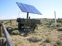
It was a cool, breezy, mostly sunny morning. We followed a jeep track northwest, paralleling the low brown hills of Bull Rim. Jim detoured 1/3 mile to check out the solar well, which was not only working but had extra gallons of water stashed for hikers who arrived when it wasnt. Jim said the stash really wasnt necessary as the tanks were full and there was a stock pond besides. Across the road they had plowed up a large section of sage and planted grass. There was a solar pump there, but it wasnt obvious where the water was going, except that it obviously wasnt being used to water the grass.
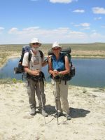
A few miles later, we topped a rise and had nice views of the Crooks, Green and Ferris Mountains. They are partly covered by trees, so are a pretty blue-green color. Lunch was at windy A&M Reservoir. It looked very different from the last time we were there, when the water was almost gone. Amoco pumps water into a large artificial lake, which is stocked with fish. There were two couples fishing when we got there. One had caught something, the other hadnt. We spoke with the second couple. He had helped build the lake, several years ago, and planted vegetation to help the fish survive in the water. When a decision was made, several years ago, to stop pumping water into the lake, he was unhappy that all the work was for nothing. With the recent oil boom, they decided to refill the reservoir and reestablish the fishing. I hope they continue it. For oil field workers, it gives something to do besides go to town and get drunk. For hikers, it is a decent fenced off water source.
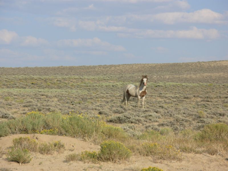
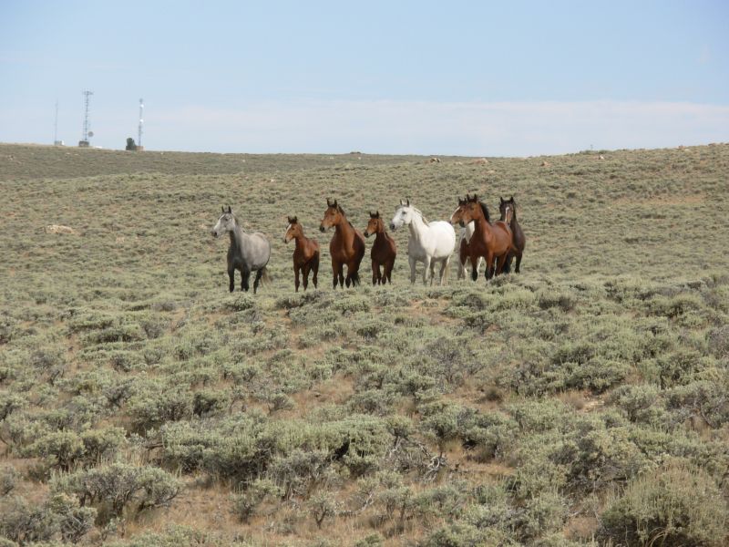
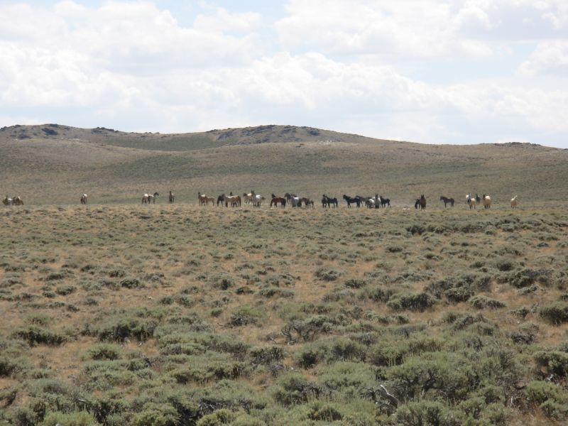
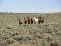
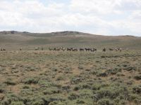
It was a busy morning for wildlife: 34 antelope, 20 wild horses, four horny toads and a jack rabbit. Yesterday we saw a baby bunny the size of my hand. The afternoon included 33 antelope and nine horses. One of them, a brown and white stallion, trotted over to say hello.
Heading toward Crooks Gap was slow on very sandy roads. We got water from a piped spring next to a stock tank, then headed on to Brenton Springs six miles away. Unfortunately, we missed a turn, which added about 1 ½ miles to our day. It wasnt hard to get back on track, but it was a bit frustrating.
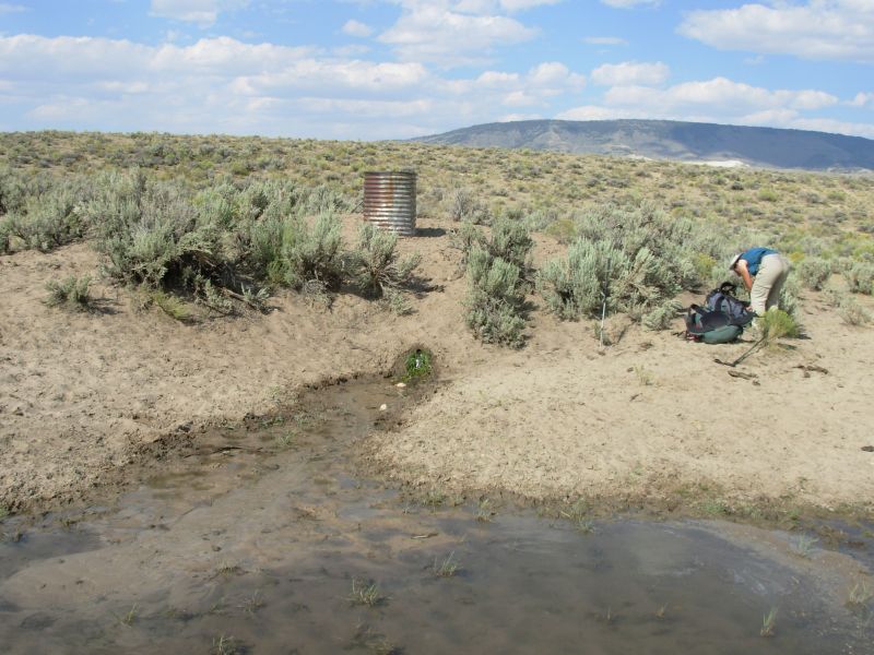
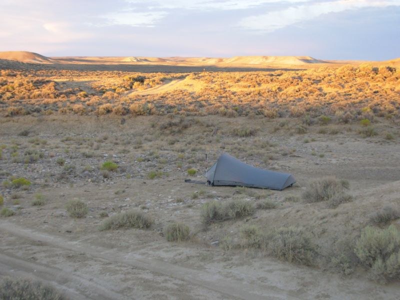
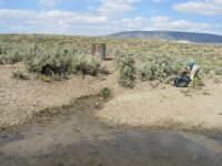
Worse, the springs are nearly dry. The upper springs are just wet puddles, the run off goes to a small muddy pool outside the fenced area and is shared with (and fouled by) wildlife and cattle. Jim filtered enough for the night while I set up the tent. We didnt get to the spring until sundown, thanks to our unplanned detour. We didnt intend to camp here, but we still need to get water for tomorrows hike. It took a while to even find water since we had to search the whole area.
The stock pond was bone dry. There are upper springs, basically wet patches in the grass in the exclosure that trickle down. The trickles become a stream, but at the moment it is only about a half inch deep and four inches wide. Jim dug a hole in the stream so we can get water in the morning. I hate hiking so late. Dinner will be eaten in the dark. I dont like camping so near the spring, but we dont have a lot of choice. Someone left a small bottle of vodka on the stile by the spring. We dont want it. I wonder if one of the hikers behind us will.
An antelope is expressing his displeasure at our presence. They snort, huff and puff when they're unhappy. Coyotes are howling in the hills. Last night we had two packs singing one on each side of us. The springs are in between two lines of hills. There are a few scattered trees, the first weve seen near the trail in three days.
Jim: It wasn't a bad day at all, but it was long. And it wasn't helped by missing a turn and doing an extra couple miles and 500+ ft climb. OTOH, if we hadn't done the extra miles, we'd have missed some of the wildlife (in particular, the horse), so it was worth it.
The water today was abundant to say the least. First was the solar well, which has also been modified and now includes a stock tank. The water cache that someone left there was total overkill - and totally unnecessary - and is now nothing but backcountry litter. This is one of the many reasons I don't like water caches.
Six miles later came the A&M Reservoir which used to be just a really deep mud pit, but is now a real honest-to-God lake, complete with fish - and fishermen.
Later we got to the faucet a couple miles south of Crooks Creek. This is the one that we surprised the BLM with in 1999. They didn't know it was there until we told them about it. It's still a good water source.
Finally, we got to Brenton Springs just at dusk. And it's not as good as it used to be. The exclosure is a lot bigger, but still doesn't keep out either the elk or some of the cattle. So the water in the upper springs (what there is of it) is fouled. The (very) small stream is still running but it's really shallow and not easy to get water. The pond outside the exclosure is really fouled - don't go there. And the stock tank down the hill is dry. In other words, there's water but you have to work for it.
Thursday, August 3 23 miles to Alkali Creek

We woke to a hot, still morning. Fortunately, some clouds moved in late morning that cooled things off. Since were heading due west again today, I hope they last the afternoon. It was difficult walking the last few miles to the spring yesterday with the sun directly in our eyes.
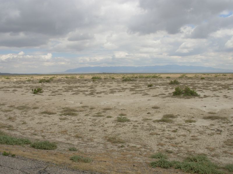
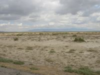
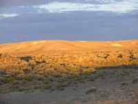
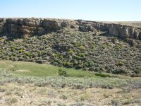
Our next water is in about 20 miles a stock reservoir. I am not looking forward to that. We passed a couple of stock ponds today that were really disgusting. The creeks were mostly dry, though a couple had a few muddy pools, much used by cows. It was nice walking though. We left the Great Basin floor and are wandering the hills of Crooks Mountain. There were trees for a while (limber pine?) but one section was burned. We climbed to the flat open plateau on top, which has a few oil wells and a microwave station off in the distance. There are lots of little valleys and draws. I enjoyed it.
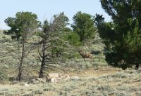
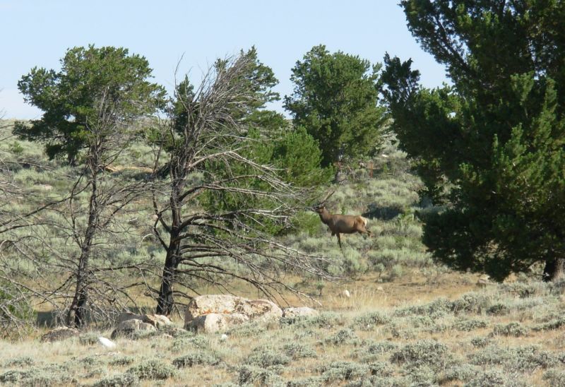
Morning wildlife count was one Great Basin Elk (with long straight antlers), 20 antelope and 16 horses. One herd came over to say hello, then the stallion ran over to stand between us and his herd to keep us from getting too friendly. They were beautiful, with two foals in the group. Now we continue westward, with views south to Alkali Creek and the plateau a few miles south of us. Its a dry and empty land. There are few flowers besides the ubiquitous sage: an occasional lupine, some yellow rabbitbrush, a few purple asters. This is dry country, much more so than the last time we passed this way.
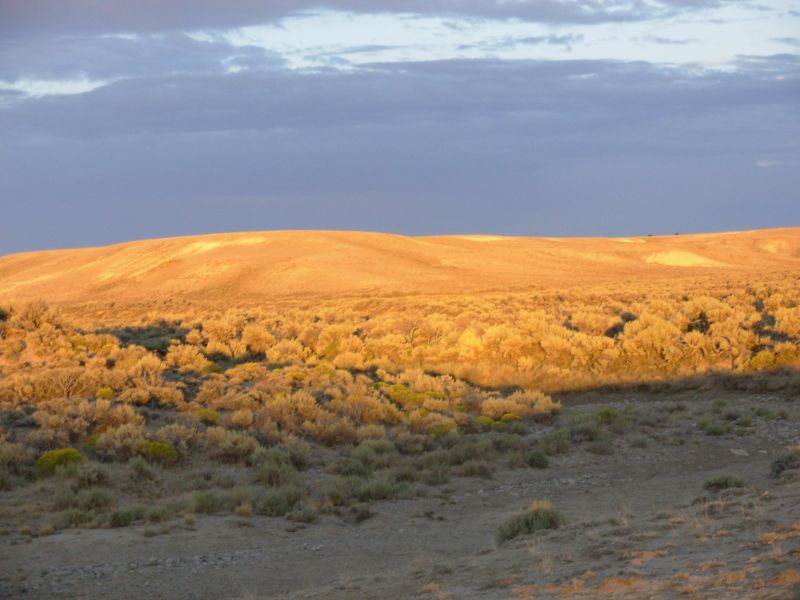
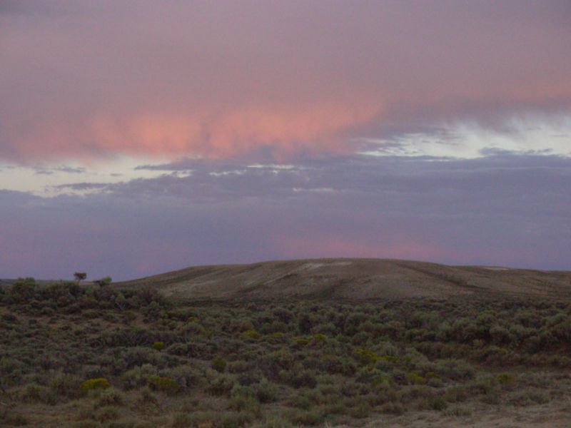
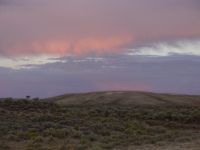
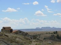
Later: After lunch we climbed up to the spine of Crooks Mountain and followed it, off and on, for several miles. It is a rounded mountain, wide and flat on top. There were good views, especially west toward the Wind River Range and the Oregon Buttes. Part of Crooks was red, part was tan and white. Later in the afternoon, we walked down the drainage of Alkali Creek and the hills were white and gray. We ended up camped in a dry creek bed. Despite the clouds, I dont expect any rain. Theyre all drifting away. This land desperately needs the rain.
Our planned water source for the evening turned out to be unusable. It was a large stock reservoir near Bison Basin Road where we got water last time. The reservoir has shrunk. It is now a pool about 15 across and 3 or 4 inches deep, shared by all the neighborhood cows, horses, antelopes, and ducks. Disgusting doesnt begin to describe it. Even though we had walked 20 miles to get there and the next possible source was five miles beyond (and the next sure source was 9 miles farther), we wouldnt touch it. It would destroy a filter and even boiling wouldnt make it drinkable. So we went on, empty-handed. That was about 5:00, so we had time to go five more miles, though we hadnt planned to do so.
Then some trail magic occurred. Up the jeep road that is the CDT came a white BLM truck. We stopped it and asked the driver if she had any water. She did. We got 3 quarts from her, enough to get us through the night with the 1 ½ quarts we still carried from Brenton Springs. Then she offered us fresh blueberries. Wonderful! Finally she gave us a couple of Luna Bars. She said she likes to keep a few things on hand for hikers she runs into. What a trail angel. And what a miracle for us.
I really didnt want to walk five more miles only to discover another dry creek. Instead we walked three more, since we were energized by the encounter. Well drink what we have tonight and in the morning we can hike the remaining two (or seven if the creek is dry) in the cool of the morning. Trouble is, Jim and I are both dehydrated. Wed like to drink it all NOW, so well have to be careful to make sure it lasts.
Afternoon wildlife count: 25 antelope, one coyote and three horny toads. A good day.
Jim: North of Brenton Springs, there was no useable water until Lower Coyote Gulch - 25 miles north. The stock reservoirs (Haypress and Bison Basin) are almost dry and beyond disgusting. We planned on Bison Basin as our water source for the night. Getting there after a 20 mile day and finding it so depleted wasn't happiness. So we planned to go five more miles - but then the Trail Magic began. A white government truck pulled up on the jeep road we were following. Turned out to be a BLM agent, checking grasses. She had water, fresh blueberries (most delicious thing I've eaten in weeks) and granola bars. An unexpected trail angel, just when we needed her.
We could very well have continued the next couple miles to Lower Coyote Gulch - with or without the extra water. It was certainly early enough when we stopped. But we saw no real point to it. After 23 miles, the question becomes - what's our hurry? Contrary to what most hikers seem to feel about it, I love the desert.
Yeah, it's short on water - that's what makes it desert. Duh!!
But the desert has it's own beauty - the sunsets, the flowers, the wildlife, the stars and the peacefulness of the night - even the bleakness of the land is beautiful in its own way. It's a form of "wildness" that many hikers fail to understand or appreciate.
Friday, August 4 22 ½ miles to the Sweetwater River
It was an easy morning, climbing gently up draws and down valleys. Mostly we followed Coyote Gulch, which is a wide draw bordered by low rounded brown hills. One area had interesting cliffs, but mostly it was just the round hills. We got water at the lower spring from a small pool in the otherwise dry creek. Even filtered, it tasted like pond water green but it was very welcome at the time as we only had about a pint left from the BLM rangers gift. About six miles later we exchanged our green water for better water from Weasel Spring. That one is an improved spring in a fenced exclosure with a culvert pipe. The water was so low we ended up filtering because the hose allowed us to reach down deep enough to reach the water. My arm wasnt long enough.
Visual interest this morning was the occasion rocky outcroppings (pink boulders) and the views directly ahead toward the Wind River Range. The mountains are getting closer. This morning I saw 17 antelope and one jack rabbit, plus lots of cows, of course. Its breezy, so feels relatively cool. Weve been lucky in that regard. The Red Desert in August can be brutally hot. Last week temperatures were 90-100 degrees. I think weve been in the low 80s. There have been cloudy afternoons, rain the first two days, and a constant breeze. This afternoon it was a pretty stiff wind, not quite staggering, but close. There were no dust devils, though weve seen some small ones off in the distance.
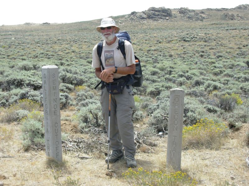
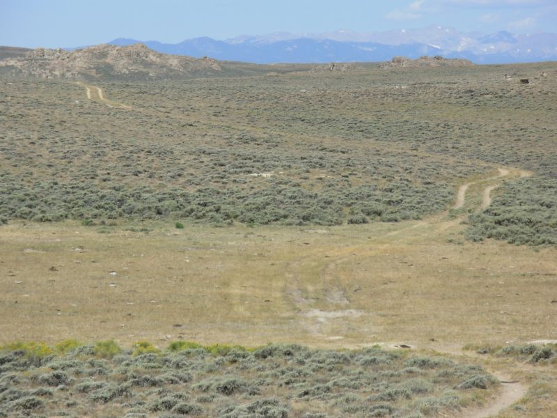
Around noon we reached the Seminoe Cutoff of the Oregon Trail, which well follow for the next several miles. I love the connection to history we get from things like following pioneer trails or passing old log cabins and fallen in mines. I enjoyed thinking about the pioneers as we followed the Oregon Trail. Their journey was also six months and brought about a total transformation of their lives. I wonder about the Mormons who ended up in the barren desert. What must they have thought when they reached their destination? I couldnt live out here. There is a beauty to the desert, but also monotony in looking at brown sage-covered hills stretching out for mile after mile. We only experience it for a week or two at a time. It makes a change. Living with it every day, year after year, that would be different.
We got water twice this afternoon. First we stopped at Mormon Spring, which was much dryer than when we were here in 99. Then the meadows were green and very wet, with an inch or two of water between the tussocks. Today, the meadow was bone dry. There was a rocky area with some clean pools that the cows cant reach, but very little water runs off beyond that. Still there were dozens of cows, so there must be some moisture draining down the draw. Six miles later we filled a bottle at Harris Slough, which is a creek that runs under the jeep track through a culvert.

Looking up the meadow at the slough I was surprised to see a herd of antelope at last 40 strong. My afternoon total was 72 antelope, one deer and a large herd of 30-40 wild horses. They were funny. I noticed them off in the distance, standing in a line, looking like they were waiting to be saddled. When we approached, several came over to check us out, and then the whole herd ran off.
Question: why is it that the only lizards weve seen are horny toads? Usually there is more variety in lizard life in the desert. In California we saw lots of different varieties, including several different horny toads. Why do lizards turn blue when they die? Ive seen several.
Weve seen no rattlesnakes since New Mexico, though we were warned by several people in Rawlins that they are active this year.
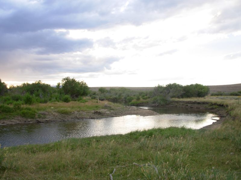
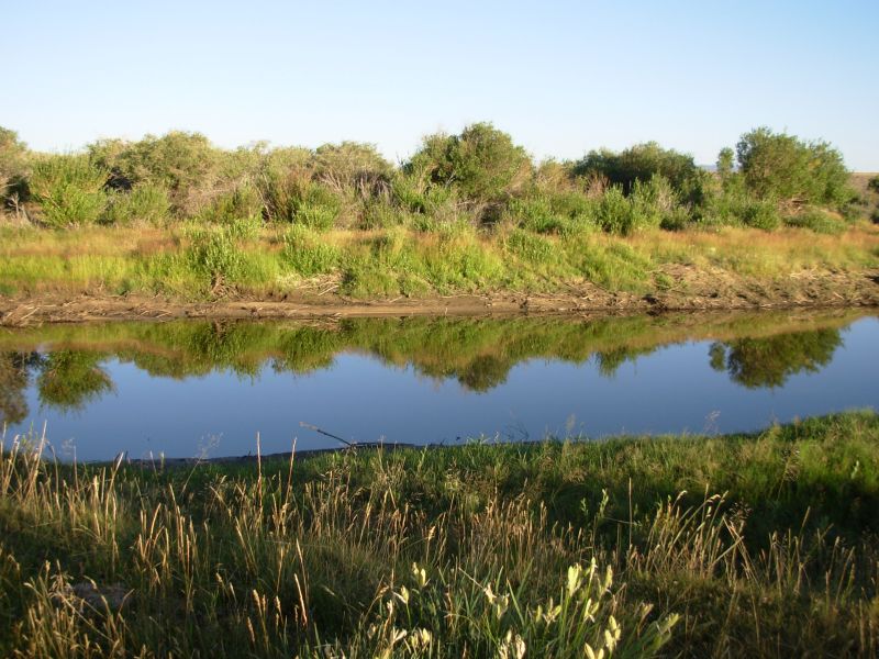
We ended up camped in a meadow next to the wide and beautiful Sweetwater River. There are tiny blue gentians in the grass. This place feels like such an oasis: tall willows, green grass, fish jumping in the river--very nice! We stopped early (5:15) because it is such a nice spot. Besides I was desperate for a bath. It has been too long. The bath felt wonderful.
Jim: We've been REALLY lucky with the weather - we were told that one day last week it was 115 degrees.
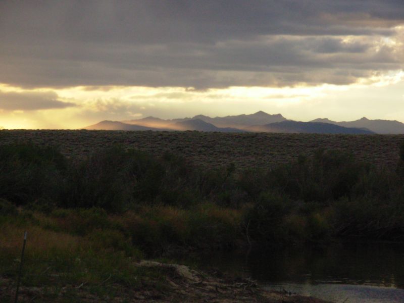
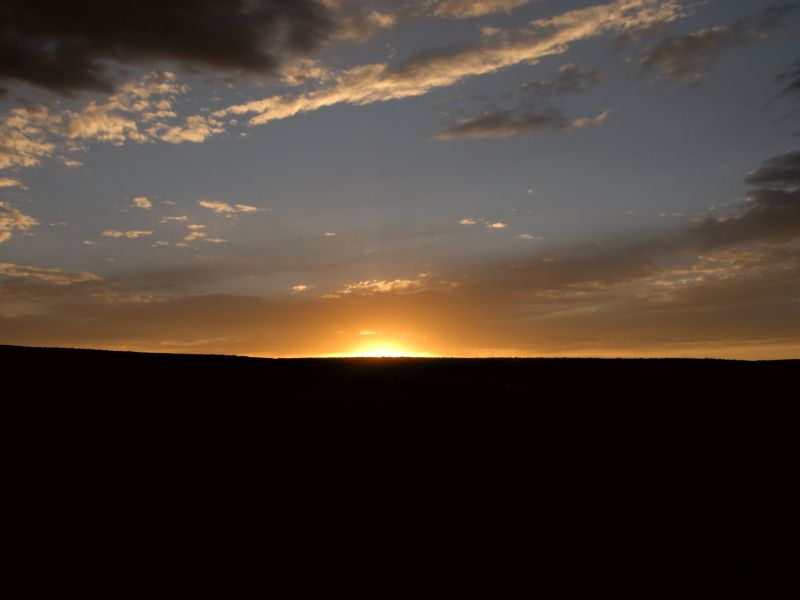
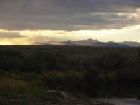
The campsite by the Sweetwater was something we promised ourselves seven years ago when we passed through here. So this time we made it happen. It was as good as we expected it to be. The bath was really welcome after the last few days of living in the sandbox. Then as we ate dinner, we also got to watch a really dramatic sunset through a storm in the Winds.
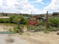
Saturday, August 5 15 miles to South Pass/Lander

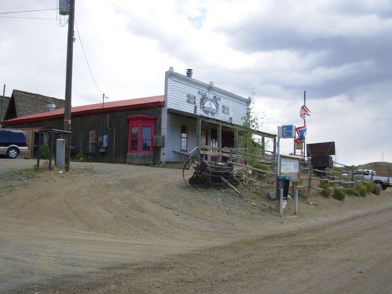
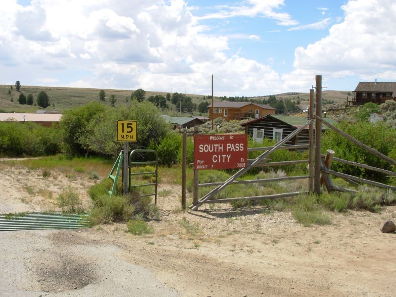
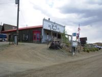
We had a rather relaxed and easy day. We wandered the desert on good trail, and then followed a graded road to tiny Atlantic City, where we ate lunch at the Mercantile. Our waitress was a bit surprised when we ordered, Water, Mountain Dew and beer, ASAP. We drank them all, and had refills. From there we walked on to South Pass City where we picked up the box of maps we had mailed to ourselves. We got a ride to Lander, which is a town about 35 miles away. We didnt stop there last time we hiked the CDT but weve heard good things about the town. While there is a motel and a couple of restaurants in Atlantic City, there is no grocery or other services. South Pass has even less to offer hikers, since it is a historic State Park which reconstructs the town as it existed 150 years ago, but only has a permanent population of seven. You can buy coke and candy, but thats about all. It doesnt even have potable water any more. It is, however, an interesting place to visit if you like history.
We plan to take tomorrow off to rest up for our ten day hike through the Winds. Im not as worn out from this desert stretch as I expected to be. The cool weather helped a lot. Although there is no shade for mile after mile, we were lucky with cool winds and afternoon clouds, so it was not as brutal as it can be. Also, we didnt have to push the miles as much as we did last time. Yesterdays short day to a riverside oasis gave the section a leisurely feel. So despite the lack of water on two of the days, it wasnt a really difficult week. Watching for wildlife kept me alert, despite the monotony of sage covered hills stretching in all directions. I saw 22 antelope this morning. The lack of development is astonishing. There are so many miles of unpopulated land. Yes we crossed gas pipelines and saw a few mines and oil wells, but they were very few and mostly in the Crooks Gap area. We only saw a few ranches. It is amazing. Almost wilderness but not quite.
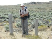
The BLM did a really good job marking the trail through the desert. There were new stickers on the carsonite posts, and most of those were still standing. We fixed a few that had fallen over, but most were in good shape. Most of the junctions were well marked, in both directions. I was very impressed.
One funny thing was that as we walked up the road toward Atlantic City we kept seeing cars and buses heading out into the desert, then back again. There is a historical site, Handcart Willies Site where a Mormon group died in a blizzard. Evidently this is the weekend when half of Utah came out to visit. I understand they can push handcarts to see what it was like. We saw 14 buses and about 20 cars in less than two hours walking the road. Thats a lot of people. Most had Utah plates. There were only a few at South Pass, which I found to be an interesting place to visit.
We ran into a couple more Divide Trail bicyclists from Florida just outside Atlantic City. We stopped to talk for a while. Its odd. Weve seen fresh footprints in the dust, but have seen no other hikers except the section hiker, Bill. In South Pass no one had signed the register for a week. So whose tracks are we following?
As we left the river this morning, I looked at all the beauty around me--the intense blue sky, the green bushes around the flowing water, the antelope grazing on the hilland felt an intense rush of gratitude. I felt so happy, totally at peace. This is why I hike, for that mixture of awareness of my surroundings, physical well-being, and appreciation of the beauty, the wholeness, of life. On every long hike there are moments of joy not every day, but often enough to keep me going forward, despite the hardships that are also part of the experience. Sore feet are a small price to pay for those moments of pure happiness.
Jim: The first few miles this morning were on trail, then the rest of the day was graded road. Atlantic City is actually off-trail. But for those who aren't stopping in Lander it's a really good place to get a meal and a beer. There are two restaurants (one supposedly carries a few groceries), a Bed & Breakfast and a motel. And they still have the pay phone out in front of the Mercantile (which is NOT a store - it's a bar/restaurant.
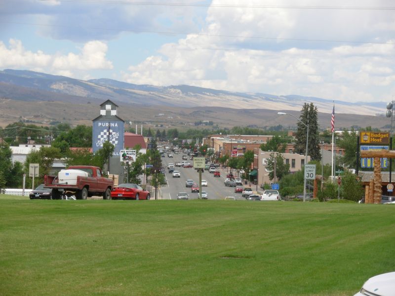
Five miles up the road is South Pass City - an old mining town. Also a former outlaw hideout. Today it's a Wyoming State Historic Site. Notice the caps. Odd thing - there's no water in town. The water system was shut off by the State some years ago, supposedly because of contamination. Even the permanent residents (all 7 of them) have to import their water. Anyway, we got our maildrop (mostly maps) and hitched into Lander where we went into the usual song and dance - room, shower, meal, laundry, sleep. Not necessarily in that order.
August 6 Rest Day in Lander

Jim: Lander is another town that has about anything a thruhiker would need. The Library has Internet access, and there's a laundromat, several restaurants, Post Office, two groceries, motels, an outdoor shop, book stores, and a hardware store. It was a restful stop for us, but I think we're ready to head for the Winds.
Home | Links| Trail Journals |
The Thruhiking Papers | Bun-bun
Created: Dec 2006
Revised: 30 Sept 2016Copyright © 2006-2017 Spirit Eagle