|
 |
 |
 |
 |
|
|
|
|
|
|
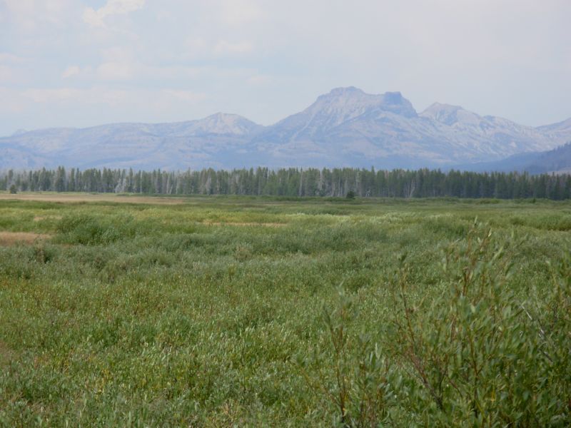
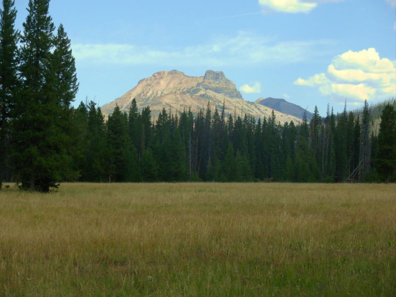
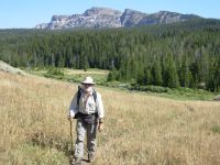
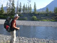
August 18 14 miles to the South Fork of the Buffalo River
Im really excited to be starting this new section. Most of the next 300 miles will be new to us, on a route that I created. We really enjoyed Jim Wolfs recommended routes through Yellowstone and up the Divide in the Centennials and Bitterroots, but we wanted to spread our wings and explore more new country. Yellowstone is a huge park and the CDT just touches one corner. We wanted to experience more of it. From there it was only a short stretch to, How about the Devils Backbone Trail, I hear thats spectacular, and The Spanish Peaks sounds interesting, and I wonder what the Tobacco Roots are like? Ive been looking forward to this since we started planning it last winter. We asked people for recommendations, but didnt get a lot of concrete information. Those that really knew the area had too many recommendations, the rest not enough. Ultimately, we just looked at the maps and figured out a way to get from here to there: from Togwottee Pass to Butte where well pick up the CDT again. We have no idea how it will work out, but it should be interesting.
We called from Dubois and was able to get reservations in Yellowstone that were close to the ones I had hoped for. We proposed, the Park countered with whats available. We looked at our maps to see if theyll work and if not, countered with an alternative. Well have some short days and some long ones through the Park, but nothing we cant live with.
We enjoyed our two days off in Dubois. Its an easy town for a hiker, with lots of motels and restaurants, a good grocery, post office and library within easy walking distance. We met Mark Flagler there for our post-Wyoming interview. Hes traveling with Allen, his Irish father in law, and a new assistant, Karma. Michael had some urgent family business he had to take care of, so Mark needed a new assistant. I enjoyed meeting them both. Marks wife, Terri, whom we met in Colorado, went back to Ireland.
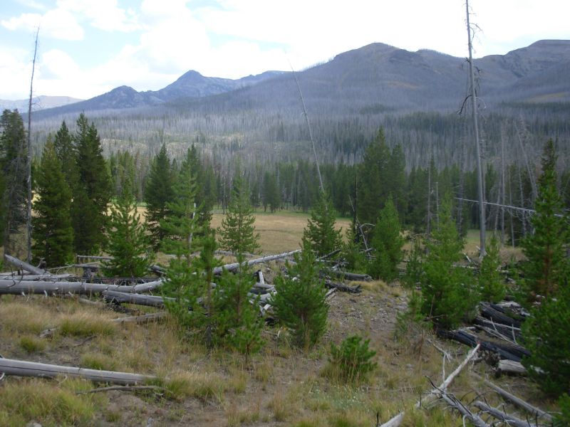
Allen drove us to Togwottee Pass, along with a southbound hiker named Pineneedle who plans to walk the highway back to town. Getting a ride was unexpected trail magic. Its 35 miles to the pass, and with road construction along several miles, its a long way to hitch. We considered walking to Togwottee Pass or Brooks Lake from the point where Union Pass Road meets the highway, so there would be no gaps in our journey, but in the end we decided that we really didnt care that much. Walking the highway, especially with construction going on, just didnt appeal. There is a road that we could have taken to Brooks Lake, but it goes through a lot of private property and is very exposed for the first few miles. It looked hot, dry and dusty and not really worth the effort. Graded roads are almost as deadly boring as paved ones. Im sorry that we didnt connect our steps, we have done so for the rest of this journey, but fires make that difficult sometimes. It happens fairly often on the CDT. Last year it was the Bitterroots that were closed for part of the summer. One year all of Montana was closed because of fires. Some hikers come back to fill in the miles, some dont. We plan to come back to hike the section through the Gros Ventre in a year or two, when the trail is open again.
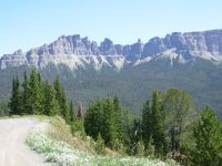
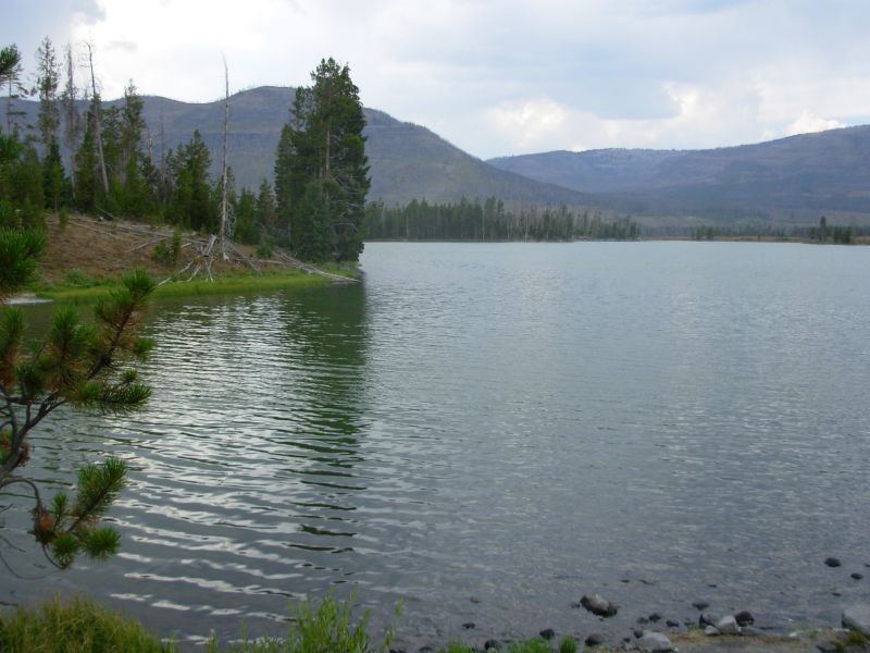
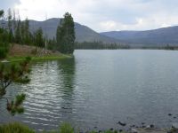
We actually started at the wrong pass. The sign said Togwottee Pass, but it was the Windy Lake Picnic Area instead. We picked up a dirt road to beautiful Brooks Lake, since we missed the trail and didnt feel like going back to the highway. This area has beautiful cliffs and meadows, very spectacular. The smoke is west of us at the moment. We ate lunch at the parking area next to Brooks Lake, looking out at the beauty and watching groups of people out fishing and hiking pass by.
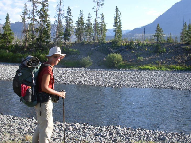
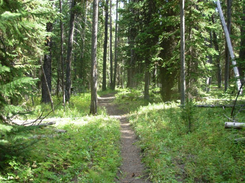
I enjoyed our afternoon hike past Brooks and Upper Brooks Lakes, then along and above Cub Creek. There was a mixture of dense forest, sage-covered hillside and grassy meadows, with beautiful cliffs off in the distance. Theyve built some new trail, easing some of the descents with switchbacks. Its a little longer, but worth it. Were camped next to the river, which well cross first thing in the morning. We considered crossing this evening, while it is warm, but a good campsite presented itself and we were tired.
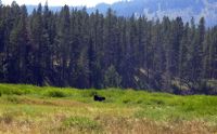
As I cook, Jim is busy tossing ropes up trees. Were heading into grizzly country, so we need to get serious about hanging our food. The trees are bad ones, with short thin branches, not much good for hanging food. Our food bags are too heavy to trust to one branch so we need two trees. I get a bit paranoid camping in grizzly country. There are a few bears south of here in the Winds and around Union Pass, but we saw no sign of them. We havent seen any scat or diggings here either, but this close to Yellowstone, Im sure theyre around. Its a bit scary actually, and exciting, and kind of a pain because it means we have to adhere to a different hiking style: hanging food every night, not cooking next to the tent, making noise as we hike, etc. Until we get through Yellowstone, at least, Ill be a bit on edge, wondering if every noise is a bear, especially when Im alone, cooking or getting water. It comes with the territory. I really want to see bears, just not too close.
We only ran into one group this afternoon five people leading three or four horses each. They said they dropped off their gear at their camp. I wondered if it was a trail crew, but their camp was off toward Angle Lakes, so we never did find out.
Jim: Dubois was a good stop. The town has grown somewhat, but not as much as some of the other towns along the Trail. It still has good food and good people. We made a point of meeting the owner of the Cowboy Cafe this time - he thruhiked the Appalachian Trail some years ago. And I got a haircut/beard trim for the first time on the Trail.
Getting out of town was interesting though. The motel manager usually tries to give hikers a ride to the pass, but today was just too busy for them to take the time. So we were going to try hitchhiking until we ran into Pineneedle and Allan at the Post Office. That solved our hitchhiking problem.
Saturday, August 19 15 Miles to North Buffalo Fork
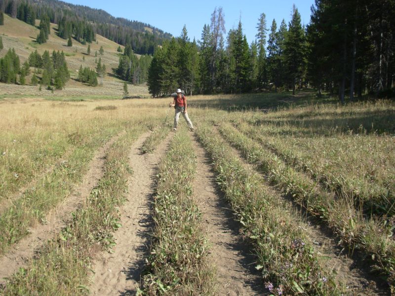
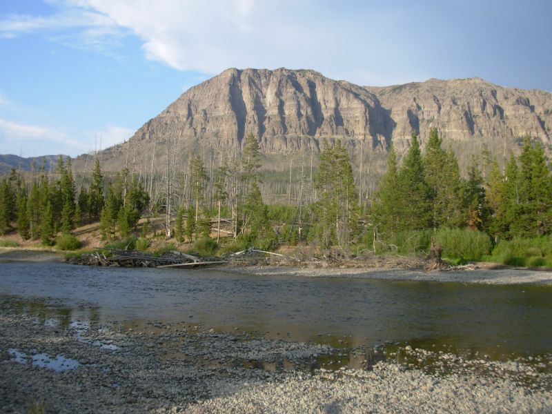
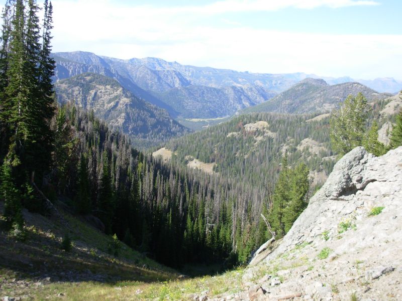
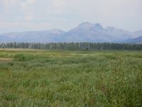
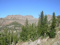
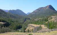
Its another beautiful day, cool and sunny. The Teton Wilderness continues to be beautiful with good, easy to follow trail. We go from meadow to meadow through spruce forest. Smokehouse Mountain above Nowlin Meadow was another very dramatic ridge with beautiful sheer cliffs.
We ran into another southbounder: Trauma. He hiked the CDT last year and is doing a Triple Crown (AT, PCT and CDT) in one year hike, plus the IAT. The CDT is the end of his 10,000 mile journey. He hikes with a St. Bernard dog that appeared utterly exhausted. We talked about an hour and a half, which made me wonder whether well be able to make it to Bridger Lake tomorrow, as planned. Because of the reservation system in Yellowstone, we are on a fairly strict schedule for the next 12 days. We arent used to keeping a strict schedule, but National Parks are different.

We didnt see any wildlife all morning, but there was lots of bear scat and one bear track, plus elk and deer tracks. If we make enough noise to alert the bears, we see no critters at all. If were quiet so we can see deer and elk, we risk running into bears. Its a puzzlement, especially for someone like me who gets such a thrill from seeing wildlife. Mid-afternoon we saw a moose cow in Soda Fork Meadows, munching on the willows.
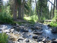
We had three knee-deep stream crossings this afternoon. There was little current, but the water was cold. Late afternoon we headed up the valley of North Buffalo Fork. Its a wide valley, burned on one side, with cliffs and peaks on the other. We saw a large group with horses, camped along the river. We decided to cook dinner early and walk on afterwards. This keeps the cooking smells away from our campsite. On the other hand, weve seen no signs of wildlife along this river. There are too many horses, I think. Traumas are the only human footprints weve seen, except near the horse camp. No deer or elk or moose tracks on any of the multitude of trails. Packhorses tend to spread out in meadows creating 6-12 lanes to the trail.
There are lots of little ponds with ducks and what looked like five blue herons flew off at a bend in Soda Creek. On our after dinner hike we spotted a mother and calf moose near the trail. So much for not seeing wildlife. We found a good campsite in the trees about 15 miles in, near a trail junction. Hanging the food took a long time and cost us some rope when the rock got snagged on a branch.
Jim: Running into Trauma was cool. We'd never talked to him before. And we didn't know he was on the trail this year. He doesn't participate in the on-line madness much. Smart.
The Teton Wilderness is beautiful. In '99 I got somewhat upset by the sheer numbers of horses we encountered. This time it doesn't bother me nearly as much and I enjoyed the country and the hike a lot more. But then, there aren't as many horses either.
The trails in the Wilderness tend to be multiple lanes because horses and mules don't like to follow each other if they can avoid it. So they spread out laterally, thus making multiple trails.
Sunday, August 20 14 miles to Thorofare Creek
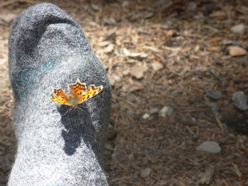
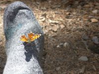
Yesterday was a butterfly and grasshopper day; both were abundant. There is a feeling in the air of the last days of summer. Nights are cool, the days still warm and sunny. Frost has already begun to color the vegetation: red leaves on fading wildflowers, yellow willows, and brown grass. Yet still the butterflies dance.
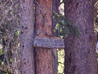
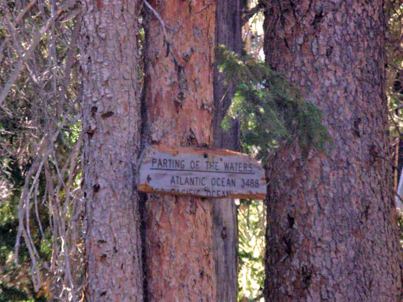
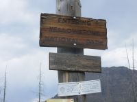
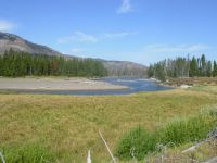
Today we began our alternate route through and around Yellowstone. First we hiked through intermittent burnt forest to the famous Parting of the Waters, a CDT landmark. Two Ocean Creek splits there into Atlantic Creek and Pacific Creek. A sign notes the distance to each ocean, though part of the sign has broken off. We took our morning break there, then headed ¼ mile back to the trail up Atlantic Creek. Jim slipped crossing the creek and fell in, dropping the sunglasses he hangs around his neck. We spent half an hour feeling around in the water before I finally found them, just at the point when we were both ready to give up. If they werent prescription we wouldnt have been as determined, but he lost a pair on our last CDT hike and we really didnt want to do it again, even though at this point theyre so scratched it is hard for him to see through them. (The dust storm in New Mexico did a lot of damage.)
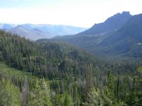
Our hike was nice, on the edge of wide meadows, mostly in trees. It is beautiful country. Jim saw a moose hidden in the willows, then we saw a buck bounce off into the woods. Down low, near the river, there are trees. Up above all is burned with only a few trees. Recovery from the fires of 1988 will take a long time. A couple on horseback passed us heading south and a small group with pack animals headed north passed us while we were eating lunch. They may be the same group we saw in camp a couple of hours before. Horses move faster than we do, plus we had our little detour. We found a nice campsite to eat lunch near a small stream and off the trail. We passed a huge empty outfitters camp with corrals, a raised platform, seats, etc. I thought permanent camps werent allowed in wilderness areas any more, but weve seen a few.
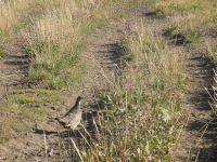
I enjoyed looking at the tracks on the trail this morning: deer, elk, moose, and one very clear set of black bear tracks, both front and hind feet. We saw lots of birds, including a grouse that didnt want to move off the trail this morning.
There is a relaxed feel to the day. We cant go much beyond Bridger Lake, 14 or 15 miles, because the park boundary is only a mile beyond the lake. We cant camp in Yellowstone without a reservation. I didnt want to get too ambitious because I wasnt sure how far it is from the CDT to Bridger Lake. It looks like 9 or 10 miles, but sometimes the wiggles dont show. Plus well have some stream crossings to contend with. So we decided to do a short day today and then spend some time relaxing by the lake this afternoon.
Later: The afternoon didnt go quite as planned. We intended to camp at Bridger Lake, but the trail we took only touches the eastern end, which was in a burn zone with no live trees taller than 6 high. No camping there. The other end of the lake had some tall trees, but the only way to get there was to back out to the Patrol Cabin and look for a trail heading west. Instead, we picked up water and went north. The Park boundary is a mile beyond the lake. Most of that mile was also burned. Off to the south there were scattered clumps of trees, and finally, after much wandering in circles, we found a spot on a sandy bank near Thorofare Creek. There is a grove of trees next to us, so we were able to find two suitable trees to hang our food. It was gray and gloomy all afternoon, with a few sprinkles while we were looking for a campsite, which added an unwanted urgency to the task.
We probably came about 14 miles today. The walking was quick and easy, so it was hard to estimate distance. We followed shallow creeks through wide meadows. We met an outfitters group of 15 horses and played leapfrog with them. The leader said he helped mark the CDT from Yellowstone to Rawlins. Later on we ran into a Forest Service trail crew packing gravel on mules to create raised turnpike trail through the meadows along the Yellowstone River. We said thank you for their hard work. Since were camped way off the trail, were not likely to see the horse group again, though there is an informal trail that is used by horses leading to the river. Thats what led us here. Were camped only 100 or so from the Park boundary, but legal.
We saw a doe as we were tripping through the downed trees, but only chipmunks here by the river. A couple of sandhill cranes flew overhead and a lone wolf howled from the opposite river bank as we lay in bed reading. It was exciting to hear him so close.
Jim: Parting of the Waters wasn't quite as I remembered it. Partly because there are some trees down around it and partly because it's a little more 'worn' after 7 more years of heavy use. It's a popular destination for many of the horse groups. Losing the glasses was a bit of excitement I could have happily missed.
After Parting of the Waters, we headed east over Two Ocean Pass rather than going over Two Ocean Plateau. This is new trail to us - and one that few thruhikers will take. It's generally pretty, and easy walking. Our campsite was on the south side of the Thorofare River. The north side of the stream is Yellowstone. We could have crossed the stream and gone a few more miles, but we're at least trying to be legal.
The wolf was a surprise - most of the Yellowstone wolves are located further north in the northeast corner of the Park. But they DO wander a lot.
Monday, August 21 23 to Eagle Creek Meadows
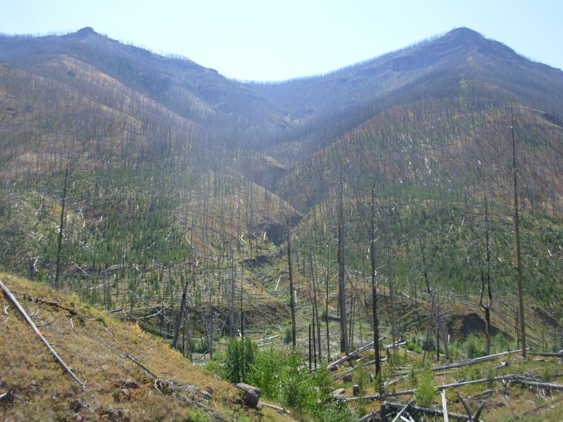
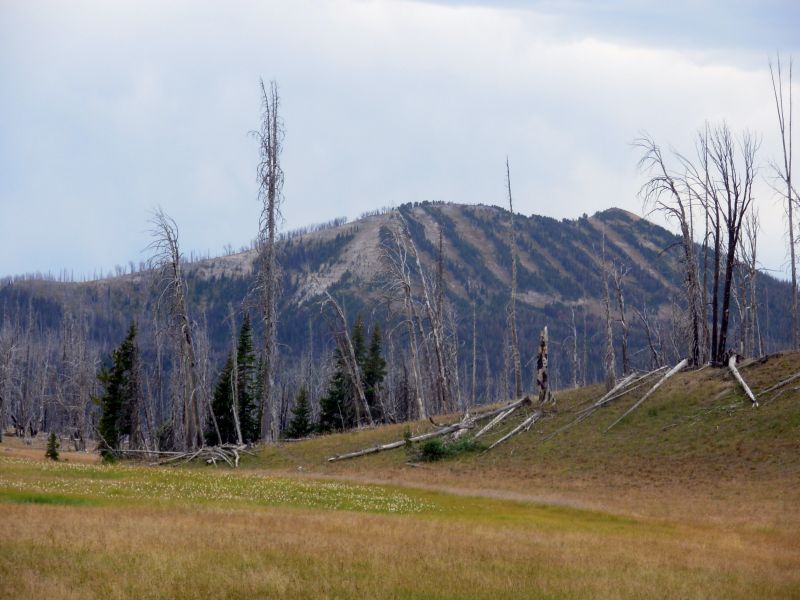
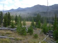
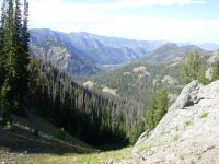
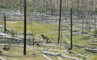
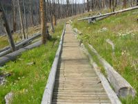
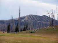
We had an easy morning on the Thorofare Trail, heading up the wide valley of the Yellowstone River and Thorofare Creek. We only had one crossing, an easy knee-deep ford of the creek first thing in the morning. In places the valley is more than a mile wide, with the river meandering from one side to the other. There are official campsites every couple of miles, though some are a long way off the trail. They have to be in trees and the forest was largely burned in the fires of 88, though many old and new patches of trees dot the valley. What surprised me was how many of the dead trees are still standing, 18 years later. I would have expected them all to be down by now, but the ghostly forest remains, even while saplings spring out of the deadfall.
Wind in a burned forest has a very eerie sound: not moans, but screams. Last time we hiked in Yellowstone, the burned forest bothered me; this time I dont seem to mind as much except where blowdowns make walking difficult. Partly its that there are so many young trees, partly its that I can look out into the open valley, which I enjoy. Ive seen no wildlife so far, but I enjoy looking out over the meadows to the mountains beyond.
Around 11:30 we left the main valley with its good horse trail to head up Mountain Creek Trail. The first mile had lots of downed trees, but there is another trail coming in from the north that meets it that is more used by horses. We have a campsite reserved today, but it is only 14 miles or so from our starting point. We couldnt get the one we wanted, which would have made a 16-mile day. Its probably either a group or horse site. The map doesnt say. If we choose, we can continue up and over Eagle Pass, out of the Park, and camp somewhere on the other side. That would make a much longer day, depending on how far it is to a campsite on the other side of the pass. If the trail is rough all the way up, with lots of blowdowns, well stop early. If the trail gets better, we may continue. If the campsite is really nice or really bad, that will affect our decision. Its nice to have a choice. Usually you dont when hiking in the Park, but our route goes in and out of the park, so we have more options.
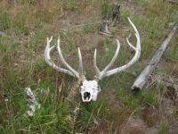
In the dust of the trail this morning we were able to see clear wolf and black bear tracks, a mama and cub. The wolf was big, or at least had big feet. Those tracks were going in the opposite direction we were. Late this afternoon we spotted fresh bear tracks going in our direction. How far ahead? I really didnt want to overtake the bear. A pack train came along over the Pass, which probably scared it off, if it was still right ahead of us.
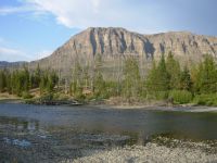
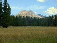
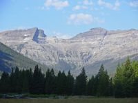
Most of the valley was burned, off and on, except for the last couple of miles. There were beautiful peaks above us, partly obscured by the dead trees. We reached our designated campsite at 3:00. It wasnt bad, and it had a nice view of Turret Peak, but we decided to continue to the pass 4 ½ miles away since it was so early. The climb to Eagle Pass was fairly easy, with most of the elevation gain in the last two miles. The peaks were dramatic, some red, some obviously volcanic. We saw two elk by the creek. The view from Eagle Pass was beautiful in both directions.
Then came the descent: steep switchbacks for the first mile and a half, then a long easy drop through dense forest. We found a campsite by a creek, but the trees all had short branches, not good for hanging food, so we kept going which made about 23 miles for the day. One of the wranglers told us about a good campsite with a bear box down by Eagle Creek Meadows, four or five miles down from the pass. Sounded good. When we got there the main campsite was occupied and the box was broken. At that point we were too tired to continue, so we found a spot nearby which had trees and set up camp there. We were exhausted. We barely had time to set up camp, cook dinner, get water and hang our food before dark. We finished eating after dark, then crashed, hard.
Jim: The bear tracks on the way up to the pass were grizzly - and a BIG grizzly, at that. And fresh. I didn't get really nervous until they disappeared because then I didn't know where he'd gone. He was probably sitting in the brush watching us go by.
We didn't plan on going over Eagle Pass - it just kinda happened. And then we were stuck with the decision cause it was a long way down off the pass (about 5 miles) to anyplace flat enough - or clear enough - to camp. The campsite we found was an area used by outfitters as a staging site for crossing the northeast corner of Yellowstone without dealing with the NPS bureaucracy.
Tuesday, August 22: 15 miles to Shoshone Lodge
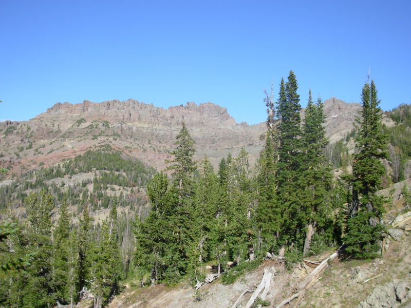
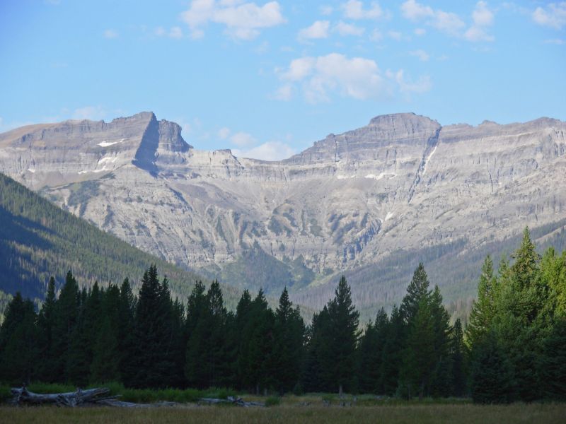
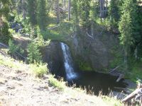
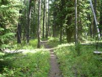
We had a most enjoyable morning hike through the Washakie Wilderness. There was a beautiful trail from Eagle Pass to the highway, one I would highly recommend as either a long day hike or an overnight trip. For the first mile or so we were in wide golden meadows. We saw an elk and her calf there. Then we walked through dense forest. This area seems to get a lot of rain as the grass and flowers were lush. Most of the wildflowers have faded, but the leaves remain. We found some ripe thimbleberries to eat yum! Part of the trail was on high prominences with good views of the peaks north and south. Sometimes we were on sidehill 50-100 above the river. We crossed the creek several times. Near the bottom it is a rushing roaring torrent. There are volcanic boulders and grassy hills. The trail has quite a lot of variety in just a few miles. I really enjoyed it.
We are now ahead of schedule by half a day, which means well have to try to change our reservations in Yellowstone, if we can find a phone in Pahaska. There are several campgrounds and a small store and lodge, so we have some hope of being able to call.
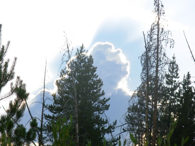
Yesterday was gray and cloudy most of the afternoon. Thunder rumbled as we climbed toward the pass, but was gone when we reached the top. Instead we had a 60 second shower after we went to bed. Clouds are building again today. As dirty as I am, a shower might be nice, even if it is cold rain. My feet are clean from all the stream crossings, but the fords just make my pants more and more muddy.
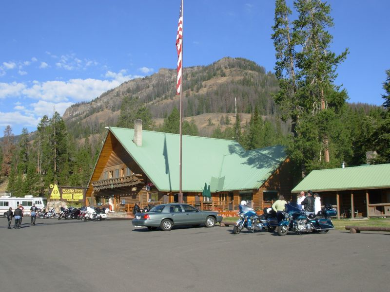
Later: We ended up getting a shower and clean clothes, unexpectedly. The Eagle Pass Trail ends at a highway, which we followed, heading toward Yellowstone. It was a pretty walk. Our next trailhead is about four miles to the west, at a small resort called Pahaska Tepee. Jim wanted to phone the Backcountry Office to alter our reservations in Yellowstone if possible, so we stopped at Shoshone Lodge, about a mile before Pahaska, to ask if they had a phone he could use. They did. They also had cabins with showers and laundry and meals, so we stayed. I just couldnt resist the lure of hot water, and Jim didnt fight too hard. Five days in the backcountry creates a good stink. Stopping early, after yesterdays long miles, felt quite good.
Jim reworked our itinerary for the next few days. I hadnt planned on a maildrop in Cooke City, but he asked that the REI box that was sent UPS instead of USPS to Rawlins be sent there, so now we have to get there on a weekday instead of Saturday, as originally planned. It means missing Sunlight Peak and the Hoodoo Basin, which I was looking forward to, but by going over the Frost Lake Trail, well cut the distance and will be able to pick up our mail on Friday. The Park was willing to work with us and made the changes to our reservation.
Shoshone Lodge has a guidebook on hiking in Yellowstone that is different from the one I used in my planning. It makes me very excited about the western leg of our hike, which will be very strenuous but beautiful, a bit worried about Specimen Ridge, a 3300 climb on obscure trail for 19 miles, and less excited about the Lamar River stretch, which is supposed to be easy, but burned and heavily used by horses. I shouldnt have read the book. We have some long days in store; I hope were up to it. Trouble is, when we plan short days we get to camp too early, which just doesnt feel right when youre used to hiking until 6:00 or 6:30.
Jim: The Eagle Creek Trail was a really pleasant surprise - a long section of pretty meadows and then about 10 miles high above the creek with great views of the creek and the surrounding mountains. Lots of water, lots of rock - just a little short on wildlife.
The Shoshone Lodge was also a surprise. The map said there was a lodge there, but no details. When we got there we were looking for a phone to change the Yellowstone reservations so we wouldn't have to stay the weekend in Cooke City. By the time I'd rearranged the reservations, Ginny had us taking a shower and eating "real" food. She didn't get any objections from me.
Wednesday, August 23 15 miles?
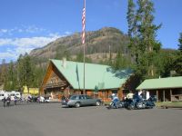
We enjoyed our unexpected stay at Shoshone Lodge. Its a family business, now in its fourth generation. The guest to guest interaction isnt as good as at Big Sandy, but it was a pretty and comfortable place with friendly staff. We enjoyed the meals greatly: lasagna last night, and pancakes and eggs this morning.
Its a good thing we only needed a few supplies, thanks to our stay at the lodge and the reworking of our itinerary. The store at Pahaska Teepee, a mile or so down the road, was extremely limited and very expensive. We picked up some crackers, cheese, Oreos and chocolate bars for about $12.00. We saw about 50 Harley riders there, part of a four day Iron Pony Ride from Missoula through Yellowstone to Thermopolis.
We took a shortcut from Pahaska Teepee Lodge to the trail, which we hoped would work, though it wasnt clear from the map whether or not we would be able to connect with our route. Since they do trail rides at the lodge, we were hopeful. We headed up the North Fork of the Shoshone River to Red Creek. The trails were good, but with no markings at junctions and several informal trails to campsites or shortcutting switchbacks to confuse matters. We didnt see one of the side trails that was on the map and we lost the main trail at an outfitters camp a couple of miles in. Fortunately, since we were heading up the river, it wasnt that difficult to get back on track. The whole area is badly burned, with few patches of live trees. Depressing. Even so, we saw a moose and her calf down by the river and a brown snake. We also saw one large hind bear print. The only people were three people on horseback we saw near the lodge. A storm was brewing, but never did materialize.

The trail we were following, despite the lack of signs, was good trail with switchbacks and fairly recent maintenance. Unfortunately, after several miles it dead-ended at a nice outfitters campsite with a bear box and bear pole, etc. The map we were using, a National Forest map, was not topographic and was on such a large scale that there was no detail. It just showed the trail headed westward. We looked around and spotted faint trail heading off to the west; it ended at another campsite half a mile away where we spotted an elk with a very young calf. We backtracked and spotted trail heading across a meadow by the first camp. It wasnt as good as the trail we had been following, but it led to the Park border. Someone had been lopping branches (and dropping them on the trail), so we felt reassured that we were back on track.
However, once in the Park the trail totally deteriorated. We continued on what looked like very old trail, over a lot of dead fallen trees. Stupidly, we followed it until it vanished completely in the deadfall. We thought, Maybe theyve abandoned the trail. Its amazing, the justifications you give yourself. Eventually we realized that there was no way we could be on National Park trail. We should have turned back, but we didnt because it was so late in the day and we still had a lot of miles to go to our designated campsite. According to the map, the Frost Lake Trail was on the ridge above us, but it was too steep to climb back up the ridge and there were too many blowdowns, so instead we went downhill to the creek and followed it, more or less, all the way down to the Lamar River four or five miles away. The area was almost solid deadfall, with occasional groves of old trees and lots of very dense patches of saplings that were harder to go through than the deadfall. The walking was very slow, with lots of backtracking and circling to get past bad stretches. When we could we followed game trails, but they either disappeared in blowdowns or went in the wrong direction after a few minutes. We saw a huge elk stag in the trees. We made so much noise crashing through the deadfall, bears werent a worry.
Eventually it started to get dark. We were still at least a mile from the point we could pick up the trail by the river, so reluctantly we set up camp. It wasnt safe to continue in the dark. Dinner was a bowl of cereal and some Oreos since there wasnt time to cook, and besides, we didnt want the smell to attract bears. Jim hurt himself (cuts on his hands and arms) but all in all we were remarkably unscathed considering the possibilities with that kind of bushwhacking.
Jim: The day started with a roadwalk, then came a disappointing resupply stop, then miles of burn area which then became steep (but newly cut) trail to the top of the ridge which then became one of those "I know where I am, I know where I'm going - but how do we get from here to there?" days. The four or so miles from the top of the ridge to where we finally camped is without doubt the toughest "hiking" I've ever done. There's no way to accurately describe "hiking" in the kind of blowdown-rich environment that requires climbing over multiple blowdowns every 20-30 feet no matter which direction you try to move.
In spite of all the disasters (or maybe because of them?) our attitudes were still positive. Of course, getting out of there in the morning was "interesting" to say the least.
Thursday, August 24 18 miles to Cooke City
We didnt sleep well last night. We were camped near a game trail that had quite a bit of nighttime traffic. Crashing in the trees made us fear for our food bags, hung on a leaning tree. No one seemed particularly interested in us except a mouse that checked out our packs. We woke early (did I sleep at all?) and headed out another game trail. After an hour or so we reached the meadows by the Lamar River and one of the official campsites. Hurray! We never did see any sign of the trail we were supposed to be following except a sign at the campsite that indicated, Frost Lake Trail -- > There was no tread. As it was, even on the Lamar River Trail we kept losing the tread in the meadows for the first half mile or so. I dont think many people go that far out. Soon it got better. It was such a relief to have good trail again. I was happy. Yesterday was really frustrating because we kept getting boxed in by the downed trees. It was hard to find a way through. I also worried about injury. I came close to breaking a leg this morning when a log I touched while going over a downed tree spun around and rolled to where my leg had been. It bent my hiking stick, but I was able to lift my leg out of the way in time, thank God.
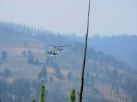
Then came another worry. Last night we spotted smoke to the north of us, a large gray plume with an orange glow underneath. We have no idea how close it is to our trail. We saw no one on the trail, though there were some horse-people camped across the river in a meadow. So the question arose: Is the trail closed ahead? Will we have to backtrack 10 or 15 miles? The air is smoky, but not heavily, so there is no way of knowing where it originates. If they evacuated the area, we werent at our designated campsite last night to be notified. Oh well.
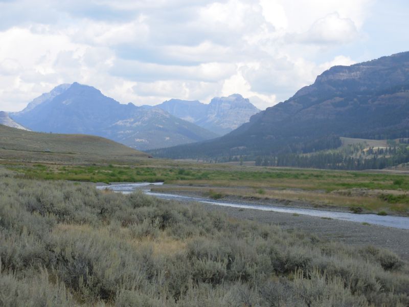
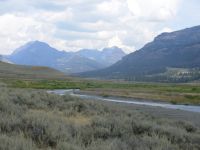
The hike down the Lamar River is a nice one. The trail is a bit of a roller coaster. Where there are meadows, we hike down by the river, otherwise were up on the hillside 50-100 above the water. There are lots of old and new trees in here. Its not a total burn zone like yesterdays hike along the Shoshone River. Its much prettier. We saw no wildlife this morning except a brown snake. We did see a big bears tracks and those of a mountain lion.
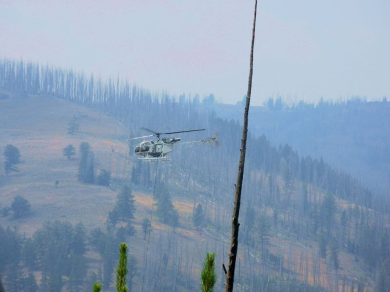
We kept hearing helicopters and planes. Until we were sure which way they were going, we were worried. Was the helicopter dropping water on the trail ahead of us? Thats what it sounded like. Finally we discovered that a helicopter was picking up water from the river ahead of us and taking it to the fire, a couple of miles up the nearby Calfee Creek valley. Soon after, we met an outfitters group heading in, so we knew the trail ahead wasnt closed. We later met a backpacking angler, one of the very few hikers weve met out here. Most of those weve met were on horseback.
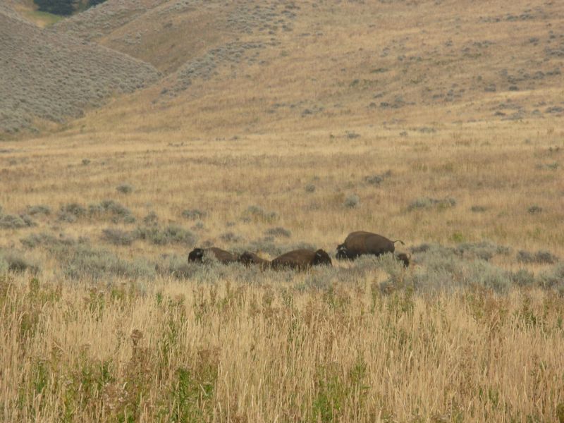
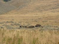
The last few miles were interesting: sage and grass-covered hills, with several resident bison. They werent at all nervous about us walking by. We reached the trailhead at 5:00, after 18 miles. We got a ride quickly from two fishermen from Utah, but only four miles down the road. Shortly afterwards we got a ride the rest of the way to Cooke City from a man from California whose sons live here. We got a room, dropped our packs and went across the street to the Beartooth Café for a good dinner. After all the stresses and miles of the past two days, we were starving.
Jim: Camping last night was "interesting" - we camped on a game trail and Ginny heard several animals go by during the night. Were any of them bears? Probably. But I heard nothing. I didn't sleep well, but I also didn't hear anything. Figure I must have just slept through those parts when the bears/elk/moose (?) were sniffing around us. We KNOW there was at least one bear in the area last night because we followed fresh tracks for a couple miles - all the way to the meadow and the campsite we were supposed to have used last night.
The fire worried Ginny, and the idea of turning around and finding another way through the Park worried me. But I decided I wasn't going back the way we'd come in. For one thing we didn't have enough food to do that. So if they (the Park authorities) wanted us out of there, they could either let us walk - or we'd get in some "rotor-hiking" (a helicopter ride). I guess in a way I was disappointed when the fire wasn't on the trail and we had to walk out to the road. But it's better that way. The buffalo (bison) were cool - and we wouldn't have seen them if we hadn't walked.
Friday, August 25 Rest day in Cooke City
Jim: On the way into town we were invited to a fish-fry last night. Seems the whole family of the guy who brought us into town was supposed to be there. We didn't go - and neither did they. While we were eating at the Beartooth Cafe, their whole family showed up and ate there, too. And then we were told that one of the daughters and her husband are part owners of the Cafe.
We didn't send a maildrop here, but we still had mail. We had ordered some stuff from REI that we were supposed to get in Lander - but it didn't show up, so I had them resend it to Cooke City. We also ordered new sleeping bags and got those in Cooke City. The 20-degree Marmot bags we've been using are useless when it gets cold. They're more like 50 or 60-degree bags - real comfortable for the desert, but not good at all for the mountains - and autumn is coming.
Home | Links| Trail Journals |
The Thruhiking Papers | Bun-bun
Created: Dec 2006
Revised: 30 Sept 2016Copyright © 2006-2017 Spirit Eagle