|
 |
 |
 |
 |
|
|
|
|
|
|
Wednesday, July 21 - 11 miles

Today was a good day. We took our time leaving Leadore. A leisurely breakfast, making a box to ship the ice axes home finally (hallelujah!), final stops at the grocery, etc. managed to take all morning. At the post office we met a man, Barry Miller, from the Forest Service office. He offered to drive us back to the trail at Bannock Pass during his lunch break. Turns out he is a member of the Salmon Valley Baptist Church and heard about us at church last Sunday. I think we were part of the sermon. After listening to the coyotes all night, it was a real treat to see one run across the road in front of us as we drove up to the pass. It was fat and healthy looking as it trotted through the sagebrush.
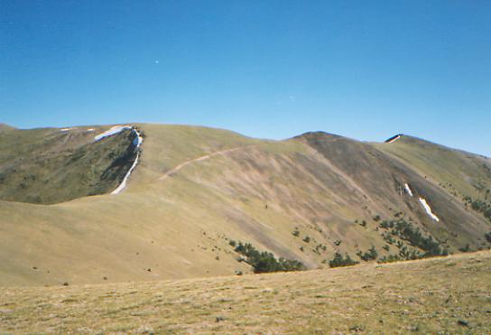
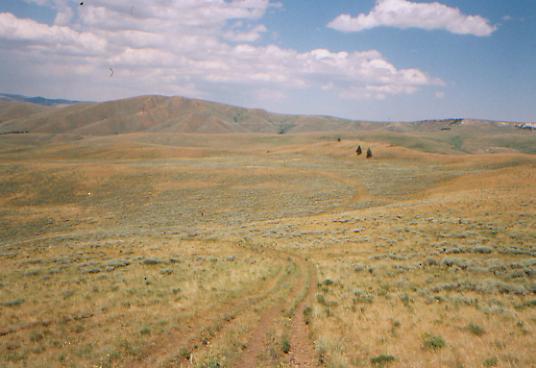
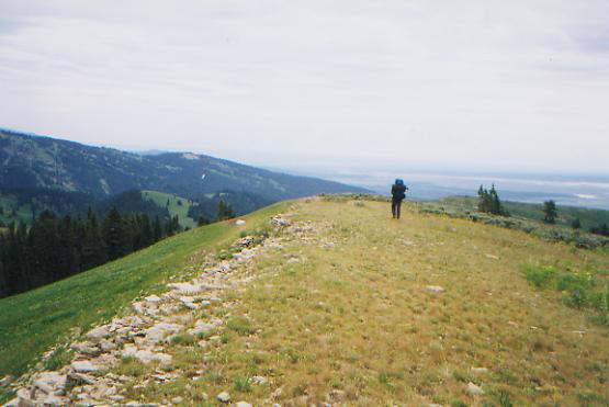
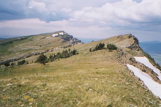
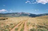
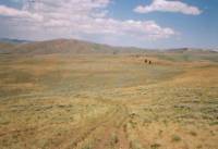
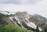
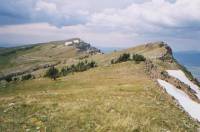
We started hiking about 12:30, following a jeep track along the Divide. The trail follows open grassy ridges, for the most part. It was very windy. We got a brief respite when we dropped down to Deadman Creek and followed it uphill for a mile or so. Then we ran into a trail crew working on Elk Mountain. They said we were the first to walk on the finished trail, about four miles of brand new side-hill. They were from the Montana Conservation Corps and the Salmon National Forest. Another group from Oregon was also involved in the five-week project. It was very nice walking, eliminating a lot of up and down along the Divide, but also the panoramic view from the top of Elk Mountain. One nice side benefit: the trail now runs right past a spring/cattle trough with a fairly flat, though rocky, place nearby to camp. The old trail had a spring about 1/4 mile from a campsite about a mile beyond where we ended up stopping. The view is beautiful from our campsite: several ridges, mostly grassy but with some trees, and jagged mountains beyond. It is a bit hazy because of a forest fire south of here, but still beautiful.
Anyhow, it was a day for feeling good: happy, excited and serene, all at the same time. Town was nice and everyone was very friendly, but I was ready to leave. The beauty overwhelmed me as we climbed along the Divide. I felt the utter inadequacy of words to describe what I feel as I look out on all the beauty that surrounds us: awed, blessed, privileged, both bigger and smaller. It is all so immense and so grand. It fills me with joy and wonder. In Salmon, several people asked us why we do this. It is so hard to come up with the words to explain it. In a way, we do it because we can. There is so much that is wonderful in this world, so much beauty, so much unknown territory to explore. We cant explore it all, but we can and do try to see what we can. Knowing this trail is here, its as if were obliged to come discover this wonderful world for ourselves. I understand the man who said he had to climb the mountain, because it was there. Most people will never know the beauty that is out here. We do, and so we come.
Jim: Ginnys right it was a feel-good day. Our packs are a little lighter because we shipped some gear home, getting out of town was easy, the sun was shining, it was warm, the trail was relatively easy and we (hopefully) are past the last of the snow. The character of the country has changed to sagebrush at the lower elevations and forest at higher elevations.
Thursday, July 22 - 18 miles to Tex Creek
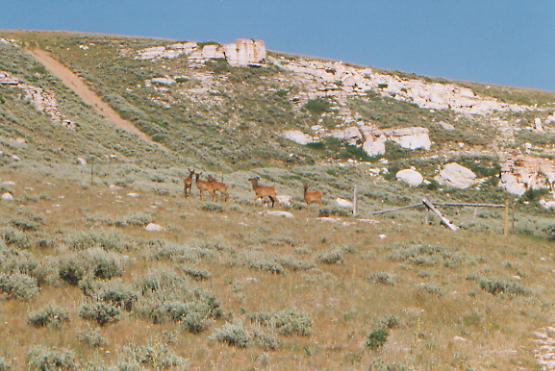
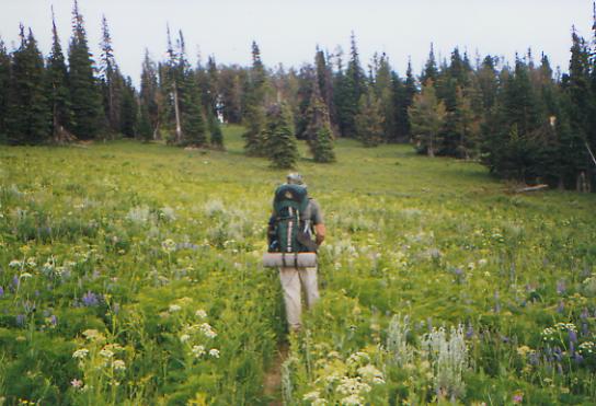
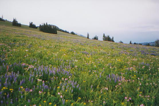
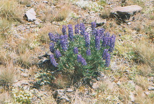
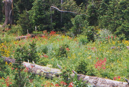
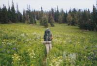
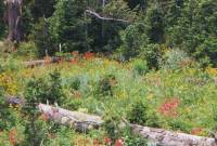
The morning was spent climbing through grassland on the Divide on a jeep track. The views are beautiful and there are lots of wildflowers: mostly lupine, but also butter and eggs, buckwheat, cinquefoil, iris, black-eyed Susan, thistles, etc. I found out yesterday that the pretty pink one Ive been seeing is Bitterroot, erstwhile source of sustenance for the Bitterroot Indians. Its low and has no leaves, but has a big pink flower rather like a pincushion cactus. We saw some people today camped by pretty little Morrison Lake. I dont know whether they saw us since they were down by the water when we passed by. Jim surprised a deer napping in the sage. Just its head peeked above the blue-green branches.
It is amazing how dramatically the land has changed these past few days. Were still quite high, 8000-10,000', but this is high desert with lots of sage and stubby grasses. Trees are scarce. It is warm in the sun, and were mostly out in the sun, but it can be quite cool in the shade. The wind has become more of a factor. Yesterday there were gusts that had me staggering. If the wind is high, the flies and mosquitoes are grounded, so I didnt mind. Our campsite on Tex Creek is a buggy one. I desperately wanted to wash up, but it became a race to see whether I could get clean before I was eaten alive. I feel better, but it wasnt the leisurely bath I had hoped for.
Friday, July 23 - 18 miles to Nicholia Creek
This morning was a bit different. There were no easy jeep tracks to follow; instead we had to bushwhack across open grasslands. There were, fortunately, posts and cairns to direct us, but some were spaced pretty far apart and there was no treadway. Following the guidebook got us off track at one point. JW said to pick up pack trail. We did, only we went in the wrong direction. It felt wrong, so we turned around. Off in the distance I saw what I thought were people, but may have been elk. In any case, we headed toward them, which led us back to the trail, and we never saw them again. Of course, following the cairns would have been worse; they led straight up a big cliff to a view off the top, but not down the other side. We did lots of climbing up to and along the Divide. There were lots of good views. This afternoon the trail goes lower, past streams and lakes on the Montana side of the Divide, cutting off the far southwest corner of the state. Well begin heading east for a couple of days.
LATER: Were both more tired than we expected to be. It wasnt a difficult day; we just rolled up and down through the sage. My feet are a real problem. The boots are shot and have started a new set of blisters, including one on the bottom of my foot, under the callus. I feel every step. Jim tripped and hurt his leg falling. I think the constant sun drains us a bit. We try to drink more, but I always end the day feeling desperately thirsty. If at all possible, we pump water once or twice during the day and we carry two quarts each. Jim is really careful about filtering, even at springs. There are some that are probably clean enough to drink without filtering, but hes not willing to take a chance on getting sick out here. (Though we do drink town water, which is probably worse.) We passed several little lakes the Harkness Lakes and got water at the outlet of one. Best was soaking our feet in the stream - aah, wonderful!
Today was a people day. Besides the phantom hikers I thought I saw this morning, we ran into a boy on an ATV accompanied by a woman on horseback and two dogs. Then, when we reached the trailhead at Nicholia Creek, we found three trucks parked nearby. Its a family group, complete with sodas and watermelon cooling in the spring. We set up camp nearby as its been a long day. We thought about continuing, but were out of earshot and sight, so well stay (and dream of cold watermelon.) We checked them out when we went for water. They werent unfriendly, but they werent particularly friendly either. They offered us good drinking water, but werent the least bit curious as to what we were doing out there. We saw some ranches and cows below us in the Nicholia Valley, but no wildlife.
Saturday, July 24 - @19 miles (+1 mile)

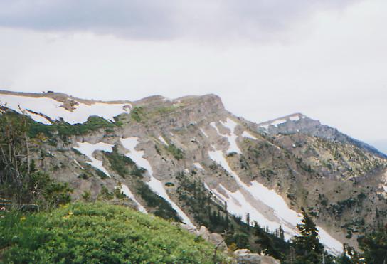
Last night about 10:00 PM a truck pulled in to the campsite where we were set up, evidently hoping to camp there. It took about ½ hour for them to decide what to do. Finally, they set up about 100' away. As they backed their truck, I was certain we were going to get run over. Fortunately, I was wrong, but sleep was slow to return. So we got a late start, not good on a hot day. We followed Nicholia Creek for a couple of miles, then turned around in the direction we had left and climbed a ridge. The area reminded me of Arizona: very dry and rocky. The mountains are twisted and folded in interesting ways with a lot of red and orange in the rock. We dropped steeply down to blue-green Deadman Lake, then headed back up toward the Divide. Lunch is in the meager shade of a willow bush by a tiny stream. Sage covers the hills and a few scattered pines dot the sheltered areas. Flies are pestiferous.
It was a mixed day. The highlights were: finally finding ripe strawberries, after months of seeing the flowers everywhere (delicious, but so tiny!); seeing an elk about 30' in front of us, and then later on seeing five more, (they watched us as we switchbacked up a road); and of course the land: the open grasslands, white rocky cliffs, white columbine, and our campsite view of huge Mt. Garfield and the Red Conglomerates; the view back toward the Divide from Bannack Pass; at the end of a long hot day, going through a cool spruce and aspen grove on good trail; and Jims loving support of my bad mood this afternoon. Lowlights include getting lost: the directions said to leave the jeep trail. We did. Unfortunately we were supposed to go back to it. We didnt. We tried to follow the state boundary fence down the ridge - wrong fence, wrong ridge. We lost time and energy with that error. Other lowlights were the incessant biting flies, chaffing, sore feet, and the straight up and down climbs along the jeep tracks. Jeep track does not mean easy, by any means. As someone wrote in the register in Leadore, Jim Wolf gives new meaning to the term, 'passable by passenger vehicle.' At the end of the day, we had a mile and a half of cross-country walking, contouring around a hill. The cross-country route meant less climbing than if we had followed the jeep road, but harder walking. On the other hand, the hill was covered with lupine and was quite pretty. We had planned to stop then, but the spring was obscure, hidden somewhere up the hill, so we went on another mile to a small creek and found a flat spot up the hill with a beautiful view. We even washed some of the dust and sweat off. It was almost 8:00 by the time we arrived, so we are both pooped and starving. Final straw: Jims camera died (dead battery) just when he was trying to get a picture of the herd of elk we saw. Grrr.
Jim: Knew I should have started carrying that extra camera battery out of Leadore, but I lost track of how much film wed taken by that time. Were gonna have a BIG film developing bill. Were truly into cattle country now sagebrush-covered high desert. Theres enough water if you plan ahead, but its still desert.
Sunday, July 25 - 18.6 miles
We woke to a hard frost covering the tent and our packs. Our good intentions for an early start were frustrated by the need to wait until the sun had melted some of the ice. When it did, we packed our wet gear and began a long serpentine climb to a pass on the Divide between Garfield and the Red Conglomerates. The trail was a mixture of nice pack trail through cool spruce forests and bushwhacking from post to cairn through open meadows. It was all pretty walking, but the lack of obvious trail made much of it very slow going. I did see a deer hiding in the sagebrush and a coyote disappearing over a rise.
Coming down from the pass, we met a family out to retrieve the rifle lost last fall when the son/husband/father was killed by an avalanche while hunting. A somber mission on such a beautiful day. Our cheerful greeting didnt suit their mood at all.
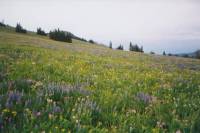
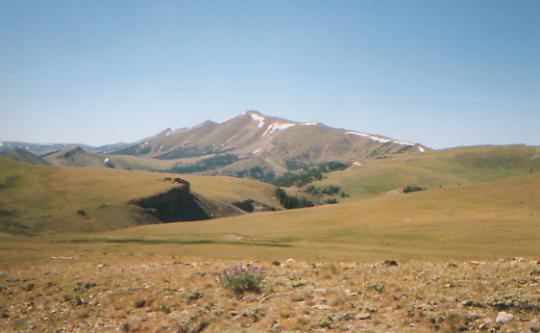
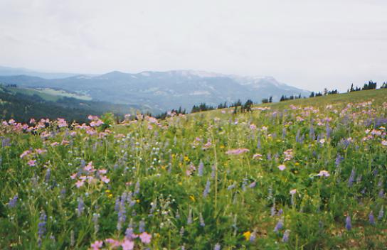
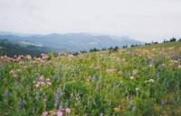
We had lunch next to a small branch of Sawmill Creek in the shade of a large spruce. It is cooler today than it has been the past few days. I like it. The afternoon was very long. Once again we hiked past 7:30 PM. We did a lot of climbing and a lot of semi-bushwhacking. A belligerent bull chased us up a ridge and under a fence, and we ended up unsure whether we were following a recommended alternate route or simply creating our own as we rose along the ridge to the Divide. Because of that we were insecure as to our whereabouts when we rejoined the CDT. It made a difference since we were looking for a stock tank to get water and set up camp. There were supposed to be two, slightly off the main ridge, then no water for the next eight miles. The first tank was missing. We finally found a stock tank, presumably the second one, and are camped on a very sloped hillside above it. It is too windy to be up on the Divide. I could go no farther. My ankle is killing me. (New boots are awaiting me in Lima, I hope!) The up and down along the Divide took its toll. The views have been gorgeous. Even here at our sloped campsite, we look out on a valley, a big lake (Lima Reservoir) and more mountains beyond. We saw a small herd of elk up on the Divide, very far away, and one lone one in the sage in a side valley. Weve seen lots of hawks and one that might be an eagle (wrong shape for a hawk or vulture.) This morning we wandered through hills covered in white or purple and white columbine, blue lupine and forget-me-nots, pink geraniums, and many that I dont recognize. One was red, with many tiny blossoms pointed upward, and one looked like a ball with either white or blue tiny five-petaled flowers. The rocks are interesting: round river rocks, some bowling ball sized, with marble insides in pink, yellow, grey and black. Were at 8500' - whence the river rocks?
I had a bit of a scare this afternoon. I was ditty-bopping along, watching my feet (those round rocks are rollers), fighting the wind, trying not to get blown into the barbed wire or off the side of the ridge, moving along on automatic. Suddenly I realized that it had been a while since I had seen or heard Jim, following behind me. I stopped to wait for him to catch up. No sign of him. I sat down for a while. Finally I dropped my pack and headed back the way I had come. Of course, I was picturing him collapsed on the trail, or blown off the side. About half a mile back, he showed up, saying he had lost his prescription dark glasses and had backtracked to retrieve them. No luck. He said he called out to let me know he was turning around, but between the wind and my introspection, I never heard a thing.
Jim: This one deserves a few more words we ended up on the ridge, not by following the trail, but by bushwhacking up a side ridge. The reason for doing so was the bull and his entourage that decided we were not to be allowed to follow the trail. They herded us to the east side of a fence and then followed us up the draw, preventing us from crossing over to the trail which we could plainly see below us on the west side of the draw. So we followed an eastern side ridge up to the main ridge where we rejoined the trail. In retrospect, it was REALLY funny although we didnt appreciate it at the time. Especially when the first water source which was listed in the guidebook didnt materialize and we had to keep moving until almost dark before we found the second one.
Monday, July 26 - 17 miles to Lima
We started the day early. I slept well, despite the slope, but Jim was ready to get up as soon as the sun hit the tent. Unfortunately, I needed to get my stitches taken out. They were supposed to come out in 10-14 days, and today was day 15, but our late hiking days made it difficult. Besides, I wasnt sure they (or I) were ready. Sure enough. Jim got 10 out, but the last two proved stubborn. One had me screaming every time he touched it, and the other is just very hard to reach and the skin still looks raw around it. So we didnt leave camp until 8:30, with two stitches still in place. We may have to look for a doctor in Lima.
Anyhow, the day was mostly more up and down along the Divide - lots of steep climbs and descents on a jeep track along a narrow ridge. The views were beautiful and we saw two more elk. We reached the valley, ate lunch under some willows by a stream, then began a hot seven-mile gravel road walk. We ran into a forester, Joe Weller, who stopped to talk to us for about half an hour about the state of the trail. He is in charge of the trail crew for the CDT in this part of the Targhee National Forest and was very friendly.
We made it to Lima, finally. For a while there was some doubt. We walked up to Monida, the freeway interchange, and were utterly unable to get a ride. There is nothing there but a huge junk yard and a few derelict houses. Finally we went out on the freeway to hitch. Even then, it took another ½ hour. Still, we did make it before the Post Office closed, thanks to a kind Mormon truck driver on his way to a job in Idaho. He gave us some travel muffins to try - healthy but a bit bland. They can last two weeks, if you cook them hard enough. Takes strong teeth to chew them, but they would be nice trail food -- a kind of Logan bread.
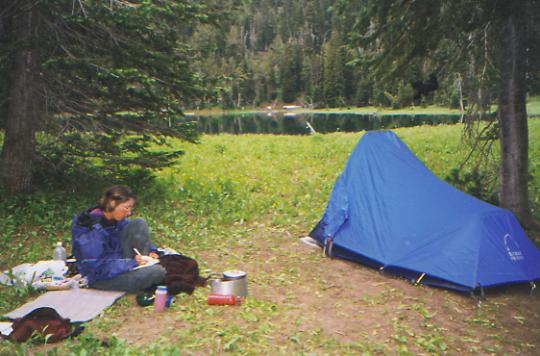
Lima looks like a fairly good sized town, but only has two motels, one cafe, a post office and a convenience store. There is no laundromat, unfortunately, so our sink will get good use. There are lots of houses, a school and several sporting goods stores. The motel is nicer than it looks and even has a phone in the room. I hate standing outside to make phone calls. Dean and Maryann, the two section hikers, left here today. Drat. We hoped to meet them. My body welcomed the hot shower. I was filthy. Weve been camping near stock troughs or small springs lately, not good for a real bath, and with the mosquitos and biting flies so bad, who wants to strip? Not me.

Jim: Lima wasnt on our original itinerary, but its a sorta good place to break up the long stretch between Leadore and Macks Inn. But you have to be willing to hitchhike on the Interstate. The only thing at Monida is the Interstate interchange and a phone. We were told that only one person lives in Monida, although its literally the biggest junkyard Ive ever seen and Ive seen some big ones. And we did get the spare camera battery.
Tuesday, July 27 - 14 miles to Pete Creek Divide
Getting a ride out of town turned out to be easier than expected. Checkout time at the motel is 11:00; we left at 10:50 am. The morning was spent at breakfast (of course), getting out my last two stitches (slow but ultimately successful, thank you Jim), repacking, packing up the drift box and mailing it, buying a few last minute groceries at the Exxon station, replacing Jims lost sunglasses, calling Yellowstone to reserve campsites (easier than expected) and trying unsuccessfully to reach Kahley (who sent some very nice goodies along with my boots and medicine.) At 11:00 we went out on the freeway on-ramp. No cars. After about 20 minutes, a local boy, returning from a grocery run to Dillon, got curious and offered us a ride. Easy. We started walking up the road from the bridge near Monida where we left off. Clouds covered the sun for a long while, making it feel much cooler.
After about five miles, we finally reached trees and it was time to taste some of the goodies we had been sent by friends. Besides being welcome for what they represent a gesture of friendship and support goody boxes give us a chance to try trail foods we might not otherwise, like tuna jerky, or dried strawberries, mandarin oranges, papaya, mangos and pineapple, definitely nice changes from raisins and peanut butter. The fancy gourmet hot chocolates make a welcome change from Swiss Miss and are easy for people to slip in a letter. Of course, the letter is the most welcome part. Amys gingerbread and Kahleys little cheesecakes never made it as far as the trail, but then, I dont think they expected them to. The time and effort represented by these packages is really appreciated. It is nice to have hiking friends.

Its four days to Macks Inn, where we plan to take a day off, then head into Wyoming. Thats exciting. Montana has been terrific, but I look forward to starting a new state. We have to follow a planned itinerary through Yellowstone, thanks to the backcountry reservation system, which I dont much like, but for the rest, I look forward to seeing the Park and the Wind River Range. It feels as if we are really making progress. Slowly, but surely. In Salmon, when we told people we were going to walk to Mexico, Im not entirely sure that I believed it even as I said it. It seemed such a long way away. Crossing the state line will make it seem a little more real.
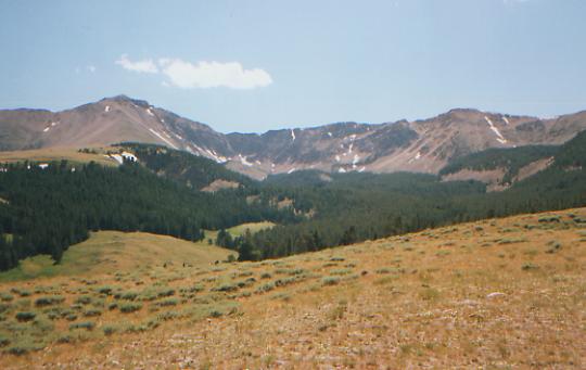
LATER: This section, the Centennial Range, is physically quite different from the other side of I-15. There is a lot of volcanic rock, mostly pumice and obsidian. Although the Divide has grasslands and sage, it feels more alpine. Little Table Mountain is a fairly broad plateau with nice views and dense spruce forests lower down and flowery meadows. Same flowers, different colors. The columbine is red and yellow instead of lavender and white; the paintbrush is red or orange instead of pale yellow. Instead of steep narrow ridges, the Divide has more broad rolling hills. Its amazing what a difference a few miles can make.

We saw no wildlife this afternoon except bluebirds and a hawk. We managed to terrorize another herd of cows though. They stand watching us approach and suddenly one will dash off in fear, with the rest in hot pursuit. Its funny that an animal that big can be so nervous. We hear them bellowing for a long time after we pass.
Wednesday, July 28 - 18.5 miles to Aldous Lake
A late start is a bad way to start a long day, but neither of us slept particularly well until it cooled off toward morning. At noon, we had only gone 5 ½ miles. We lost half an hour looking for the trail, which disappeared in a meadow on Big Table Mountain. Its a notorious place for getting lost, though there are intermittent blazes and cairns. We kept backtracking to where we last saw the trail, but the blazes never got any better. Finally, we noticed faint fresh tire tracks heading cross-country across the grass. The direction was right, so we took a chance and followed them. Sure enough, they took us to the pack trail we were supposed to intersect. Shortly afterward, we met a trail worker putting up carsonite posts. We had seen signs of recent trail work; it was very nice to meet the worker. Joe Weller, his supervisor, must have sent the crew out ahead of us. Thank you! After that we were able to follow the trail - past a dead coyote caught in a trap and a drowned squirrel in the spring. Yech!
The afternoon was mostly spent contouring endlessly around a big mountain, with many small ups and downs as we went around the ridges, rather like Brushy Mountain on the AT. It was partly in forest and partly through meadows with waist-high flowers. The trail crew had already been this way, so route finding was pretty easy, despite the overgrown meadows. It got very dark and we heard faint thunder rumbling in the distance, but we only got a few drops of rain. Enough to make me take off my glasses, but not enough to put on a rain jacket. Actually, I was hoping for a good gully washer so I could take a shower. The clouds did keep things nice and cool though, and it could still rain tonight. Its certainly dark enough.
We ended up camped by a popular (though deserted tonight) scummy lake. Because of the mosquitoes, were uphill at a group site with a picnic table and fire ring. The lake has a resident moose. I went down to get water, heard stumbling in the brush behind me, turned around to see what it was, and about 10' away was a huge bull moose coming right toward me. I yelled for Jim to come look and the bull backed off, heading straight for our campsite. Jim never heard me, but he did see the moose, who was rather put out to find Jim there. Earlier today I saw three deer, separately. Each was asleep when I surprised it. The last was a still spotted fawn. It moved fast though.
Tomorrow is a worry. There is no water along the Divide, so we may have to go 22 miles tomorrow. Ouch. I dont like the really long days. Just knowing there are no options to stop sooner turns the day from a hike into a forced march. If we can get an early start it wont be as bad, but 18 miles between water sources means we have to carry extra in the water bag and will be hiking late. There is a bit of uncertainty too: did the relocation really add three extra miles? If not, well be okay. Thirsty maybe, but not exhausted. Jim pointed out that we really need a day off. A real rest day, not just a half day spent running around and doing errands. Were both tired: tired of bugs, hills, long days, and being thirsty. We need to play more. Maybe Macks Inn?
Jim: Yeah I saw the moose too. And he was even bigger than Ginny thought he was.
July 29 - 19 miles to Blair Lake

The incessant whine of mosquitos kept us up very late, then chased us out of camp early -- without coffee since we decided against taking the time. Clouds of bugs surrounded us for the first few miles, then the mosquitoes were replaced by biting flies. Oh joy! It is pretty country, with a lot of open meadows, but the walking isnt easy since the track is so faint. We lost the trail completely when we changed from the Dubois to the Island Park Ranger District, but the directions said to climb to the Divide, so we did and picked up the trail a mile or so later.
We finally caught up to Dean and Maryann, the section hikers we first heard about in Anaconda. They were camped across the lake from us last night, though we didnt know it, so we stopped to say hello this morning. They started in Basin, where Dean was forced off the trail two years ago by injury. Maryann plans to leave at Yellowstone. Dean intends to continue hiking until September or October. (Actually, he ended up going home in Yellowstone too.) They met Dave and Grandpa Goat, finishing his last CDT section, but not Willis or Julian and Jason.
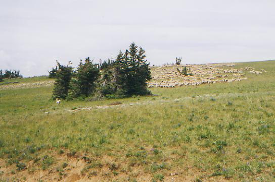
This afternoon was nice, first following easy switchbacks on a jeep road up Mt. Taylor, with views into Idaho and Montana, then new foot trail down to Keg Spring Road (shorter than expected), then a short climb up to a nice plateau, then a very steep drop down to a small lake. Wildflowers were abundant all day. We saw one deer, a hawk, some ducks and grouse, and a huge herd of sheep. This section is part of the U.S. Sheep Experimental Station - a large area where they test to see how much damage grazing sheep do to the lands and waters. We met a ranger who said there is a grizzly that has been eating the sheep. We didnt see a shepherd with the flock, just a big white guard dog. We saw lots of snow patches today. We used some for extra water when we thought wed run out. With the clouds its pretty hazy so we didnt get the expected view of the Tetons, but the nearby mountains were nice.
Were camped by pretty Blair Lake. It is prettier than last nights lake, but the mosquitoes are equally bad. We got a few drops of rain last night and a few more during the day, but no real showers. The clouds do cool things off though.
Jim: Ginny underrated the flies and mosquitoes this morning - it was hot but we had to keep our rain gear on so they wouldnt bleed us out in the first 5 miles. We had to stop to pump water at one point (the campsite was no place to do that) and that was a real ordeal. Its obvious that snowmelt in this area was recent. For the last several days, the flies and mosquitos have been constant, overwhelming, pestiferous, annoying, vexing in general, a pain.
Friday, July 30 - 19 miles to Macks Inn
It was a very mixed day. We followed good trail from Blair Lake to Lillian Lake, then left the official CDT for the Macks Inn alternate route. Most thruhikers go directly to Macks Inn rather than follow the official loop around Henrys Lake because it is a good place to rest and resupply. There was intermittent trail up the meadows of Hell Roaring Creek, then a quick steep climb, bushwhacking up to the Divide, then a mile of excellent new trail back to an outfitters campsite by a creek, then a couple of miles of bushwhacking up the creek valley to the Divide again. Once there, nothing matched the guidebook. We probably went up the wrong branch of the creek. There were no jeep tracks, so we kept heading toward the radar dome on Sawtelle Peak. Unfortunately, there was a big drop between us and the peak. We suddenly found good trail across a gully and decided to follow it. We didnt know if it was the right trail, but it was a tourist path heading in the right direction so we decided to try it. Its better than bushwhacking.
Navigational uncertainties aside, it was a good morning. We saw a golden eagle take off from a meadow about 20 yards away, and two moose--one hiding in the willows, the other in a grove of trees. The walking was pretty easy above Hell Roaring Creek, and there were lots of wildflowers: mostly lupine and paintbrush, with a few mariposa, some columbine, cow parsley, etc.
LATER: We did manage to get to the Sawtelle Peak Road via the good trail. We saw four dayhikers on it. Then things got interesting again. We missed the very obscure turn (when the guidebook says obscure, he means invisible) so we continued down the gravel road to where Jim Wolf said we could connect with his route if we missed the first turn. We would have done better to stay on the gravel road. The side track disappeared in a grassy meadow, but we continued in the same direction, looking for the guidebook jeep track. No luck. We found a logging road, heading basically in the right direction. It disappeared in an old clear-cut. So we followed game trails, till they disappeared at a stream. We finally found the route about 4:00, then wound through the woods some more on old roads, heading in all different directions. One was blocked every ten yards by ten foot earthen speed bumps. They hope to keep out ATVs; they just make hiking difficult. That continued for about half an hour. By the time we reached the highway into Macks Inn, we were sore, tired, irritated and frustrated. Then, since it is a tourist area and it was Friday, there was no room at the Inn, so we ended up at the nearby campground. Fortunately, they have showers and a laundromat, so our basic needs will be taken care of. They also have a cafe with mediocre pizza but a real salad bar and ice cream. All in all, were not doing too badly. I think the noise from the highway may get irritating, but we would have had that at the motel.
We saw some more wildlife this afternoon - another deer and two birds that looked like herons or cranes. It was hard to tell which when they were flying.
Jim: We were never lost this afternoon, but there was considerable doubt as to where we were. The guidebook directions didnt work because the trail petered out in a meadow, then the maps lied again (the roads dont do what the map says they do), then the Forest Service has closed some of the road s with tank traps, and finally, back on the guidebook route we should have bushwhacked the half mile to the road and saved ourselves a 3 or 4 mile loop.
Saturday, July 31 - Macks Inn

We decided to take a couple of days off in Macks Inn, partly from need, partly because of the Post Office schedule. We picked up our boxes this morning, but need time to sort through everything and repack the drift box to be sent ahead with spare gear. We refill bottles of soap and sunscreen from the drift box, and have extra first aid supplies and such. The sorting and packing is time consuming and we werent in the mood to rush it. So were at the campground again today and will go to the motel tomorrow. Its less expensive here, but it will be nice to have clean sheets and an inside bathroom tomorrow. Laundry and mail took up the morning, the afternoon will be spent reading and writing. We stood by the river for a while watching hordes of people in canoes, paddle boats, and rafts as well as the fly fishermen. For a small place, this resort is awfully busy. It has a motel, campground, gas station and a cafe. Thats all besides a few dozen houses and a post office. They also have a dinner theater, so tonight were off to see a musical show, The Robber Bridegroom, based on a Eudora Welty novella. It should be fun and different. I havent seen a play in ages.
Jim: This is an appropriate place to end the month near the Idaho/Wyoming border. At times I wasnt sure wed make it this far especially this close to being on schedule. Well be into Wyoming on the second day out of Macks Inn. Its funny, but I havent felt any great tearing urgency about crossing the state line. Montana/Idaho is the longest state (mileage-wise) on the trail so the rest should be a piece of cake ---- and if you believe that, Ive got this beautiful piece of ocean-front property right outside of Phoenix Reality is that were less than one third of the way to Mexico - the desert and the high peaks of Colorado await.
Home | Links| Trail Journals |
The Thruhiking Papers | Bun-bunMontana | Wyoming | Colorado | New Mexico
Created: Fri, 16 Jan 2004
Revised: 30 Sept 2016Copyright © 1999-2017 Spirit Eagle