|
 |
 |
 |
 |
|
|
|
|
|
|
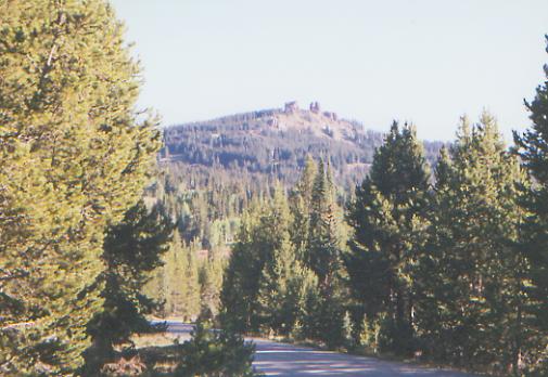
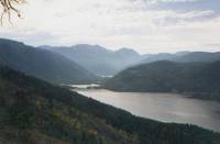
Wednesday, Sept. 8 - 16 miles to Dumont Lake Campground

It feels good to be on the trail again. It is a beautiful sunny day. The trail is easy, winding through the woods over gentle rolling hills. We were lucky in getting a ride from one of the employees of the motel. The owner loaned him his truck to take us back up to Buffalo Pass. Hes a mountain biker and hiker. Although there were lots of cars at the trailhead, it has been a quiet peaceful morning. We saw one bike and one bow hunter. The feeling is very different from the crowds we saw on Labor Day weekend. Im glad.
We slept little in town (the highway runs right through the middle of town - noisy!) so Im feeling kind of slow and lazy. Our packs are heavy. I think we have as much food on this six day stretch as we did for the eight-day stretch before this. Friends sent us lots of goodies: candy, dried vegetables, jerky, dried fruit etc. That adds to the weight, but is also very welcome.
We ended up at an unusual, for us, campsite tonight: a public campground. Jim and I are the only ones here besides the campground host and his dog. I hate to pay to camp, but at 5:30 it was still 3 miles to water if we kept going (and that a pond by the highway) and only half a mile to the campground. We have a nice site in the trees, protected from the wind, but with a few rays of sunshine at the picnic table. After the hustle and bustle of Steamboat, it is very nice and peaceful. Tonight we can have an early night, I hope.
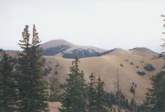
Anyhow, we continued on easy trail and then jeep road past Rabbit Ears Peak to Rabbit Ears Pass. We saw a few dayhikers and a marmot, but mostly it was pretty quiet. Tomorrow is another long road walk, the worst in Colorado according to one of the guidebooks. I dont look forward to it. This is a connector section, and private property issues prevented selection of a better route, at least for now.
Jim: The only advantages to the USFS campground are water and a privy but for tonight its worth it.
Thursday, September 9 - 23 miles to FR 104
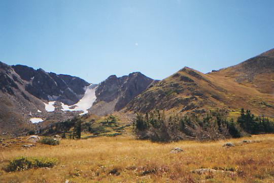
Because of the road-walk, and water issues, this will be a long day. Were stopping early (4:00 p.m.) to cook dinner and take a break after almost 20 miles, then well move up the road to a dry campsite a few miles farther on. Water will be a problem for this whole stretch, forcing long hard days. I really dislike that, but it cant be helped. The road-walk wasnt as bad as I expected -- 13 miles of paved two-lane highway, first on very busy US 40, then on less busy CO 14. Maybe were getting used to the road-walks. I remember when a dirt road was not real hiking, now we take any type of path, even paved, pretty much in stride. If its heading south, its the trail. We walked in sage country, as seems to be usual for road walks along the CDT. We saw lots of cows, including some that were being rounded up and loaded on trucks. Otherwise, the only wildlife we saw were hawks and a marmot. We passed a few ranches, and one lake with a couple of fishermen, but otherwise there wasnt much to see. Then we turned off the highway onto a gravel road and had more of the same, though we finally entered trees about three miles up that road. There were a couple of aspen-blanketed peaks, just barely turning yellow, and Indian Creek had several herds of cows. Finally, we entered National Forest again. We saw some people car camping, and one large group that may have been there for round-up, but mostly we had the road to ourselves.
Jim: It took us a while to find water and then a flat spot off the road to put the tent down. And once again, the roads and the map dont agree.
Friday, September 10 - 20 miles to Troublesome Pass area
So far, the walking has been fairly easy up and down along gravel road. The next 10 miles will be more remote and strenuous, according to the guidebook. We had some nice views from the road along the Divide. We also saw a surprising (to me) number of bow hunters, all in pickups, ATVs or motorcycles. Naturally, we saw no deer or elk. We did have a brave (or stupid) squirrel attack the tent this morning in a kamikaze dive. What was he thinking?
Were having lunch next to the only sure water in this 20-mile stretch, though we found a nice small spring along the road that wasnt in the guidebook. It is cool and cloudy, and I felt a few drops of rain, but I dont think were in for anything serious. I hope not anyway.
The oddest thing today was that the Arapaho Forest, in order to prevent ATVs from using the side trail down to Arapaho Creek, has cut down trees every 20 yards or so for 1½ miles to block the jeep track. Its annoying enough for hikers, but horse people would really have trouble with it. I dont mind when the trail isnt marked (so far only 20 miles of Colorado have been marked, and that was done just this summer) but when the Forest Service deliberately obstructs the trail, I get irritated.
'
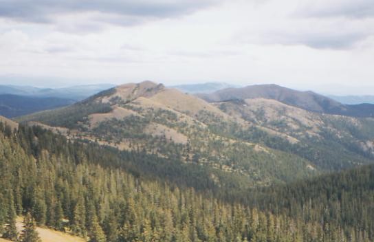
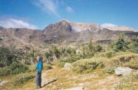
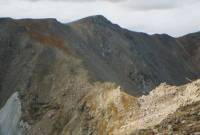
LATER: It was a pretty hike, though fairly strenuous, back up to the Divide, then around Hyannis Peak, Sheep Mountain, and along Poison Ridge. I always enjoy open ridge-walks, though the narrow trail around grassy Sheep Mountain seemed a bit too exposed and narrow. I felt like a mountain goat. The views were awesome, despite the rain that surrounded us. Big thunderstorms to the east and south made us move quickly as we headed along the open Divide. Fortunately, we only got a few sprinkles and a brief burst of hail before we reached our campsite, when it rained seriously for about ½ hour. We set up the tent, then waited under semi-dry trees, watching it rain through the sunlight. We had lots of views of tomorrows hike around Haystack and over Parkview. That scares me, because it is so big and open with a really nasty descent, supposedly. I hope the rain goes away and it isnt windy. Both could be a real problem up there.
Jim: Actually we had thunderstorms to the north and west as well. The walk across Poison Ridge was interesting to say the least we walked very fast across 4 or 5 miles of open ridgeline with thunderstorms all around us. I think were catching the tail end of a late Colorado thunderstorm season.
September 11 - 14 ½ miles to Trout Creek
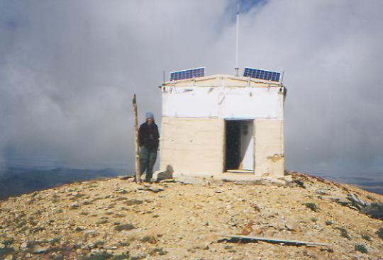
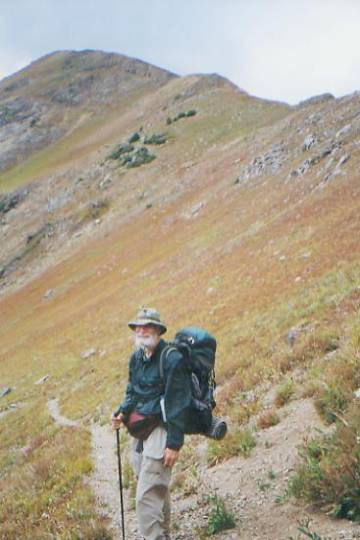
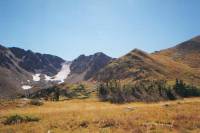
Today is Jims 60th birthday, and a strenuous one it was too. Happy Birthday, my love. It rained for a long time during the night, and we awoke to gray skies. The clouds helped keep it fairly warm though. We packed our wet tent and began to climb: first two easy miles on jeep road past Haystack, then a 1000' bushwhack for about a mile straight up to the trail on Parkview, then three more miles STEEPLY up the ridge. The clouds settled in partway up and we could only see about ten feet ahead, just enough to note steep drop-offs to the side. We got occasional bursts of rain and hail when we were below treeline, but none when we passed out of the woods, fortunately. At one point, we descended the wrong ridge, noticed that the ridge was above us on the wrong side, and ended up doing a circle back up to where we lost the trail. We had followed cairns; they were just the wrong cairns. Just as we were approaching the confusing spot the second time, the clouds lifted, briefly, just long enough to see where we were supposed to go-- straight up. Talk about a breathtaking climb!

Finally, at 12:15, we raced into the hut on top of the mountain. We went inside for lunch, and while we sat there shivering, the clouds lifted and the sun came out. The views, especially of the mountain itself, were awesome: orange, autumn-colored narrow steep ridges stretching out in four directions. Looking at our descent--a narrow open rocky ridge--we almost wished for our whiteout back. It turned out to be easier than expected, until we reached the bottom of the descent. We followed Jim Wolfs recommended route instead of the official route, which is supposed to be rough and rocky all the way down. We got off on the wrong side ridge (turn at the knob can be a confusing direction when there is more than one knob) and ended up doing a steep bushwhack from tree to tree until we reached the jeep road at the bottom.
From there on, the day was easy, though with some more climbing on the far side of Willow Pass up to the narrow rocky Divide. Then winding trail, heavily used by motorbikes, took us down to Trout Creek, our first water source since breakfast. We decided to call it a day earlier than usual. Off and on thunderstorms, with little rain, made us long to stop to try to dry out the tent and ourselves. We were both tired from the climb and steep descent off Parkview, and this is a nice quiet little valley. No sun, so our stuff wont dry, but it is very peaceful.
Jim: After the descent off Parkview, we crossed a highway - and seriously considered hitching into town for some real food. Theres a bar about 10 miles up the road. Unfortunately, when we got to the highway there was zero, nada, zilch, zed, NO traffic so we kept on going. And I got more Liptons for my birthday dinner. But dont feel sorry for me it was my choice.
Sunday, September 12 - 17 miles
Sitting in the cool sunlight just below Bowen Pass, looking up at beautiful Ruby Mountain, were trying to dry out our gear while eating lunch. It was soaked last night in another rain, then frozen solid when we woke up this morning.
The highlight this morning was running into a northbound CDT hiker, Rob Thurston. He started at Antelope Wells, NM in April and plans to stop October 1 in Lander, Wyoming. He has been taking his time, with a lot of time off. He said he never hitchhikes into town, only walks, so he had few maildrops along the way. We talked by the side of the road for about an hour, then began the climb up to the Divide and the Never Summer Wilderness. Unfortunately, we barely touch that. JWs recommended route does a long loop north, but were heading south on the official route, at least for a while. The official CDT does a 30-mile loop eastward in Rocky Mountain National Park which we are also skipping. It doesnt get us any farther south and winter is too close for scenic side trips. We may do that another year. I wont feel deprived missing one loop, especially since it is really such a senseless one, starting just a few miles before Grand Lake and ending up about a mile south of where you start. They had weekenders in mind for that one, not thruhikers.
We met a bunch of hunters this morning. The trail over Illinois Pass is open to ATVs, and it gets a lot of use. One hunter was bemoaning the fact that while he was wandering in the woods, a deer walked right past his parked car. They were the only tracks he had seen all morning.
LATER: On the way up to Bowen Pass, the wind knocked me off my feet (into the mountain fortunately, not off the mountain!) We looked up at the black clouds gathered overhead and decided that walking along the Divide wasnt a really good idea right then. An alternate route dropped off the Divide, through a pretty cirque area, into deep dark forest, back up past pretty Bowen Lake, and up to the Divide again. It was a bit longer than the official route, I think, and the climbing was at least as much as on the Divide, but we were protected from the wind and the lightning. The storm had passed when we reached the Divide again, so the views were magnificent: east toward Rocky Mountain National Park, south to the Gore and Ten Mile Ranges, over to the lakes near Grand Lake, and just north and south along the Divide itself. On the descent we saw a moose family: two females, a male and a calf. We carried water for a mile or so down a very nasty rocky jeep road to a campsite in the forest. It is late and cold, but we are a little closer to the town of Grand Lake, tomorrows destination. Jim was some irritated at what they call trail along there. I think the contrast with the good trail above was just too great, though a rocky eroded jeep track is never pleasant walking. I just look at it as a connector piece - more or less a necessary evil, though hopefully theyll replace the roads with real trail someday.
Monday, September 13 - 8 miles to Grand Lake

Jim: As long as were in town and I have time to think about these things - a few more random thoughts about the trail:
1. The relationship to Pennsylvania trails at one time I said this would become clear, so Ill try to make it so. Weve hiked and maintained trails in Pennsylvania for the last 6 years. Its helped us to cope with the CDT. Many of the Pennsylvania trails are what might be called a blow-down rich environment. So are parts of the CDT. PA is famous for its pointed rocks. The CDT has some of these, but generally it has millions of little round rocks (especially on steep descents) that act like ball bearings under your boots. PA has trails that have no treadway just blazes. The CDT treadway (when there is one) very often disappears in high-alpine meadows or wet parks and doesnt always reappear in a logical place. Just like Pennsylvania.
2. Town visits/resupply --- are necessary. Our appetites require more food than we can carry. Six days food now weighs more than 10 days food did in Montana. And we still run short at the end of each section. After 5-6 days on the trail our bodies start screaming for more fat so we go into town and eat big, juicy hamburgers, ice cream, steak and double breakfasts. And then spend massive amounts of time in the bathroom because our bodies are no longer (and probably never were) accustomed to that much of that kind of food. But it refuels us for a few more days on the trail. The worst part of town visits, though, is that we just dont sleep. Too much noise, too warm, too many people, too much activity --- and the air is too thick. The towns we visit now are at 7,000+ ft elevation and were used to sleeping at 10,000- 12,000 ft. Im not sure how - or if well ever be able to readjust to civilization again.
Tuesday, September 14 - 7 ½ miles to Monarch Bay
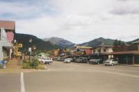
It has been an interesting, busy couple of days. We arrived in Grand Lake about 11:00 a.m. and ended up staying at a very beautiful hostel, Shadowcliff Lodge, that is perched on a hill overlooking the town, the lakes, and the hills. We got a private room with a view for $30, took wonderful hot showers, then walked down the hill to town to eat lunch and take care of errands. The town is small, with a pretty, albeit touristy, main street that is only about a mile long, with nice shops and restaurants. The Post Office is on the far edge of town, out beyond the stables. There was a library where we paid to use the Internet for half an hour. All the libraries in Colorado have public Internet service, but many of them charge, especially if you dont have a local library card.
We had arranged to meet Lynne Welden here. He is doing a video on How to Hike the CDT, similar to ones he has done about the AT and PCT. He interviews hikers about gear, trail conditions, philosophy, etc. Lynne showed up at about 8:30 p.m. and we talked for a couple of hours last night. This morning we all went to breakfast together, then filmed in back of the hostel overlooking the lake for a couple more hours, went to lunch and talked for a couple more hours. Jim got sunburned from sitting outside all morning. I have no idea how we appeared on film, but we sure had fun talking about the trail and long distance hiking in general. Of course, Ive since thought of dozens, nay hundreds, of better answers (delayed intelligence strikes again), but whatever the result, we had a lot of fun. We didnt leave town until 3:30 p.m., after a final visit to an expensive ice cream parlor. Lynne was surprised that we were willing to take so much time to talk to him, but we always enjoy trail talk, and dont meet many people who really understand what long distance hiking is like. While he hasnt done the CDT, he is an experienced thruhiker and a nice man.
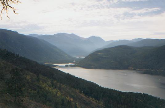
The walk out of town was a nice one, past expensive log homes and lakeside villas, along a lake, a reservoir and a bay lots of pretty water. There were a few boats and one bald eagle, but no hikers. We were tired from so much talking and thinking plus all the usual town busyness. After eating so much in town, and after such a short hike today, we decided on a light soup and sandwich dinner. It will be an early night, I think.
Jim: Dont know what Lynne will do with 3 hours of video, but Ive been through some of this before and seen 90% of the video end up in the trash. Based on past performance I think the final product will be good. Lynne took us down to the Post Office before breakfast and we found a note and a present there from Russ Dade. Hed been through town looking for us a couple days ago. Were sorry to have missed him. Thank you, Russ.
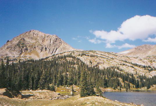
Wednesday, September 15 - 17 miles to Caribou Lake
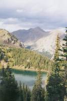
Lunch by beautiful Monarch Lake: The clouds are gathering and it is cool, but not too cold. We spent the morning either above or beside Granby Lake. The views were nice, but not spectacular. They were different, anyway. Were heading into the Indian Peaks Wilderness, following Jim Wolfs route, longer and more scenic than the CDT, supposedly. It feels very autumnal. Two of three campgrounds by the lake were closed, the ranger stations are locked up, only a few people are out fishing in the sparkling waters, and the leaves are already starting to turn yellow. Its pretty, but definitely a harbinger of winter. There are signs of beaver activity around the lake, but the only wildlife weve seen was a flock of Canada geese that landed next to us while we were walking by the lake.
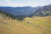
LATER: Were camped at 11,000' in a rocky bowl by small Caribou Lake. It is absolutely freezing! The sun never really reached us, though most of the clouds have gone away. Were camped on the wrong side of the cirque to get sunlight. There is a group of 8th graders from Texas camped nearby. We decided we didnt have the energy to climb 900' to the pass above at the end of the day. The trail switchbacks straight up the wall to a very non-obvious pass. The afternoon was mostly easy steady climbing in spruce forest. Not difficult, but the altitude seems to be affecting me a bit. Im slow and headachy. The back view of sheer rock walls along the valley we climbed is quite dramatic. All the peaks here are named after Indian tribes, hence the designation, Indian Peaks Wilderness. It is beautiful.
We may run low on food for this stretch. Our late start yesterday wasnt smart. We would have done better, perhaps, to just stay over an extra night and start this section in the morning. Then we wouldnt be camped so high, and we wouldnt be in danger of running out of breakfasts. Plus we might have gotten a much needed rest. On the other hand, we are trying to get south before the snows begin, and we dont have much time. Even a half-day could make a difference.
Jim: This is one of the few times that I havent listened to that inner voice thats kept me out of trouble so many times we left town in spite of the feeling that we should have stayed another night. And now were paying for it were both tired, slow and just a little out of sorts. We missed needing a permit for the Indian Peaks Wilderness by one day if wed gotten here yesterday we could have carried another piece of paper up that 3000 climb.
Thursday, September 16 - 16 miles to notch near Rollins Pass

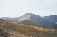
Lunch by beautiful Jasper Lake. A long, many-tiered waterfall drops into the far side of the lake from the glacier above. Another smaller waterfall drops from the outlet of the lake. It has been a very strenuous day so far, with two major climbs and a third on the way, but it has also been extremely beautiful. It was cold and very clear when we began the climb to Arapaho Pass above Caribou Lake. Every rock and ridge was clearly defined. Thin clouds floated over the pass, shrouding the jagged peaks above. On the far side, we could see alpine tarns and orange hills far down the valley. We passed the derelict Fourth of July gold mine and pondered the machinery that remains. A side trail dropped us down, then led us back up to Diamond Lake, then steeply over a ridge with views of James Peak to the south and Arapaho Peak to the north.
We ran into a trail crew there, doing trail relocation and rehabilitation. Its a busy area for a weekday. We met dayhikers, another school group from Texas, and a runner. So much for wilderness, and this is mid-week and off-season. Summer must be a zoo around here! I can understand why. This is a really beautiful area, rugged and dramatic, but with trees to soften the alpine harshness.
My mood has been erratic today. I was flying high with the beauty, then got mad because Im so slow. The altitude is affecting my breathing and pace on the climbs. Stopping to say hello to everyone today cost us about an hour. At first it was rather fun to see people, but that didnt last since there were so many. After a while I started resenting all the stops -- except the trail crew, which I always appreciate meeting. Its nice to be able to say thank you sometimes. Because tomorrow will be exceptionally difficult, I wanted to make more miles today, but I doubt we will. It is starting to get dark early and we still have a couple more passes to cross, plus we need to pump water as were nearly out.

LATER: We think we made it to our planned destination tonight, maybe. The directions were a bit vague. We found a road, we found a spring. They may or may not be the right ones. The trail was a bushwhack along or below the Divide, with occasional cairns in odd places and lots of talus fields. Not fun to do at the end of the day. We went over the Moffat Tunnel as a train was passing underneath. We couldnt see it, but we heard its whistle. We saw three bow hunters with llamas and two backpackers doing a very leisurely journey (25 miles in six days.) We passed high above several lakes. It was all very beautiful, but I was so tired by the time we climbed Devils Thumb Pass after lunch, I hardly looked around any more, except occasionally to see how far we had to go. For cross-country, the walking wasnt that bad over the alpine tundra, but it made a long day.
Jim: Were at a campsite thats been used before close to the only water source weve seen for quite a while. The view is beautiful and we have a birds-eye view of whats probably one of the most expensive little resorts in the world Winter Park, CO. Its cold and clear lots of stars.
Friday, September 17 - 12 miles to Winter Park
We are utterly exhausted, worn out, beaten up and dead. I knew today would be difficult, but I only expected part of it to be hard, not the whole day. It took nine hours to do twelve miles, but then nine of those miles were rough cross-country over tundra and talus, with five 13,000' peaks. The first mile and a half was a 1000' climb on jeep road and trail, climbing toward Mt. James. Then we left the trail and began another 1000' climb straight up over tundra and loose talus. Love those rolling rocks! My thought was, and this is supposed to be the easy side? At least thats what the guidebook implies. We finally reached the top and briefly enjoyed the views, such as they were on a grey, cloudy, hazy day.
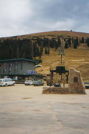
Then we began an easy descent to a wet open area below, where we again left the official trail for one of JWs scenic routes. There was a very steep nasty notch between Mt. James and Bancroft, with lots of exposure (e.g. a LONG way down), loose rock and a lot of cairns but no clear path across. Jim kept saying, This is crazy, utterly insane! I agreed. On the other side, the route goes straight up again: 500' in 0.3 miles. We then contoured around the rocky slopes of Mt. Bancroft, talked to a day hiker for a while, then went on to climb 400' up Parry Peak, our tallest point on the CDT. Then we dropped 1000' before climbing up steep Mt. Eva with its ruined radio tower, down the rocks on its back side about 700', then straight up 700' to the broad plateau that is Mt. Flora, then down and up and down and up along the ridge, past the radio installation on School of Mines Peak, and finally down, down, down on dirt road to Berthoud Pass. We were exhausted. We had planned to eat at the restaurant at the pass, especially since we never got a real lunch, but it was closed until the weekend. Finally, we decided to hitch into town --Winter Park--instead. We were tired and hungry and in no mood to climb the ski trails on the other side of the highway with no more reward than a dinner of Lipton noodles.
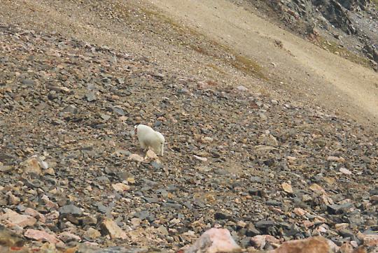
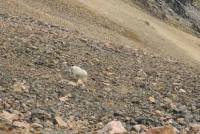
One highlight was having a fairly close (100') view of a big mountain goat. He wasnt scared of us. He just stood there, then wandered back under an overhang. That is the closest Ive ever seen one. Usually theyre just faint white dots high on a peak or dark silhouettes on a ridgeline. The high country is incredible, with the mosses and ferns changing color with the passing season. We could see range after range of mountains and lots of small lakes far below each peak.
Jim said that this was the first time on the trail that he seriously considered quitting. He had to ask himself whether the reward is worth the risk. At the time it was hard to come up with an answer. We both reached a point this afternoon when we wondered, Why do we do this? We risk life and limb; we kill ourselves with these climbs, why? It didnt help that the usual views (Mt. Evans and Bierstadt, Gray and Torreys Peaks, the Gore Range, etc.) were blurred by clouds and precipitation. Jim Wolf calls this section the crown jewel of the CDT. Today it was all grey. We saw a couple of snow flurries as we hiked and the wind picked up later in the day, but we were lucky, considering the fact that we were well above treeline all day and storms were all around us. As Jim said, Ego isnt a good enough reason to kill ourselves. But I reminded him that the happiness we felt yesterday on a clear and sunny day, looking at all the beauty around us, was why we are here. It isnt just pride. Sometimes you wonder, am I here because we told people we were going and now its too late to back out? For some, fear of losing face is a good enough reason to stay on the trail even when theyre miserable - but not me. I have a lot of pride - but hopefully Im not that stiff necked. Im here because I love this life - the beauty that surrounds me, and the lifestyle of long distance hiking: the simplicity, the challenge, the adventure, even the risk, a little. Some days that can be hard to keep in mind.
I first heard about the notch between James and Bancroft three or four years ago. I heard it was steep and rocky and dangerous, and I knew that someday I would have to do it. Then the official route was changed to avoid the notch and the next three peaks. It now climbs over Mt. James, then descends to the valley and follows dirt roads around the area, and climbs cross-country back up to Flora. Its safer, longer and more boring. Yet thats not why we did the high country route. We did it because I refused to let my fear of the rocks stop us. I had to face the fear and do it anyway. Never mind that the small rocks rolled under my feet, that the big ones were slanted and unstable and that I was afraid to use my hands for balance for fear of setting off another rock slide, or my secret paranoia that the big boulders are just waiting for me to pass so they can start rolling downhill on top of me. I had to do it. And, though it was physically and emotionally exhausting, Im glad we did. In some ways, it wasnt as bad as I expected. I didnt freeze or panic, even when the rocks rolled underfoot. That doesnt make me look forward to the next long ridgeline cross-country traverse, but I know we can do it. Thats why were out here. But oh, is it hard!
I wont quit, despite my fear of rocks. I overcame my fear on the AT, and Ive overcome it here. Neither am I willing to quit for fear of winter cold and snow, or because Im tired of climbing endless numbers of steep rocky knobs. Fear is not my master. I love this land and this life, and thats a much more powerful guide than my fears, even when they are justified. Were both tired and worn out and it is easy to let fear and anger and unhappiness build up larger than life. But they do pass. When we rest and eat and rest some more, well remember why were out here. And well see the small beauties that all the gloomy skies cant hide.
Jim: As I predicted 4 years ago, my 60th birthday was on the trail. We celebrated with a steak dinner when we got to Grand Lake, Colorado two days later. And then Lynne Whelden caught up with us that night and we talked trail for 3 or 4 hours. The next morning we had breakfast and talked trail for a couple hours, then did the video interview (another 3 hours). Then we went to lunch and talked trail for another 3 hours. We walked out of Grand Lake at 3:30 PM and only walked 8 miles that day.
Now were at a motel in Winter Park, Colorado an unplanned stop after one of the most frustrating days weve had on the trail. Twelve miles in 9 hours is frustrating. So is one 1000 to 1500 ft per mile climb after another. So is mile after mile of scree and talus that make Pennsylvania look like a playground. So is walking through some of the most wild and beautiful country in the US on whats supposed to be a crystal-clear day, but instead is overcast, windy, with occasional snow bursts. So is having your body tell you that it WONT go any further because it has no reserves left that youre running on empty. So were in Winter Park an expensive little town. And I didnt even mention The Notch.
This was as close as Ive come to quitting the trail. Having the weather go bad on us (although not REALLY bad) through one of the most beautiful parts of the trail and then getting to the lodge at Berthoud Pass and finding that there was no restaurant, no food and no water just put the cap on it. Getting into town, having a shower and a good meal turned a lot of my attitude around, though. Well go back tomorrow, but for tonight were in a feeding frenzy. And we still cant sleep even though were both exhausted.
I recently told Kahley that were in a race for the border in this case, the Colorado/New Mexico border so we can beat the snow (and hunting season) in the South San Juans. Then we immediately took a longer route out of town which was at least a day longer because it was more interesting. Conflicting requirements. We may not win the race for the border, but well keep on trying as long as possible. We came out here to walk the mountains not the roads.
Home | Links| Trail Journals |
The Thruhiking Papers | Bun-bunMontana | Wyoming | Colorado | New Mexico
Created: Fri, 16 Jan 2004
Revised: 30 Sept 2016Copyright © 1999-2017 Spirit Eagle