|
 |
 |
 |
 |
|
|
|
|
|
|
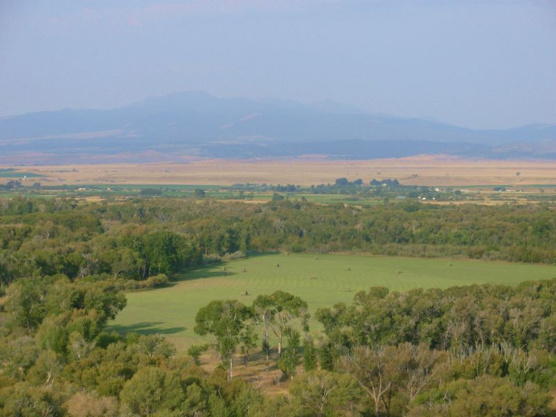
Sunday, September 3 15 miles to Upper Hellroaring Creek
It took a while to get a ride out to the trail this morning. At least we didnt get arrested. When we reached the road two state police cars were investigating an abandoned truck across the highway. We stuck out our thumbs anyway. Unfortunately, most of the traffic from the motel was headed the other way, toward Yellowstone. After half an hour or so, an Australian who lives and works in Big Sky picked us up. He was headed just past the Deer Creek Trailhead, so it worked well. There are several trailheads into the Spanish Peaks area. We chose the Deer Creek Trailhead, as it looks like a fairly direct way westward into the Wilderness.
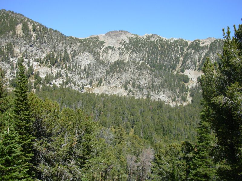
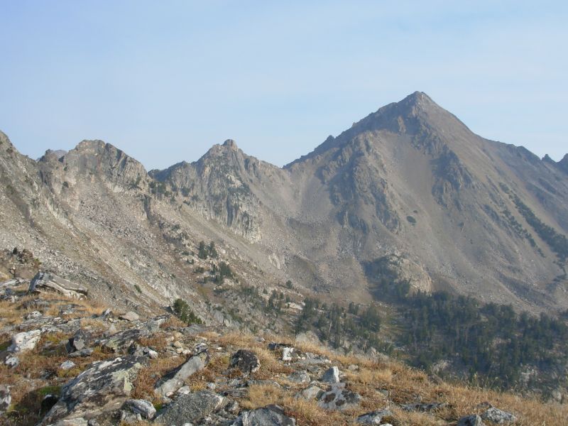
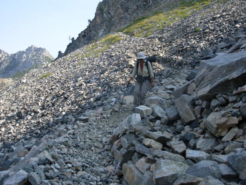
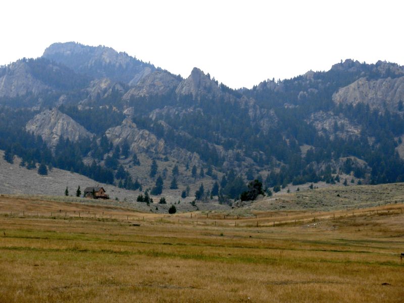
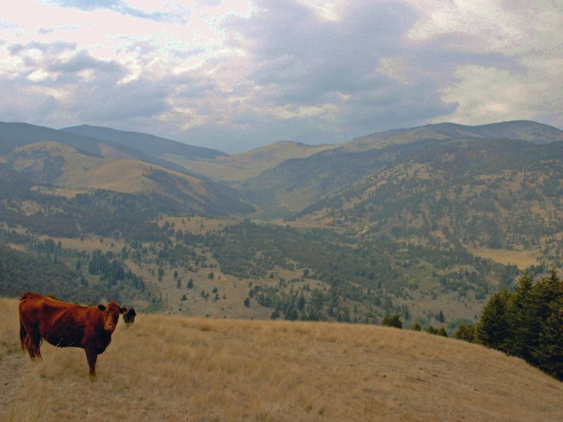
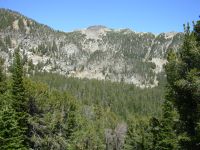
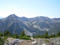
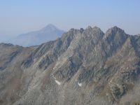
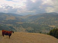
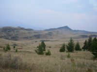
We reached the trail at 9:30 and began our rather strenuous day. I knew little about the Spanish Peaks, except that its part of the Lee Metcalf Wilderness and has a reputation for being rugged. Thats no lie. We climbed 3000 to lunch by Moon Lake, then another 1000 to the ridge above Deer Lake, then we dropped a bit, then climbed back up to the ridge above Hellroaring Lake. It was very dramatic country: steep steep ridges, lots of talus, hanging valleys, gray and white rock. We dropped 2500 down Hellroaring Creek, switched to the Gallatin Peak Trail and climbed back up 1200. Whew! We still have 1000 to do in the morning to the top of this valley. As I said, its rugged.
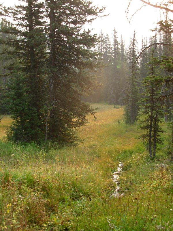
Unlike many wilderness areas weve visited, this area feels wild. Two bow hunters left the trail as we started up, a couple played leapfrog with us to the first lake, and a fisherman arrived at Moon Lake just as we left it, but we saw no one all afternoon. There are few footprints, mostly elk and deer. The trail to Deer Lake was very good, after that it got steeper, narrower and less defined. We lost it briefly in meadows near Hellroaring Lake, but soon picked it up again. Most of our hike through this area will be climbing up one drainage and down the next. It makes it hard to get lost, but well be doing lot of climbing. Most of the hike was in forest, with occasional views of the peaks around us and some meadows.
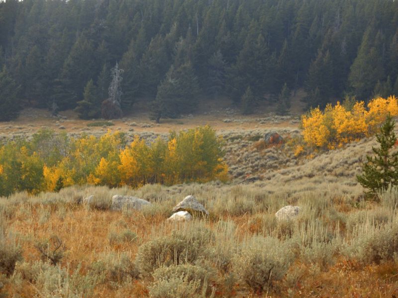
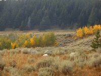
From the first ridge we could see a huge plume of smoke from a new fire near Hyalite Peak, the one we were supposed to hike to on the Gallatin Crest Trail. The whole area is hazy from several fires. Evidently a lot of Montana, Wyoming and Idaho are on fire this summer. Autumn colors are everywhere: the grass, reddened blueberry bushes, etc. We saw some aspen just starting to yellow, but the thimbleberries are ripe and edible. I grazed as we climbed the first ridge.

Jim: If we hadn't bailed off the Gallatin Crest, we'd have walked right into the Hyalite fire. As it is, the smoke is pervasive - there won't be a lot of clear, sharp photos today or any time in the near future. I think we' still got a few good ones, though.
The Deer Creek Trail climbs 3,000 feet through forest in the first 6 miles from the road (which is at 6000' elevation). We had lunch at a small lake. Then we got to climb to the ridge at something over 10,000' and then back down - and up - and down - and up. Total elevation gain was somewhere around 6,000 ft for the day.
Monday, September 4, Labor Day 17 miles to North Fork of Spanish Creek

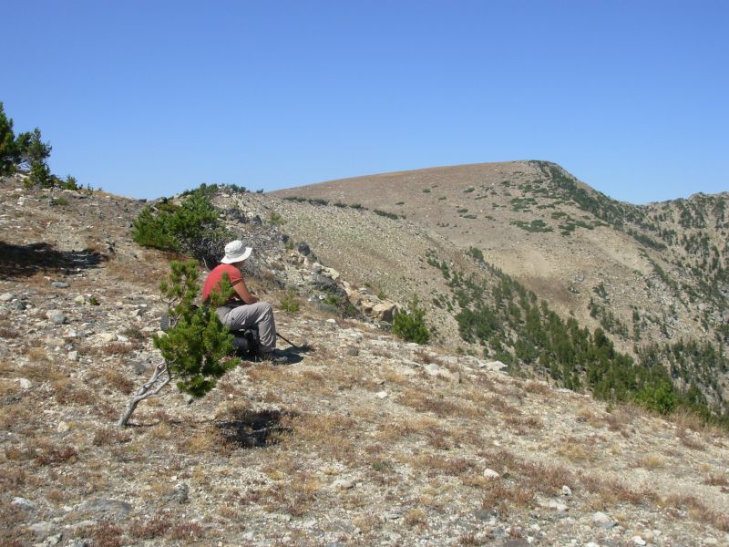
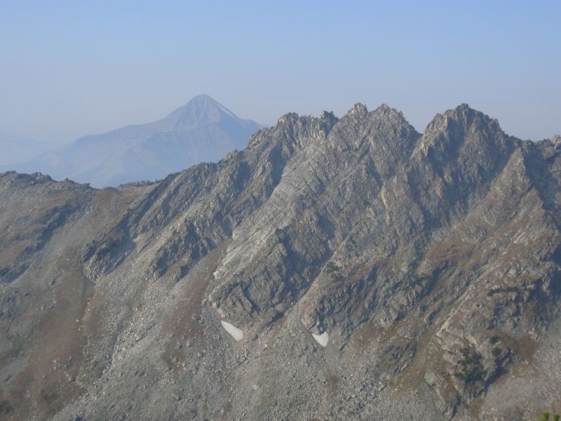
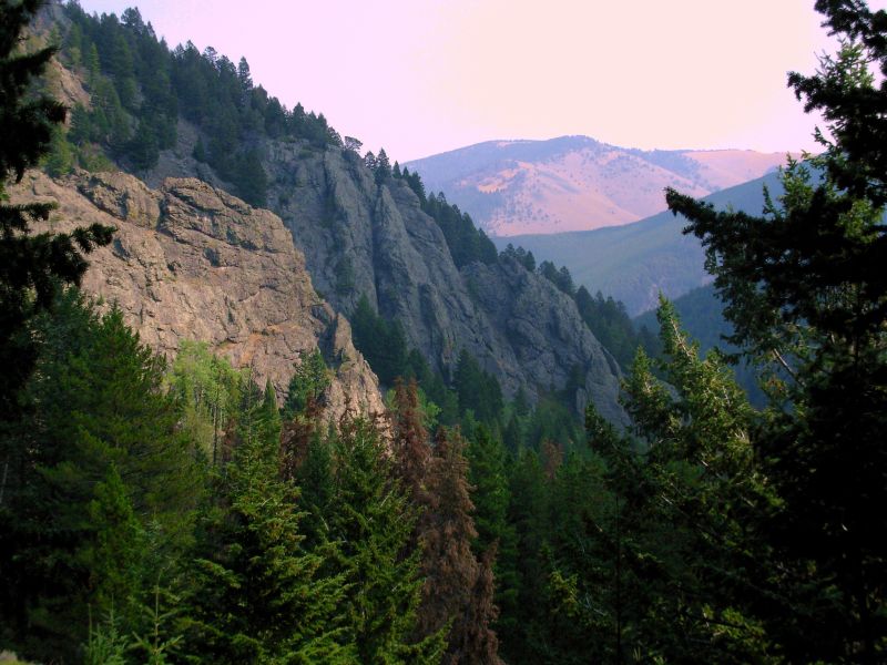
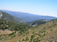
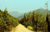
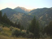
The smoke haze has thickened. We can taste it in the back of our throats. Visibility is very limited, which is really too bad as this area is very dramatic, with sharp jagged peaks and narrow valleys.
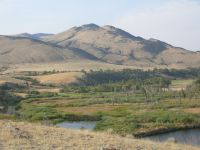
We climbed 1200, mostly by zigzagging up a cirque wall, then dropped 700 into narrow Bear Basin, then climbed 500 out, then dropped across talus and scree to the South Fork of Spanish Creek. We stopped for an early lunch beside Mirror Lake. We started seeing people there seven hikers in 10 minutes, including two groups camped by the lake. I shouldnt be surprised, since its a holiday weekend and theres a trailhead only eight miles away.
We saw a buck this morning, bouncing across the first cirque basin, and several picas in the rocks, meeping at us, and a couple of squirrels that scolded us vociferously. After lunch, we continued to drop down the creek, then climbed 2500 back up to an area with several small lakes and ponds in little rocky basins, then we dropped back down 2000 to the North Fork of Spanish Creek. This area has lots of water, though it feels very dry right now. We met four more backpackers on their way home, then we had the trail to ourselves. Part of the trail felt very unused, part was heavily eroded from overuse. It was a mixture.
I think most people go up to Spanish Lakes, Solitude Lake or Mirror Lake. All of them are 7 or 8 miles from the trailhead. Farther back takes more work. The trails have been signed, mostly, and there were cairns across the meadows. There were even a couple of bridges near the trail to Spanish Lakes. Fairly civilized, for a wilderness area. No sign of bears anywhere; no tracks, scat or digging. There are lots of deer and elk tracks but I only saw the one deer this morning.

Jim: We woke to heavy smoke this morning. Climbing in smoke is an experience I could happily live without. Makes breathing unpleasant. Also makes the photos a little foggy.
We saw more people (backpackers) today than we saw in Yellowstone. As Ginny said - it's a holiday weekend. But, all things considered, the traffic is still VERY light.
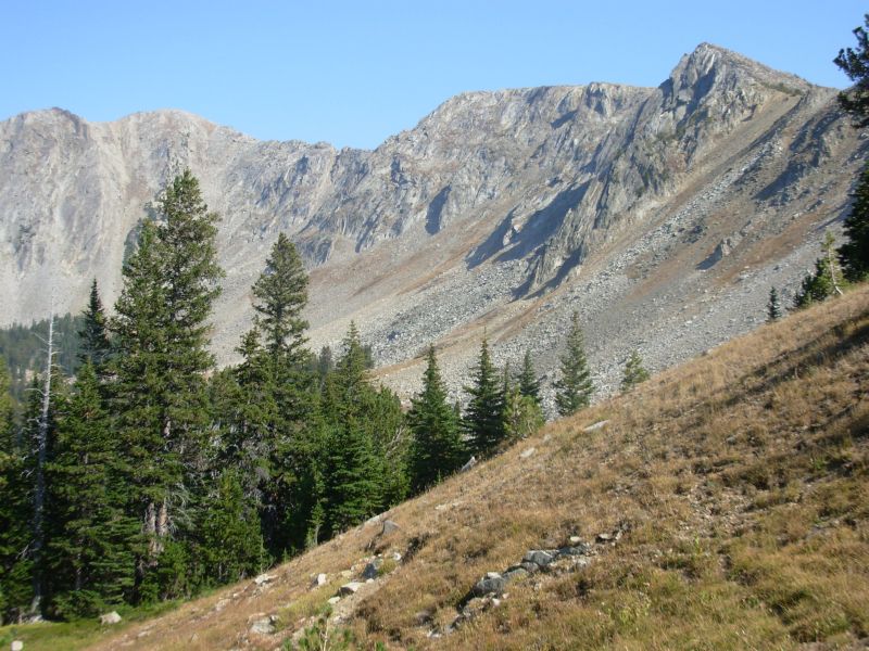
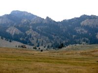
The land is steep raw rock with open meadows (read "bog"), conifer forest and steep tumbling streams below treeline. The trail likes to go above treeline a lot. And there's been some really good (and expensive) trail work through the talus fields. Overall, it's the most "real" wilderness we've seen since the Weminuche. And it's a lot tougher than the Weminuche.
Tuesday, September 5 17 ½ miles to Ennis

Our day got off to an interesting start. First there was the squirrel that woke us up by tossing pinecones at the tent for 15 minutes. He stopped when Jim emerged. Then there were the two elk bugling nearby as we climbed. Come to me, you sweet young cow. No come to me. I am much the better stag. Or something like that. They may have been talking about us, since one elk followed us for a while. The last bugle was very close, though we never saw him. A mile or so later, near Cherry Lake, I saw a bear. It was smallish, black and ran away, so I assume it was a black bear. I just saw its back end.
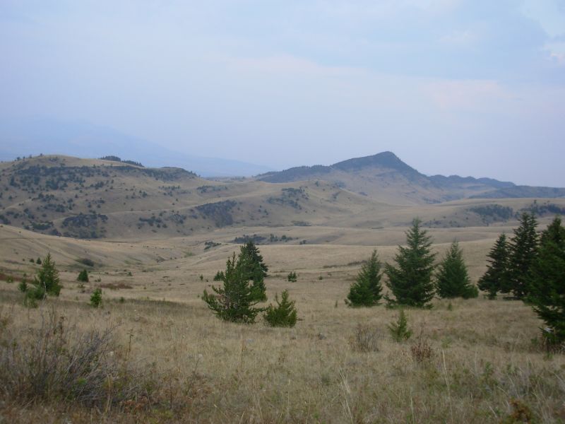
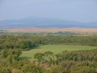
The hiking was fairly easy today. We climbed 1000 in a mile and a half, then went up and down across several small ridges, then began a long descent to an area known as Cowboy Heaven with rolling grassy hills and pine trees. We continued descending from there through sage to the Madison River and Ennis Lake. We left the Wilderness Area, as evidenced by motorcycle tracks at the border, but then touched the edge of the Bear Trap Wilderness. We didnt see anybody on the trail.

It is still smoky today, though we are now at least 30 miles west of the Hyalite fire. The few views were hidden in the haze. Oh well, thats life in Montana. Supposedly there are four major fires right now affecting air quality across the state. (Mark Flagler told us later that he was unable to film in southern Montana because of all the smoke. He will have to come back next year to get the footage he missed because of all the fires.)
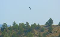
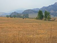
Our afternoon was an easy descent through sage, juniper and blooming rabbitbrush. We walked along the Madison River, a big one, for about half a mile, then along Ennis Lake for four or five miles. There were a lot of houses along the lake. We lost our wilderness. We watched a bald eagle soar over the junction of the river and the lake. Weve seen lots of hawks and several golden eagles, but this was our first bald eagle on this trek. Later we watched three deer grazing in a field. There is a lot of hay and alfalfa grown around here.
We got a ride to Ennis quite easily with a local woman who owns a supper club in town. She was willing to have us ride in the back of the pickup, but not inside with her. She kept apologizing, but we told her that we were absolutely fine with that. She felt safer that way, and besides, she didnt have to smell us. Much better. She gave us a ride the five miles to town, so we were happy. We got a room at the Fan Motel, and then went out for a good supper. Well stay over tomorrow to take care of our usual town chores and rest a bit. Although it has only been three days since Big Sky, it has been a strenuous three days, and we got no real rest there. I hope tomorrow will be better, but we have a lot of errands and the town is a bit spread out.
Jim: Spanish Peaks was a tough section - I think we averaged over 5,000' elevation gain per day. But it was worth it - it's a beautiful area that I'd like to explore some more. Coming off the ridge was another 4,000 foot descent. Not a bad grade, but still a knee-buster. But it does go through some pretty country - forest at the top, then sagebrush desert as the elevation drops.
Wednesday, September 6 Rest day in Ennis
Jim: A number of past thruhikers have come through Ennis. I'm not sure which routes some of them used but I think ours isn't one of the more common routes. The town itself has all the services a thruhiker needs - it's just a long way off the normal trail route.
There are several motels, a couple good restaurants, an outfitter, laundromat and a Forest Service office. We stopped to talk to the Forest Service trail specialist and he gave us some good ideas about alternate routes through the Tobacco Root Mountains, which are our next section.
Thursday, September 7 15 miles to Sureshot Lake
As usual, we didnt rest much in town, but we did manage to eat a lot of good food and take care of our town business. The pharmacy/café/soda fountain also had Internet, which allowed us to take care of three things at once: breakfast, drug store and communication with the outside world.
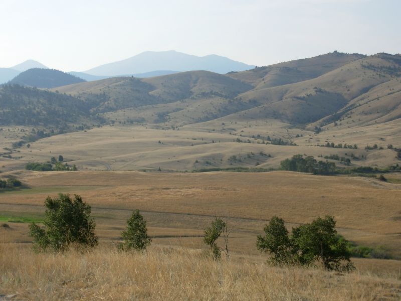
The smoke remains a major issue. There are several very large fires throughout the west (one is 300 square miles) so the entire region is blanketed with smoke. Air quality is code red, meaning, dont go out if you dont have to, and dont exert. I think backpacking qualifies as exertion, but what can you do? We need to keep walking north. Yesterday we talked to a ranger at the Forest Service Office about possible routes through the Tobacco Root Mountains. There are several options. The problem is the middle, where a 10,000 ridge divides the two forests, with no trails across. We can do easy jeep roads and trails around or a cross-country trek over the top past a bunch of mines. The whole area is riddled with mines. Evidently it was a huge gold producing area 130 years ago.
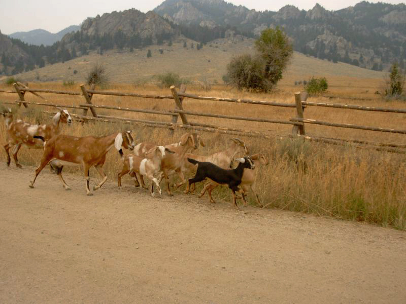
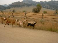
The morning hike was on a dirt road through ranch country, past some very nice houses and some junky ones, with paddocks full of cows, horses, sheep and goats. One herd of goats got out and followed us up the road. Jim got to play pied piper again. It was also a bird morning: ducks flew overhead in a very ragged formation, a golden eagle passed us flying low over the ground, a grove of sycamores held a noisy rookery, and a small flock of goldfinches were hidden among the yellow sunflowers along the road. That was fun.
One of the more unusual sights today was a stone house with a chimney being moved on a flatbed truck. The electric company was installing power and they had traffic control stopping traffic this out on a dirt road just a couple of miles from the National Forest. We followed the road for about 10 miles through private land, then another five in the Forest to Upper Sureshot Lake. It has a primitive campground with an outhouse and several obvious campsites next to the lake. No one else is here. Once in the National Forest, traffic eased. We saw only two cars in two hours. We saw a doe and very small fawn (small for this late in the year) and a snake on the forest road. The land is rolling hills covered with trees and sage. You can see a few tall peaks through the haze. The area just outside the forest had some nice rock formations and dramatic gray cliffs. One house tucked back under the cliff really caught my eye -- as much for its location as its style, though that was also nice. It was a log house, nestled among the rocky spires. Beautiful.
We need to take it easy the next couple of days. Our route is shorter than my original projection and we dont want to arrive in Whitehall on Saturday since we have a major maildrop there with our winter clothes and maps for the next stretch. I had figured 5 days to get there; it could take only three. We may simply head west and go on to Homestake Pass which is part of the CDT route, then hitch to Whitehall on Sunday. Or we may do a more winding route through the mountains, though that goes against the grain. Jim is in a lot of pain right now. The steep descents in the Spanish Peaks really hurt his knees. Adding miles and climbs without good reason just doesnt make sense. On the other hand, Jim says the trail winds more than shows on the National Forest map, so the trail may be longer than it appears. We bought two topo maps for part of the route, and they give more detail than the NF map.
Jim: Getting out of town was interesting - we were hitchhiking and once more had a single woman stop to pick us up. Do we really look that harmless? Once she dropped us off, the day was a long gradual climb out of the valley to the Forest and then up to Sureshot Lake.
The goats were a little strange - they had no fear of us. They were domesticated, of course, and had evidently gotten loose somehow. I've chased goats that got loose before - they can be really tough to corral if they're having fun or if they've gotten into something good to eat. They tried to follow us up the road and we kept trying to send them back home. Finally, a truck came up the road and blocked the road and turned them around.
Friday, September 8 17 miles to the National Forest Boundary
It rained during the night, only half an hour, but enough to get the tent quite wet. Around 11:30 this morning it started again, light but cold. The walk was a nice one on jeep roads, ATV trail and hiking/motorbike trail in mixed forest and sage/grass meadow. The rain lasted, off and on, until about 2:00. We ate a quick lunch in the shelter of some trees then kept climbing. It was pretty country: open bald meadows with spruce and aspen, some lodgepole pine groves, several streams. There were cows everywhere. The only wildlife we saw was a coyote and a snake. The trail got a bit obscure, thanks to competing cow paths, but there were posts in meadows and blazes on the trees, so we were able to find our way easily. Most of the junctions even had signs.
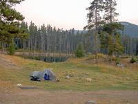
We reached a trailhead after about 10 miles on the foot trail, then picked up a jeep road again that took us out of the forest for four miles, then back in again. Were camped just inside the National Forest, near North Willow Creek, by an old gold mine. It has a pretty view with a ridge rising 500 above us, covered with sage, grass and scattered trees. No cows in sight, though they obviously spend time here. We had to kick the cow pies out of the way before we set up the tent.
This morning as we were eating breakfast we heard a dog barking for about ten minutes. Later we saw a man stop his truck, get out, and search a grove of trees in the area we heard the barking. We figured he lost his dog last weekend. I hope they got back together.
Jim: This was a "Montana" day - meadows, streams and pines; climbs and descents; dirt roadwalks, cows and mines. I love it.
Saturday, September 9 19 miles to Bone Basin
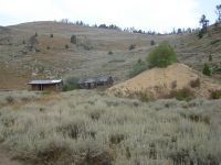
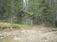
It was an up and down day. We climbed on the road up and over the ridge past Atlantic and Pacific Mine, then dropped 2000 on old jeep track past some old log cabins, mines, cows, and recently logged areas to the Boulder River. A sign at the bottom said, Private property. No Trespassing though the map shows it as National Forest trail. We passed through Mammoth, a community of mostly summer homes. There were no businesses that we could see. Following the map, we headed up a road that seemed to dead-end at a driveway. We spotted a gate in the fence and jeep tracks beyond. The homeowner came out to see why her dogs were barking and I asked if the trail over the mountain lay beyond her house. She said to go on through. Trouble was, the gate was locked. So we squeezed through the fence, lifted our packs over, and headed up the mountain. The trail vanished at a deer fence enclosing a couple of acres, but faint ATV tracks led us northward. While we were eating lunch, we met a man riding his motorcycle up the trail. He lives in Whitehall, which is a gold mining town that we will be visiting in a couple of days. I asked where we could get a good meal in town. He answered, Nowhere. I hope hes wrong.
It sprinkled again in the night, so the air is still hazy with humidity and smoke. We climbed back up 1000 on winding trail. The map doesnt show switchbacks, so distances are hard to gauge. We almost have to double our estimates. The forest maps are such large scale (2 1/2 miles per inch) a lot is hidden, especially since they arent topographic. We hadnt realized what a roller coaster today would be. The trail went over several ridges with some really long climbs and descents. We ended up climbing at least 4500 and descending 6200 today. Thats a workout. The trail was mostly quite good with easy switchbacks, but in a few places we went straight up and down. Worst was a mile or two of old eroded jeep road that was really rocky. We were very tired by the end of the day, and Jims knees were in agony. I enjoyed the hiking, though most of it was in the trees. There were occasional meadows and views.
The end of the day was typical Montana rolling grassy hills with lots of cows. The herd ran away, then turned around en masse and began following us. I was afraid of getting run over in a stampede, which they did a few minutes later. We got some really nasty cow water from the stream there. It was awful, but the previous spring was dry and it was after 7:00 when we reached Bone Basin and it was getting dark. The map showed several springs in the basin, but all we found was a little trickle, much used (and fouled) by the cows. We found a campsite hidden in a grove of trees and set up just before it started to rain again. That didnt last long. Neither did the late afternoon thundershower that just made the world very dark for a while.

We saw two deer, three hawks and a garter snake today. The second deer just stood there watching us for a while, totally unafraid. It was quite young.
Bottom line: I liked the Tobacco Root Mountains, despite the motorbikes that shared our trail. We saw five motorbikes today, plus two horses. There are big 10,000 peaks, nice trails, lush forest and open sage country. There was a nice variety. Aside from Mammoth, it felt quite remote.
Jim: The knees screamed at me today - after the third 1,500+ ft climb and descent. Well, we knew it was gonna happen. But they do pick the damnedest times to do it - when we're in a place with no water and no place to camp. Just like teenagers.
Someone once said that the Tobacco Roots would be easy to bushwhack. That could only be said by someone who roadwalked through the area. The maps lie. If you actually hike the trails and jeep tracks through there, there's a 10,000' ridge that runs through the middle of the range. And a lot of side ridges that have to be crossed to get through the section. Because of the scale of the Forest maps, a lot of the detail gets lost, so the mileages you might estimate from the maps have to be multiplied by at least 50%. But the Tobacco Roots are really beautiful country for those who have the inclination and energy to explore them.
The north side of the range is DRY. There are springs indicated on the map, but there's little or no water in them. We know there's "some" water because the cows were out there. But we didn't have time to search for anything better than the one cattle-fouled spring/stream.
Sunday, September 10 12 miles to Whitehall
We had to change our plans again. We intended to walk from the forest to the mountains west of here all the way to the CDT at Pipestone Pass. However, the bridge across the Jefferson River we intended to use no longer exists, despite being shown on two different maps. We had to detour east four miles to another bridge, which made it too far to walk across the valley today. According to a sign at a river access point, the water in the river is so low, fishing is forbidden. It didnt look that low, but I dont know whats normal. It was high enough we didnt want to cross it. Using the Kountz Bridge brought us directly to Whitehall. Now we have to figure out how to get from here to the CDT. More roadwalking doesnt appeal, but we have no choice. There is a valley between the mountain ranges that we need to cross, one way or another. My original plan was to go north to pick up the CDT near Delmoe Lake, but we could go west instead to pick up the trail at Pipestone Pass or Homestake Pass.

The walk this morning wasnt bad, though it was on graded dirt roads. We passed several small ranches. We watched a bald eagle and an immature bald eagle that was being harassed by a flock of crows. A burro played with a herd of goats. A truck stopped to ask if we needed help and gave us some good water. The Jefferson River was bordered by green irrigated fields of alfalfa or hay.
There was a rodeo going on when we reached town. The streets were deserted, though the rodeo grounds were busy. We got a room at the Super 8 by the freeway, which was on the edge of town. Its a small town, so distances arent that great about 1/3 mile to a good restaurant, ¼ mile to the library, ½ mile to the grocery. Tomorrow is errands day. Today well just rest our feet and get clean.
Jim: Coming out today was a long descent on graded dirt roads through rolling grasslands. Easy walking, but hot - even in the morning. The water from the hunter in the truck was welcome if not strictly necessary. Never pass up Trail Magic - it might not come along again.
As Ginny said - our route was changed by "circumstances" - the map lied again. So we'll deal with it. After all, a thruhiker should be able to deal with anything that the Trail or the weather witch throws at them. We'll replan the next section while we're in town.
First stop in town was the Chief restaurant. We were actually looking for a motel - there are 3 of them in town. The first two weren't what we were looking for. But the Chief motel also had a restaurant - and they had good hamburgers - and beer. Then we went looking for the other motel - it was out by the Interstate.
Monday, September 11 Day off in Whitehall
The motorcyclist was wrong about there being no decent restaurants in Whitehall. A couple of waitresses lost their jobs last winter at the gas station café when it was turned into a Lucky Lils Casino. They opened up their own restaurant, Jane and Gabis Legion Street Grille, which turned out to have good food and great service. We ate most of our meals there, including Jims birthday dinner. They give free sundaes for customers who behave. We behaved. That was a bonus. The town isnt much a mining town with lots of bars and not much else--but our needs were taken care of: laundry, grocery, library and good food. We were happy.
Out of curiosity, I wrote to Glacier NP a week ago to find out when they close for the season. I thought that things closed down in early to mid-October, but I was mistaken. Most of the facilities close in mid-September. The east side backcountry offices close mid-September. The bridges are taken down before the end of the month. The bus stops running at the end of the month, and the border station closes October 1. This makes a huge difference, especially for people who dont have someone to pick them up at the border. We decided to jump ahead to Glacier now instead of continuing northward as planned so we can get our permits and hike the Park while there are still some services open. If the weather is bad, it could make a real difference. So we decided to hike from Whitehall to Homestake Pass where we'll meet the CDT again and then get transportation north to the Park. There are buses and planes, or we may rent a car. Well see.
Jim: As I said - we'll deal with the change in plans. From here we'll go to Homestake Pass, then into Butte to find transportation to East Glacier Park. And then we'll hike south from the Canadian border back to Butte. It's not what we planned last year, it's not ideal - but it is workable.
Whitehall is a good trail town. Although it's further from the Trail, it's probably better than Butte because it's not as big and spread out. And it's not as expensive. But it has almost everything a thruhiker would need. Depends on what you think you need. For us, it was just right.
Home | Links| Trail Journals |
The Thruhiking Papers | Bun-bun
Created: Dec 2006
Revised: 30 Sept 2016Copyright © 2006-2017 Spirit Eagle