|
 |
 |
 |
 |
|
|
|
|
|
|
Thursday, March 27: Tuzigoot, Beaver Creek Campground (4 miles)
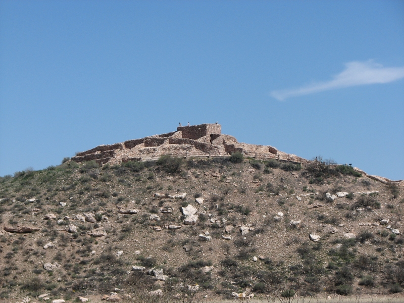
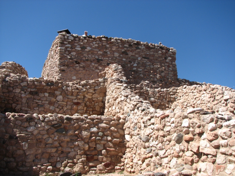
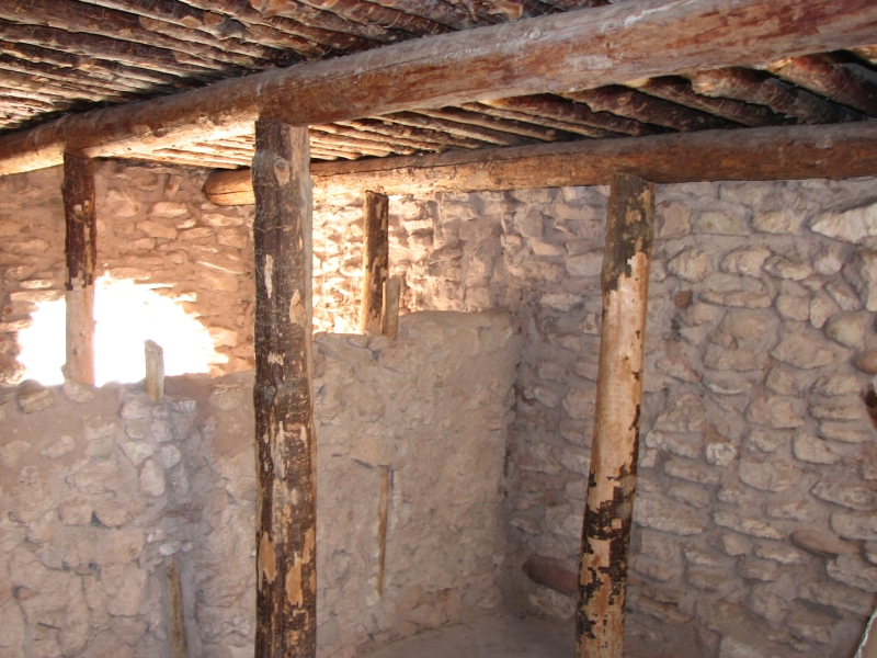
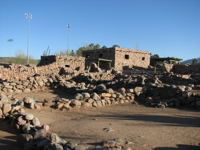
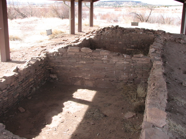
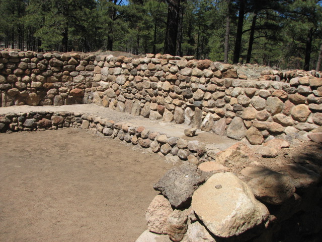
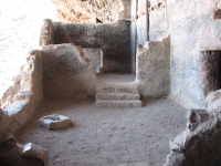
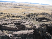
It feels really good to finally be on the road again. I am not a fan of Phoenix, though I do enjoy seeing my brothers and their families. We stopped at the grocery to pick up a few items then slowly headed north on I-17 through some construction. Our first goal was Tuzigoot National Monument, a Sinagua ruin (1100-1400 AD) near Sedona. Somehow we missed it when we visited Montezumas castle, Palatki etc. two years ago. It was a nice ruin, partly reconstructed so you could see the outline of the structure. It had some interesting items in the small museum as well, like tiny clay figurines and woven cloths.

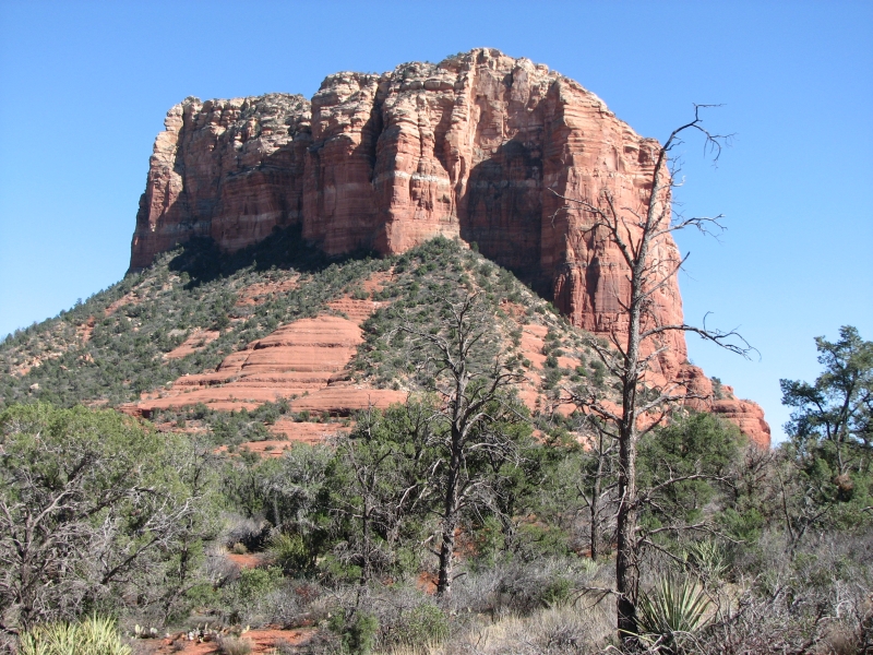
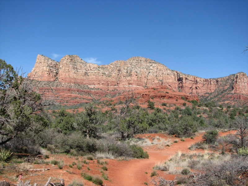
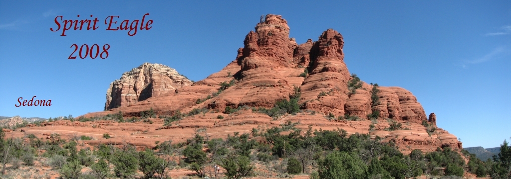
We headed into Sedona, but didnt spend any time there. It is a busy crowded little tourist town, set in a gorgeous landscape with few places to stop and admire the view. They are widening the highway so driving was slow. We did stop to take a few photos near Bell Rock but didnt leave the car because you need a Red Rock Pass to hike now. I hate that!
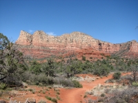
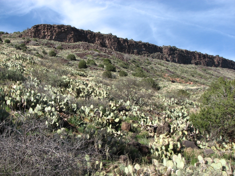
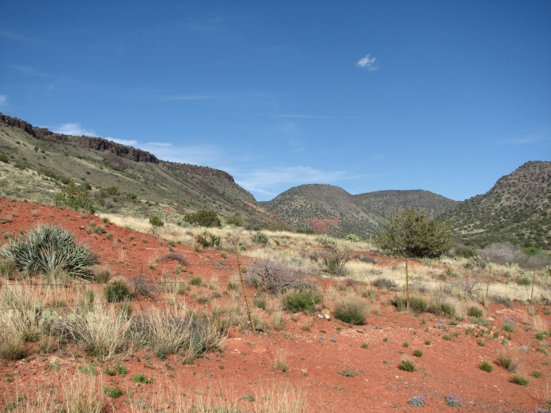
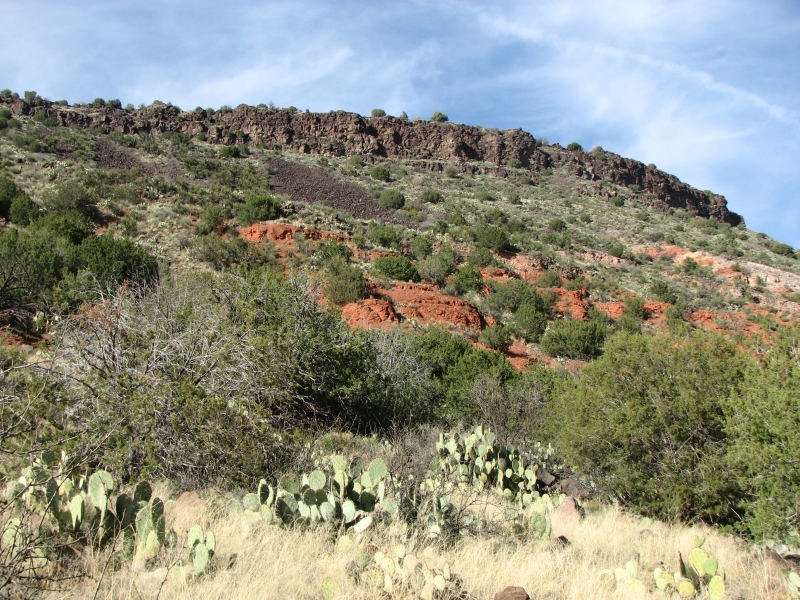
We enjoyed the red cliffs as we drove back to I-17 and a Forest Service campground at Beaver Creek on the other side. It is a small one, only a dozen or so spaces, and we got the last spot. Several people were turned away and sent on to other campgrounds near Sedona or in the forest. We were early enough we decided to go for a hike on a nearby trail the Bell Trail that heads up Beaver Creek. Its a pretty valley with black volcanic cliffs and some red rock formations below. The hills were covered with prickly pear but cottonwood trees line the creek. We walked two miles then turned around. It was easy hiking and very pretty.

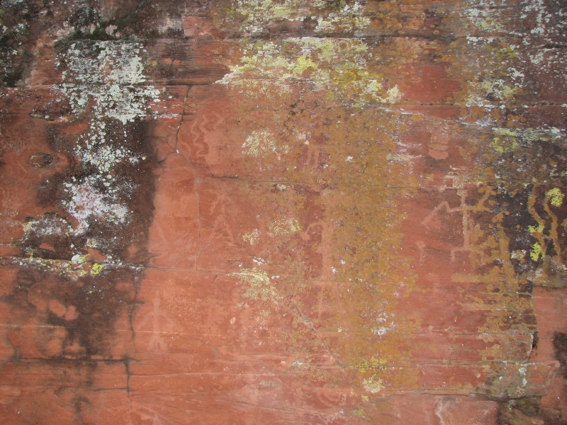
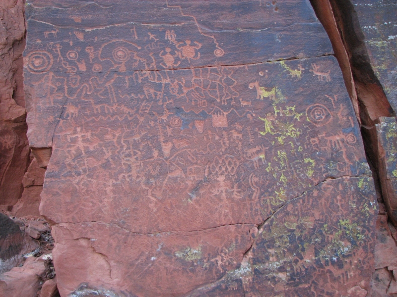
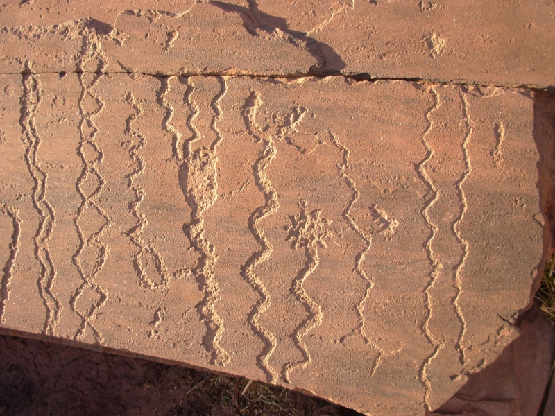
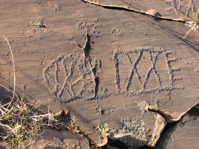
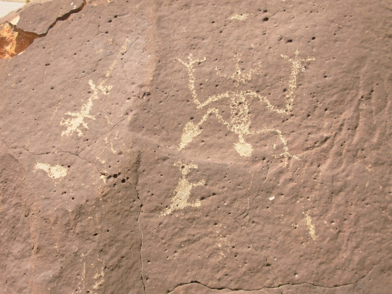
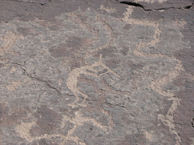
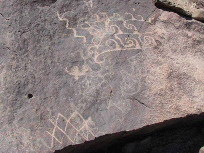
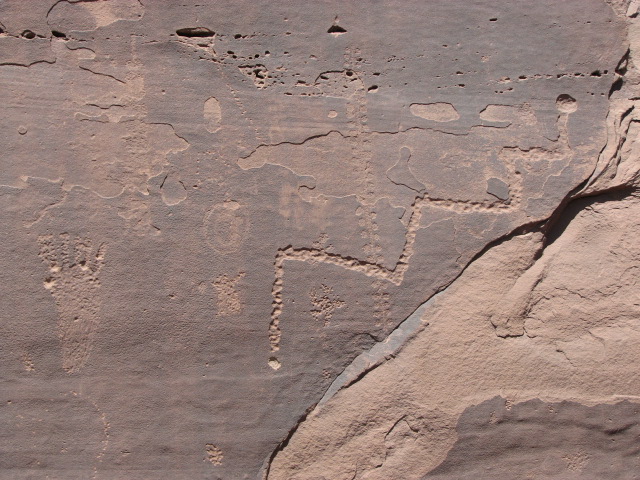
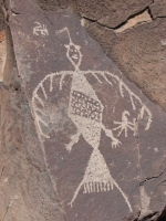
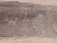
We camped at Beaver Creek because its next to a rock art site called V Bar V. Weve tried to visit the site twice before, but they are only open on weekends (F-M) from 9:30 to 3:30. I think once we were too late (4:00) and once arrived on the wrong day, so we decided camping nearby on a Thursday night would finally allow us to see it. There was a rock covered with petroglyphs right next to the road that we stopped to photograph. It was covered with lichen, so a little hard to see but there were some very old images under the growth. There were several anthropomorphs, a comb, several zigzag lines and a couple of circles. We followed a footpath nearby but it just led to a nice view, not more petroglyphs. We got back to the campground in time for dinner, just before dark.
Friday, March 28: V Bar V, Tonto, Besh Ba Gowah
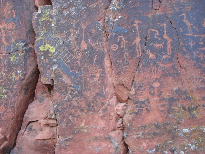
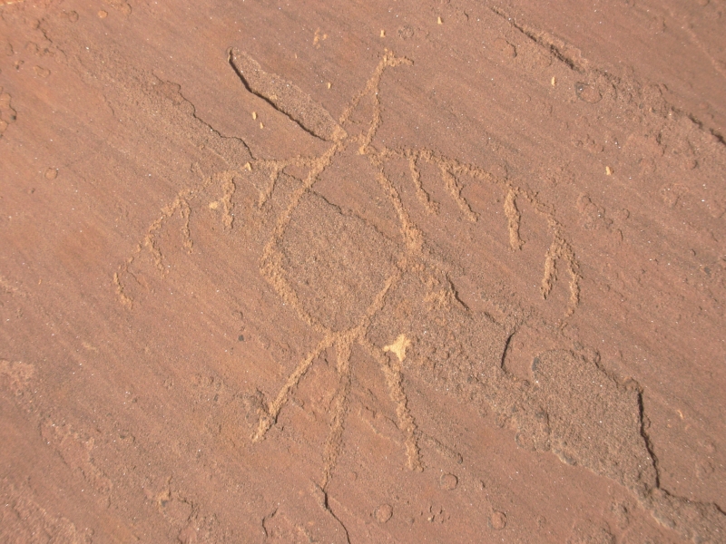
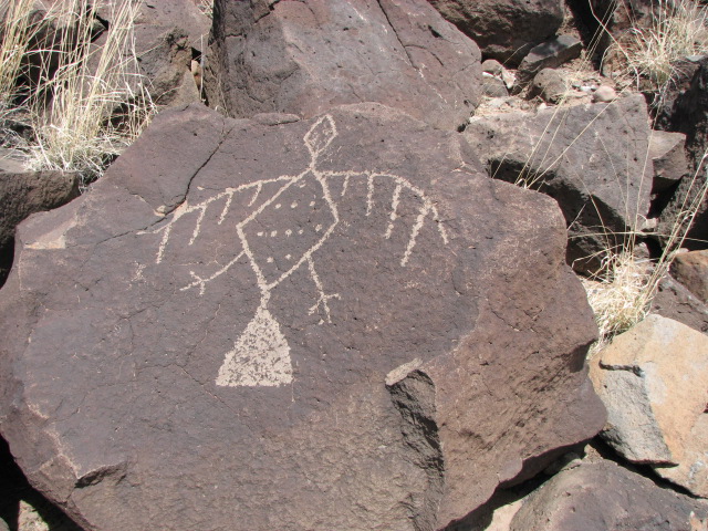
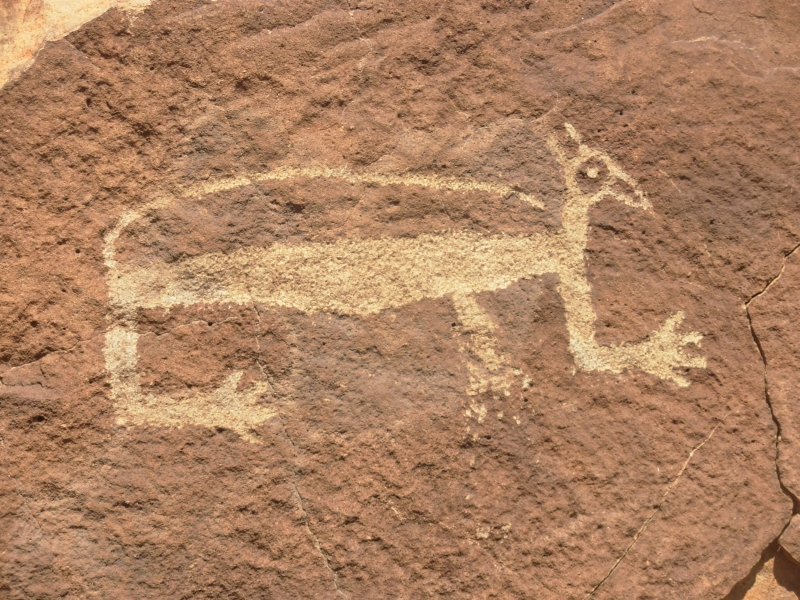
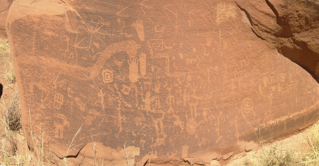
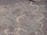
We were up bright and early and at the gate of V Bar V when it opened at 9:30. Theres a trail from the Visitors Center to a fenced alcove with several panels, very densely covered with carved images. There were birds, shamans, circles, etc. Many of the birds are water birds long legs and necks. One panel is supposed to be an astronomical calendar: two rocks above the rock face focus a shaft of light so it hits various images at various times, including the spring equinox. Theyve only recently figured out that it was a calendar. Evidently a researcher spent enough time at the site that he started noticing the light shifting to the spirals on certain dates and put two and two together. They are reexamining all the rock art in the area as a result, loking for other possible calendars. A volunteer at the site answered questions and made sure the site was not vandalized. We stayed a while, taking pictures and listening to him talk. Afterwards we walked up Red Tank looking for more petroglyphs and found one more rock with some circles.


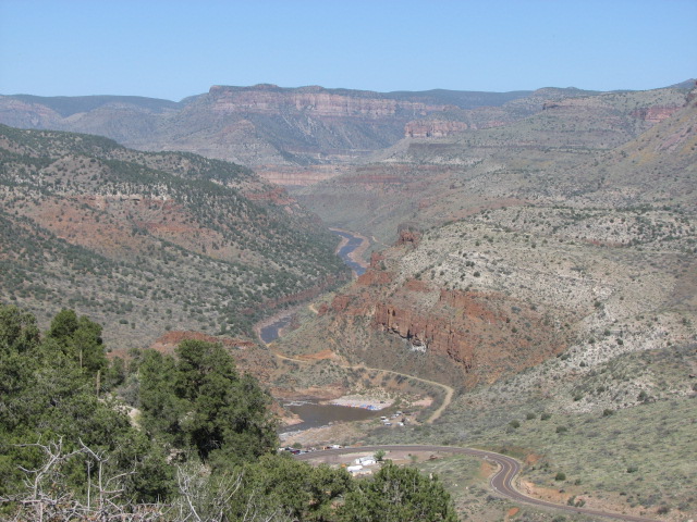
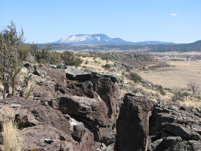
The drive south was pretty as we passed though ponderosa pine-covered mountains to Payson then south to Tonto National Monument and Globe. There was snow along the road north of Payson. The Mazatzals also still have snow, visible from below. The other day we could see that Mount Graham, where we were supposed to be hiking right now, was still very white. I expected snow on the San Francisco Peaks, but not here in central Arizona. Being unable to do our GET hike this spring may actually have been a good thing. Not only would we have been postholing on our way up Mount Graham, the rivers we would have had to cross would have been very high, possibly too high to cross safely.
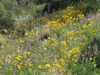
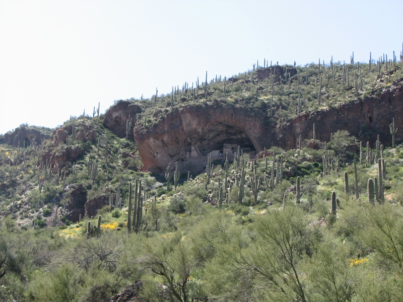
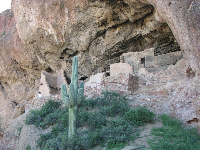
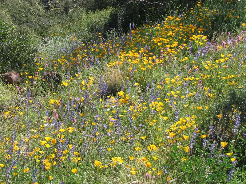
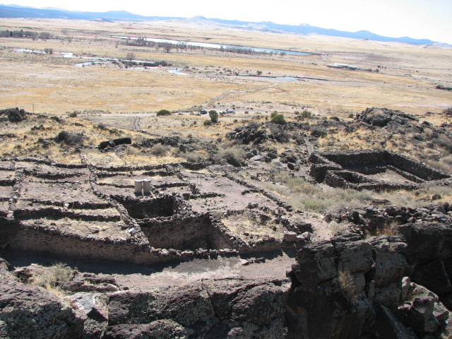
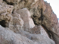
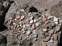
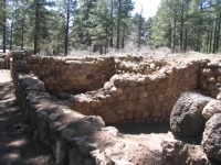
South of Payson we descended into springtime again: lots of golden poppies, blue lupine and purple phacelia. At Tonto National Monument the flowers were especially abundant; the hills were covered with a rainbow of colors. Tonto is the site of two Salado cliff dwellings. The Salado were a native people who lived along the Salt River (hence the name) around the same time as the Hohokam and Anasazi. I don't know if they were a branch of the Anasazi or a separate people. They were known for a very distinctive pottery style and, like the nearby Anasazi, they sometimes built large cliff houses.
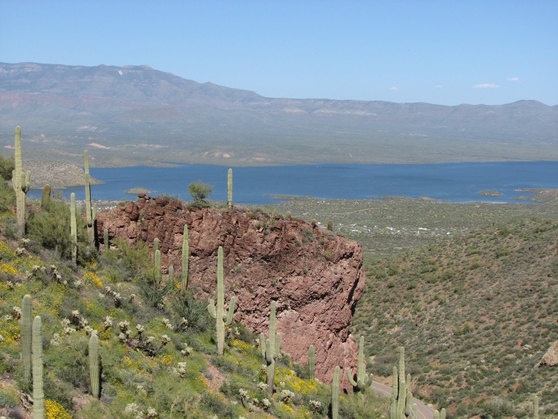
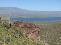
We were only able to visit the lower ruin since the upper ruin is only open to tours once a day and only on weekends. The tours fill up well in advance during prime season, and evidently this is prime season. We were told the next few days are fully reserved. That was disappointing. The small lower ruin was interesting though. It was a good climb up to the alcove that contains the ruins so the views out toward bright blue Roosevelt Lake were good ones.
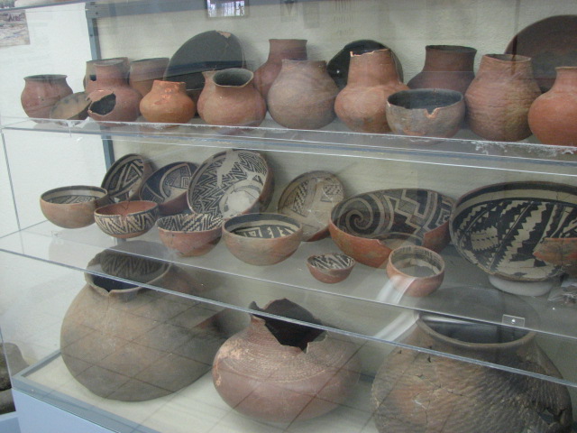
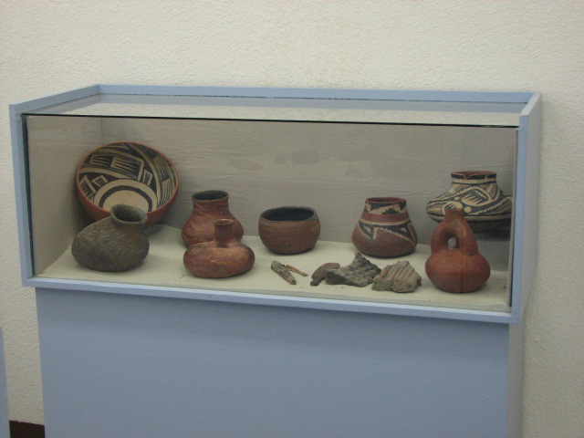
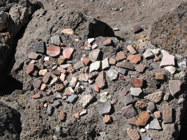
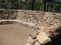
From Tonto we continued south to the town of Globe where a large Salado ruin has been incorporated into a county park, Besh Ba Gowah. It has been partially reconstructed and has a nice little museum with some good pottery. We arrived barely in time to watch a video on Besh Ba Gowah and to visit the museum before it closed. The grounds are open until 6:00 so we had time to wander around for a while.
That left us with the question, where were we going to spend the night? I wanted to drive up into the forest and look for a place to camp, but Jim thought it was too late in the day to be wandering the back roads, especially since we dont have a map of the forest with us. We tried to find a campground in town. No luck. Finally we decided to get a motel. Days Inn wanted $99 for a room and Motel 6 was full, but the El Rey had a room for $40. We took it. Weve slept in worse. Dinner was at Pizza Hut. Happiness is pizza and a hot shower.
Saturday, March 29: Kinishba, Casa Malpais and Lyman Lake CG (1 mile)
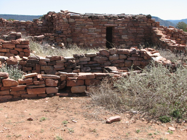
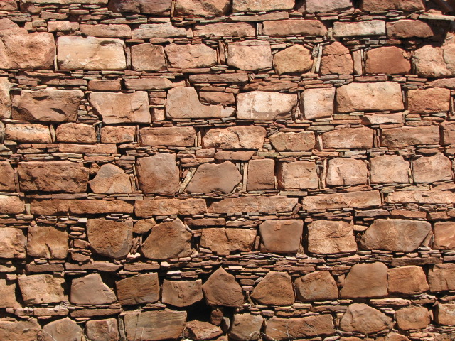
Today was an interesting blend of archaeology and scenic driving. The highway north of Globe passes through the very scenic Salt River canyon very reminiscent of the Grand Canyon. We dropped a thousand feet or so, crossed the river, then climbed up the other side through colorful cliffs. We drove through the White Mountain Apache Reservation to a ruin called Kinishba that dates from 1050-1400. It has been neglected since it was partially reconstructed in the 1930s, but we enjoyed the beautiful Anasazi masonry cut stone and mortar with small rocks in it that reminded me of Chaco Canyons construction.

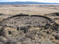
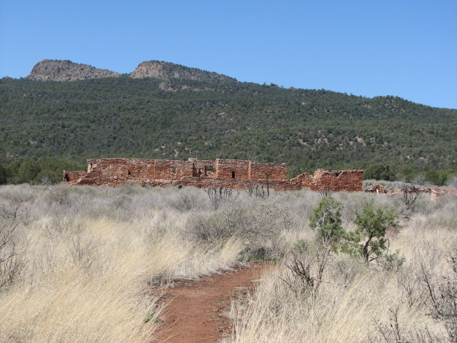
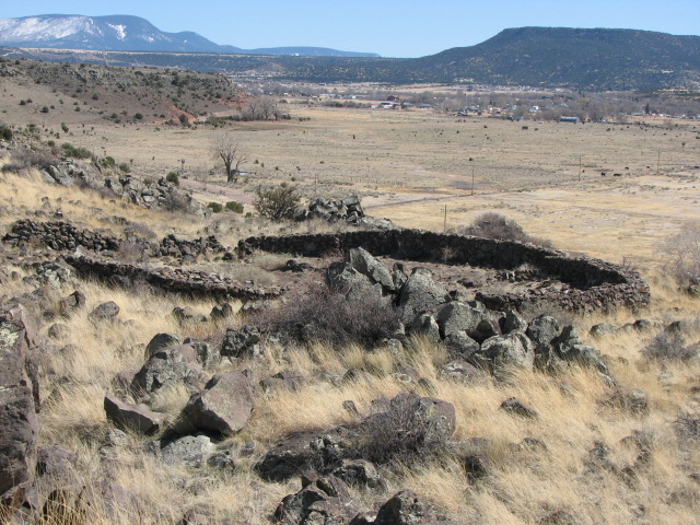
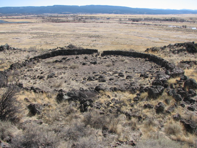
We continued up into the high country. There was still a lot of snow at 10,000. It was pretty country: ponderosa pines, and lots of half-frozen ponds and wet meadows. We dropped down to the town of Springerville, which has another ancient ruin called Casa Malpais built in a lava bed. We lucked out in arriving just before the afternoon tour was heading out. It was a Mogollan village with a Great Kiva and a large area that was an astronomical calendar marking the solstices and equinoxes. Evidently there were fissures that were put to use, including an interesting narrow rock passage that led to an upper plateau. The fields were terraced three levelsand there were unexcavated pithouses that dated from about 700 AD. All the large stone ruins weve been seeing lately date from the same era; 1000-1400 AD. Casa Malpais was built from 1270-1350, according to the tree ring data done by archaeologists on the roof beams.

The various prehistoric cultures in Arizona have different names: Anasazi, Hohokam, Salado, Mogollan, and Sinagua, but there was obviously interaction between them. I think the Salado, Mogollan and Sinagua are all part of the Anasazi civilization, but located in different areas: Salt River, Mogollan Plateau and the area near Flagstaff (Sinagua means no water). Im not sure how they all were connected, or even if they were all the same people. The Hohokam are believed to be a completely separate tribe, probably people who came north from Mexico - but I'm not even sure about that. The pottery styles and building techniques were different, but the basic plan is the same: central plazas, houses two to three stories high with rooftop entry, small low doors between rooms, central fires, etc. A sign at Casa Malpais said many of the rooms were never lived in; they may have had ceremonial purposes. The guide said it was a big trade center. Sounds a lot like Chaco Culture in New Mexico. They dont know for sure what took place there either. The Hohokam villages in Southern Arizona sometimes included walled game fields like those in Mexico, as did a few of the northern villages. Same culture, or just borrowing a good idea? We see some of the same rock art images in areas very far apart - but was the meaning the same?

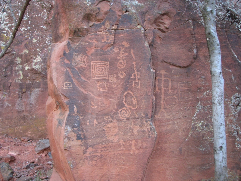
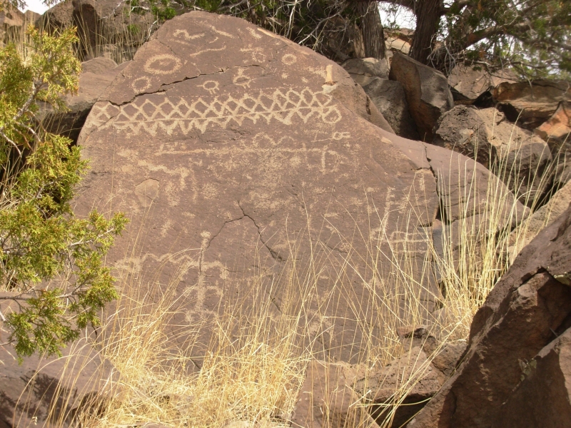
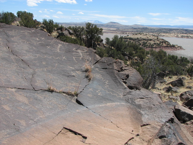
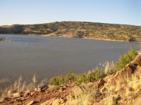
We headed north through open grasslands to Lyman Lake State Park where we picked out a campsite overlooking the reservoir, then headed up the Petroglyph Trail, which leads to a petroglyph site right next to the campground. We spent the next hour photographing carved rocks, then reluctantly descended just as the sun went down. Well go back in the morning to see whether we found all the images or if there is more on the back side of the ridge. Lyman has another site, Ultimate Rock, on the far side of the lake, but access is by boat and the tours dont begin until May. I was worried that it might be a problem finding a campsite on a Saturday night, but it is still early spring here at 6000. The grass is still winter yellow and the leaves are still bare of leaves. The campground is about half full, but no one was out on the water when we arrived. Tomorrow well check out the 14th century ruins beside the lake.
The past few days have been very densely filled, but fun. The country has been beautiful, passing though many different ecosystems: Sonora desert, high desert, pinyon-juniper grasslands, ponderosa pine forests and snowy alpine meadows. Weve visited a lot of the ancient ruins we missed on previous trips. There were a few disappointments like missing out on the upper ruins at Tonto National Monument, but I feel good about seeing some of the lesser-known sites like Kinishba, Casa Malpais and V Bar V. I really enjoy the rock art more than the ruins, but there is something fascinating about being able to visit 1000 year old buildings from a civilization that disappeared so long ago. Lyman has petroglyphs that are thought to be 8000 years old amazing! Many of the glyphs were curved lines maps or migration patterns or perhaps land plots no one knows. Even images that are clear, like human forms or turtles or birds, probably have meanings beyond the obvious. What those were is unknown. Was a snake a symbol for lightning, an omen for rain, a messenger to the underworld or something else entirely? Today a cross and a fish have specific religious meanings, but would an archaeologist 1000 years from now understand that if there were no written records and no Christians left to explain? So what do the lizards and bighorns represent?
Sunday, March 30: Lyman Lake (5 miles)
We decided to spend the day and another night at Lyman Lake. First we drove out to the ruin at Rattlesnake Point. Most of it has been filled in since excavation, but the archaeologists left three rooms open so you can get a sense of the building style. Once there were 80 or so rooms, now its just a pile of dirt.
We returned to the Petroglyph Trail to see if we could spot any images in the morning light that we missed in the late afternoon shadows. There were a few that looked clearer today. Jim wanted to ask a ranger about going across the lake, so we didnt linger. We got lucky: we spotted a ranger cleaning a bathroom, so we asked if it was possible to walk around the lake to the petroglyph site on the far side. She answered that it was a long hike and there is no trail so it is rough, but we could go across the dam if we wanted to attempt the hike. We were happy!
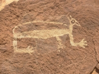
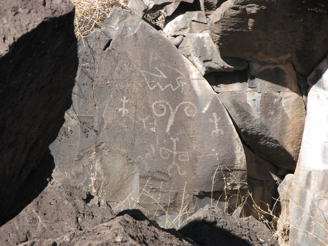
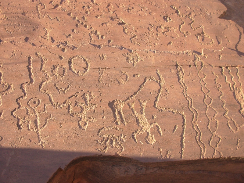
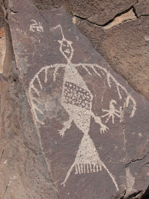
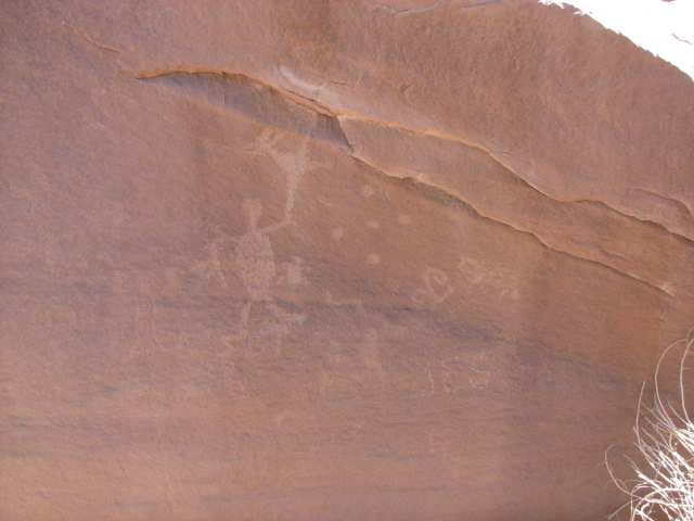
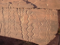
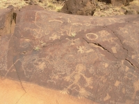
It turned out not to be that difficult. If you follow the shoreline, the route is longer and very rocky, but we climbed up to a higher bench and there were grassy stretches between the rock piles. The far side of the lake is volcanic with lots of black rock. We found a few petroglyph panels on our way over to the Ultimate Rock Site and one panel, a map (?) on the return journey. After about 1¾ miles we ran into a good constructed trail running from a boat dock by the lake, past several petroglyph-covered boulders to one large one half a mile up the hill that was covered with images, the Ultimate Rock. The rock art was worth the hike. There were some really good images, including a couple of Kokopellis, some birds (eagle or turkey or thunderbird?), anthropomorphs, lots of squiggles, some migration signs, footprints, etc. The Ultimate Rock was hard to photograph since the images were on a rounded surface. There was an atlatl, along with Kokopellis, etc. Obviously the site was in use for several centuries. The atlatl predates the bow and arrow, but Kokopelli images didnt arrive in the area until 1200 or so.
All in all, Lyman Lake was a really good site. Im glad we stopped here this year instead of last year. Last year I doubt wed have made the effort to cross the lake, since we were just beginning our fascination with petroglyphs. This year were more willing to go the extra mile to see rock art. We also see it differently now that we have something to compare it with. We look at the images and remember other sites with similar images, or are astounded at the really unique ones we see sometimes. (i.e. the red shaman at Agua Fria was very different.)
It was really windy, especially as the day wore on. We took a warm shower at the campground, then settled in the car to read out of the wind. It was a very good day.
Monday, March 31: Cholla and Flagstaff
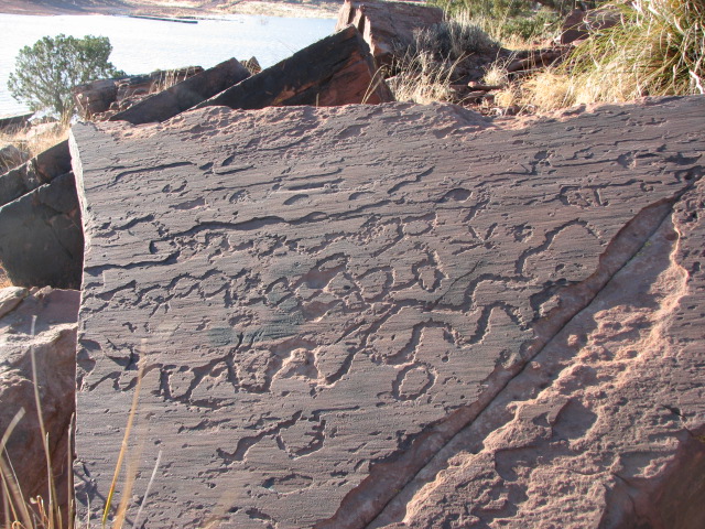
The land is still winter brown, with miles of dead grass and shrubs, shaggy cattle, drab hills. The mountains are low and far in the distance. It was quick easy driving on empty byways, but not particularly scenic except for the colored sandstone hills on the southern edge of the Painted Desert.
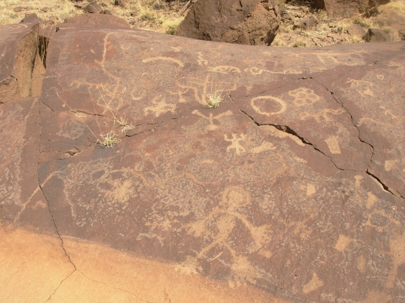
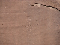
We decided to revisit the Cholla Petroglyph site. Last year we arrived there late in the day, got confused by the guidebooks off-scale maps, and found only a few scattered petroglyphs but not the Newspaper Rock that we were seeking. Today we had more time and daylight, so of course we found the panel fairly quickly. It was an interesting set up: two large boulders about 10 feet long faced each other with a narrow passage between the rocks. Both sides of the passage were covered with carvings. A power line (migration route?) connected several human images. It looked like a story being told; I just wish I knew what the story was. On the far side of one of the boulders was Newspaper Rock, covered with a miscellany of pictures, including foot and handprints, deer, spirals, etc. The passage was hard to photograph since the rock walls were so close together and the images were in the shade. There was no way to back up and get a complete view of the panel. Still, it was a very cool site. The Bicknell book has been a good one, despite its occasional errors. There were pieces of petrified wood at the site and I found a piece of petrified bone, which I reburied. I do wonder what it once was human, animal, dinosaur?
We ended up staying in a motel in Flagstaff after several stops in town. First we toured Elden Pueblo, which is an active archaeological site on the edge of town. It was a 13th century Sinagua village. They have reconstructed several rooms and there were trenches where the archaeologists have been digging. There were no signs explaining the site all we know was what was written in the guidebook. Evidently they bring in school groups and allow the kids to find out what archaeology is about with hands-on experience at a real dig. Then we headed downtown for a long wander through Bookmans, an enormous used bookstore, and made a couple of stops at outdoor stores so I could look for new shoes to hike in. Im not happy with the ones I bought, but theyll do. I wore them on the CDT in NM and they worked fairly well. Finally we looked in our Motel Coupon Book and got a room at a Super 8 on the edge of town. Dinner was ribs at Outback, a favorite of mine, followed by laundry at the motel.
Now we get to figure out where were going next. The whole world is open to us, but we have no idea where were going or what were doing. With Jims ribs still hurting, we can't do what we'd really like to do - which is hike. Backpacking is completely out, for the time being. Were in this area two weeks earlier than expected because of the cancellation of our GET hike. Snow is still a possibility this early in the season, as we found out last year, so we can't go too high or too far north quite yet. Hmmm.
Home | Links| Trail Journals|
The Thruhiking Papers Bun-bun
Created: 1 Jan 2009
Revised: 30 Sept 2016Copyright ©: 2008-2017 Spirit Eagle